 | ||||
|---|---|---|---|---|
| Route information | ||||
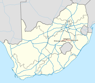
| Length | 76.7 km (47.7 mi) | |||
| Location | ||||
| Country | South Africa | |||
| Highway system | ||||
| ||||
The R714 is a Regional Route in South Africa. [1]
| | ||||
|---|---|---|---|---|
| Route information | ||||
| Length | 76.7 km (47.7 mi) | |||
| Location | ||||
| Country | South Africa | |||
| Highway system | ||||
| ||||
The R714 is a Regional Route in South Africa. [1]
The R714 begins at a T-junction with the R26 in Bethlehem (north-east of the town centre). From Bethlehem, it runs east-north-east for 34.7 km to reach a junction with the R57. It continues east-north-east for another 42 km to reach its end in the town of Warden at a junction with the N3. [1]
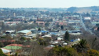
Bethlehem is a city in the eastern Free State province of South Africa that is situated on the Liebenbergs River along a fertile valley just north of the Rooiberg Mountains on the N5 road. It is the fastest growing city in the Free State province, with its target of being the third largest city after Bloemfontein and Welkom.
Harrismith is a large town in the Free State province of South Africa. It was named for Sir Harry Smith, a 19th-century British governor and high commissioner of the Cape Colony. It is situated by the Wilge River, alongside the N3 highway, about midway between Johannesburg, about 275 km to the north-west, and Durban to the southeast. The town is located at the junction of the N5 highway, which continues westward towards the provincial capital Bloemfontein, some 340 km to the south-west. This important crossroads in South Africa's land trade routes is surrounded by mesas and buttes. It is located at the base of one of these called Platberg.

The R25 is a provincial route in South Africa that connects Johannesburg with Groblersdal via Kempton Park, Bapsfontein and Bronkhorstspruit.

The R26 is a provincial route in Free State, South Africa that connects Rouxville with Villiers via Zastron, Wepener, Ladybrand, Ficksburg, Bethlehem & Reitz.

The R29 is a provincial route in South Africa that connects Johannesburg with Leandra and Kinross via Germiston, Boksburg, Benoni and Springs. For much of its route it is named Main Reef Road. The R29 used to end near the Golela border post with Eswatini, however the section from Evander to Ermelo is now part of the N17 and the section from Ermelo to the Golela border post just after Pongola is now part of the N2.

The R34 is a long provincial route in South Africa that connects Vryburg with Richards Bay via Kroonstad and Newcastle. It passes through three provinces, North West, the Free State and KwaZulu-Natal.

The R48 is a provincial route in South Africa that connects De Aar with Petrusburg on the N8 via Petrusville and Koffiefontein.

The R57 is a provincial route in South Africa that connects Vanderbijlpark with Phuthaditjhaba via Sasolburg, Heilbron and Reitz.

The R61 is a long provincial route in South Africa that connects Beaufort West with Port Shepstone via Graaff-Reinet, Komani, Mthatha and Port Edward.

The R76 is a provincial route in Free State, South Africa that connects Orkney with Bethlehem via Kroonstad.
The R103 is a Regional Route in South Africa that is the designation for some of the old sections of roads that were previously the N3, prior to upgrading. It only has 3 sections, from Hillcrest to Ladysmith, from Warden to Villiers and from Heidelberg to Johannesburg.

The Walvis Bay-Ndola-Lubumbashi Development Road, formerly known as the Trans-Caprivi Corridor and until 2004 the Trans-Caprivi Highway, begins in Walvis Bay. It runs through Rundu in northeastern Namibia and along the Caprivi Strip to Katima Mulilo on the Zambezi River, which forms the border between Namibia and Zambia. The Katima Mulilo Bridge spans the river to the Zambian town of Sesheke. From there, the road continues as the M10 Road to Livingstone, where it connects to the main north–south highway to Lusaka and extends to the Copperbelt.

The N4 is a national route in South Africa that runs from Skilpadshek on the Botswana border, past Rustenburg, Pretoria, eMalahleni and Mbombela, to Komatipoort on the Mozambique border. The entire route is a toll road.
The N5 is a national route in South Africa that connects the N1 at Winburg with the N3 at Harrismith, via Senekal, Paul Roux and Bethlehem.

The N10 is a national route in South Africa connecting Gqeberha on the Eastern Cape coast with the Namibian border at Nakop, via Cradock, De Aar and Upington.

The N14 is a national route in South Africa which runs from Springbok in the Northern Cape to Pretoria in Gauteng. It passes through Upington, Kuruman, Vryburg, Krugersdorp and Centurion. The section between Pretoria and Krugersdorp is maintained by the Gauteng Provincial government and is also designated the P158.

The N17 is a national route in South Africa which runs from Johannesburg to Oshoek (Ngwenya) on the border with Eswatini. It passes through Springs, Bethal and Ermelo.

The N18 is a national route in South Africa which runs from Warrenton through Vryburg and Mahikeng to Ramatlabama on the border with Botswana.
The R505 is a Regional Route in South Africa. It connects Ottoshoop, North West Province in the north with Wesselsbron, Free State Province to the south.

The R712 is a Regional Route in South Africa that connects Phuthaditjhaba with Bethlehem via the Golden Gate Highlands National Park and Clarens.
| | This South African road or road transport-related article is a stub. You can help Wikipedia by expanding it. |