
A digital elevation model (DEM) or digital surface model (DSM) is a 3D computer graphics representation of elevation data to represent terrain or overlaying objects, commonly of a planet, moon, or asteroid. A "global DEM" refers to a discrete global grid. DEMs are used often in geographic information systems (GIS), and are the most common basis for digitally produced relief maps. A digital terrain model (DTM) represents specifically the ground surface while DEM and DSM may represent tree top canopy or building roofs.

Remote sensing is the acquisition of information about an object or phenomenon without making physical contact with the object, in contrast to in situ or on-site observation. The term is applied especially to acquiring information about Earth and other planets. Remote sensing is used in numerous fields, including geophysics, geography, land surveying and most Earth science disciplines. It also has military, intelligence, commercial, economic, planning, and humanitarian applications, among others.
The Brazilian Space Agency is the civilian authority in Brazil responsible for the country's space program. It operates a spaceport at Alcântara, and a rocket launch site at Barreira do Inferno. It is the largest and most prominent space agency in Latin America.

NASA WorldWind is an open-source virtual globe. According to the website, "WorldWind is an open source virtual globe API. WorldWind allows developers to quickly and easily create interactive visualizations of 3D globe, map and geographical information. Organizations around the world use WorldWind to monitor weather patterns, visualize cities and terrain, track vehicle movement, analyze geospatial data and educate humanity about the Earth." It was first developed by NASA in 2003 for use on personal computers and then further developed in concert with the open source community since 2004. As of 2017, a web-based version of WorldWind is available online. An Android version is also available.

Satellite images are images of Earth collected by imaging satellites operated by governments and businesses around the world. Satellite imaging companies sell images by licensing them to governments and businesses such as Apple Maps and Google Maps.
The Global Earth Observation System of Systems (GEOSS) was built by the Group on Earth Observations (GEO) on the basis of a 10-Year Implementation Plan running from 2005 to 2015. GEOSS seeks to connect the producers of environmental data and decision-support tools with the end users of these products, with the aim of enhancing the relevance of Earth observations to global issues. GEOSS aims to produce a global public infrastructure that generates comprehensive, near-real-time environmental data, information and analyses for a wide range of users. The Secretariat Director of Geoss is Barbara Ryan.
Earth Satellite Corporation (EarthSat), an American company, was a pioneer in the commercial use of Earth observation satellites. Founded in 1969, EarthSat was first headquartered in Washington, D.C., and later moved its offices to Bethesda, Maryland, and finally to Rockville, Maryland, in the late 1980s. In 2001, EarthSat was acquired by MacDonald, Dettwiler and Associates Ltd. (MDA) of Vancouver, British Columbia. In August 2005, EarthSat was incorporated as MDA Federal Inc., the U.S. operation of MDA Geospatial Services.
Earth observation (EO) is the gathering of information about the physical, chemical, and biological systems of the planet Earth. It can be performed via remote-sensing technologies or through direct-contact sensors in ground-based or airborne platforms.
The National Space Research and Development Agency (NASRDA) is the national space agency of Nigeria. It is a parastatal under Federal Ministry of Innovation, Science and Technology. The agency is based in the Nigerian capital city of Abuja in the Lugbe district and has a ground receiving station, among various other sites. In the past, it has cooperated in space technology with the United Kingdom, China, Ukraine and Russia. The agency has struggled with meeting its financial plans and some of its facilities are rundown. Despite this, the space agency is one of the most advanced space agencies in Africa, boasting of four satellites and very grand ambitions. Nigeria's satellites have been praised for their high-resolution images. NASRDA is host to one of UN-SPIDER's Regional Support Offices (RSO) in Africa.

Copernicus is the Earth observation component of the European Union Space Programme, managed by the European Commission and implemented in partnership with the EU member states, the European Space Agency (ESA), the European Organisation for the Exploitation of Meteorological Satellites (EUMETSAT), the European Centre for Medium-Range Weather Forecasts (ECMWF), the Joint Research Centre (JRC), the European Environment Agency (EEA), the European Maritime Safety Agency (EMSA), Frontex, SatCen and Mercator Océan.
RazakSAT was a Malaysian Earth observation satellite carrying a high-resolution camera. It was launched into low Earth orbit on 14 July 2009. It was placed in a near-equatorial orbit that presents many imaging opportunities for the equatorial region. It weighs over three times as much as TiungSAT-1 and carries a high-resolution Earth observation camera. Developed in conjunction with the Satrec Initiative, the satellite's low inclination brought it over Malaysia a dozen or more times per day. This was intended to provide greatly increased coverage of Malaysia compared to most other Earth observation satellites. An audit report released in October 2011 revealed that the satellite had failed after one year of operation.

Sentinel-2 is an Earth observation mission from the Copernicus Programme that acquires optical imagery at high spatial resolution over land and coastal waters. The mission's Sentinel-2A and Sentinel-2B satellites were joined in orbit in 2024 by a third, Sentinel-2C, and in the future by Sentinel-2D, eventually replacing the A and B satellites, respectively.
Bhuvan is an Indian web-based utility which allows users to explore a set of geographic content prepared by the Indian Space Research Organisation. The content which the utility serves is mostly restricted to within Indian boundaries and is offered in four regional languages. The content includes thematic maps related to disasters, agriculture, water resources, land cover, and processed satellite data generated by ISRO.

The South African National Space Agency (SANSA) is South Africa's government agency responsible for the promotion and development of aeronautics and aerospace space research. It fosters cooperation in space-related activities and research in space science, seeks to advance scientific engineering through human capital, as well as the peaceful use of outer space, and supports the creation of an environment conducive to the industrial development of space technologies within the framework of national government.
WorldView-3 is a commercial Earth observation satellite owned by DigitalGlobe. It was launched on 13 August 2014 to become DigitalGlobe's sixth satellite in orbit, joining Ikonos which was launched in 1999, QuickBird in 2001, WorldView-1 in 2007, GeoEye-1 in 2008, and WorldView-2 in 2009. WorldView-3 provides commercially available panchromatic imagery of 0.31 m (12 in) resolution, eight-band multispectral imagery with 1.24 m resolution, shortwave infrared imagery at 3.7 m resolution, and CAVIS data at 30 m (98 ft) resolution.
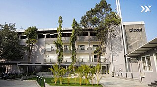
Pixxel (pik·sl) is an Indian-American private space technology company building a constellation of the world's highest-resolution hyperspectral imaging satellites into a sun-synchronous orbit along with Aurora, its in-house Earth observation platform designed to convert satellite imagery into actionable insights.
Land cover maps are tools that provide vital information about the Earth's land use and cover patterns. They aid policy development, urban planning, and forest and agricultural monitoring.
Applications of machine learning in earth sciences include geological mapping, gas leakage detection and geological features identification. Machine learning (ML) is a type of artificial intelligence (AI) that enables computer systems to classify, cluster, identify and analyze vast and complex sets of data while eliminating the need for explicit instructions and programming. Earth science is the study of the origin, evolution, and future of the planet Earth. The Earth system can be subdivided into four major components including the solid earth, atmosphere, hydrosphere and biosphere.
The history of space in Africa is the history of space activity by or sent from Africa.