
The Economy of Libya depends primarily upon revenues from the petroleum sector, which represents over 95% of export earnings and 60% of GDP. These oil revenues and a small population have given Libya one of the highest nominal per capita GDP in Africa.
Trinidad is the larger and more populous of the two major islands of Trinidad and Tobago. The island lies 11 km (6.8 mi) off the northeastern coast of Venezuela and sits on the continental shelf of South America. Though geographically part of the South American continent, from a socio-economic standpoint it is often referred to as the southernmost island in the Caribbean. With an area of 4,768 km2 (1,841 sq mi), it is also the fifth largest in the West Indies.
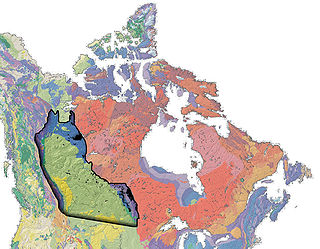
The Western Canadian Sedimentary Basin (WCSB) is a vast sedimentary basin underlying 1,400,000 square kilometres (540,000 sq mi) of Western Canada including southwestern Manitoba, southern Saskatchewan, Alberta, northeastern British Columbia and the southwest corner of the Northwest Territories. It consists of a massive wedge of sedimentary rock extending from the Rocky Mountains in the west to the Canadian Shield in the east. This wedge is about 6 kilometres (3.7 mi) thick under the Rocky Mountains, but thins to zero at its eastern margins. The WCSB contains one of the world's largest reserves of petroleum and natural gas and supplies much of the North American market, producing more than 16,000,000,000 cubic feet (450,000,000 m3) per day of gas in 2000. It also has huge reserves of coal. Of the provinces and territories within the WCSB, Alberta has most of the oil and gas reserves and almost all of the oil sands.

The San Juan Basin is a geologic structural basin located near the Four Corners region of the Southwestern United States. The basin covers 7,500 square miles and resides in northwestern New Mexico, southwestern Colorado, and parts of Utah and Arizona. Specifically, the basin occupies space in the San Juan, Rio Arriba, Sandoval, and McKinley counties in New Mexico, and La Plata and Archuleta counties in Colorado. The basin extends roughly 100 miles N-S and 90 miles E-W.
The National Oil Corporation is the national oil company of Libya. It dominates Libya's oil industry, along with a number of smaller subsidiaries, which combined account for around 70% the country's oil output. Of NOC's subsidiaries, the largest oil producer is the Waha Oil Company (WOC), followed by the Arabian Gulf Oil Company (Agoco), Zueitina Oil Company (ZOC), and Sirte Oil Company (SOC).
Challenger Ltd is a provider of contract oil and gas land drilling and workover services.

The Arabian Gulf Oil Company is an oil company based in Benghazi, Libya, engaged in crude oil and natural gas exploration, production and refining. It was a subsidiary of the state-owned National Oil Corporation (NOC).

The Zelten oil field is located at the foot of the Zelten Mountains, about 169 kilometres (105 mi) south of Brega in Concession 6. Zelten holds the title as the largest oil field in the Gulf of Sidra. The 229 wells in Zelten use a gas lifting system. The Zelten oil field is not associated with the town Zelten, which is located in the North-West of Libya.
The Elephant Field is an oil field located in onshore in Libya's Murzuq Basin.

The Sirte Basin is a late Mesozoic and Cenozoic triple junction continental rift along northern Africa that was initiated during the late Jurassic Period. It borders a relatively stable Paleozoic craton and cratonic sag basins along its southern margins. The province extends offshore into the Mediterranean Sea, with the northern boundary drawn at the 2,000 meter (m) bathymetric contour. It borders in the north on the Gulf of Sidra and extends south into northern Chad.
The Zawia Oil Refining Company (ARC) is a subsidiary of the National Oil Corporation (NOC), incorporated under Libyan Commercial Law since 1976. ARC operates the Zawia Refinery, which was built in 1974 by Snamprogetti, Italy. Zawia is currently the country's second largest oil refinery after the Ra's Lanuf Refinery. Primary products include naphtha, gasoline, kerosene, light vacuum gas oil (VGO), fuel oil, base lubricating oils, and asphalt.
The Sarir Field was discovered in southern Cyrenaica during 1961 and is considered to be the largest oil field in Libya, with estimated oil reserves of 12 Gbbl (1.9 km3). Sarir is operated by the Arabian Gulf Oil Company (AGOCO), a subsidiary of the state-owned National Oil Corporation (NOC).
The Western Libyan Gas Project (WLGP) is a 50-50 joint venture between the Libyan National Oil Corporation (NOC) and the Italian company Eni which came online in October 2004. By July 2007, 280 billion cubic feet per year of natural gas was being exported from a processing facility at Melitah, on the Libyan coast, through the Greenstream pipeline to southeastern Sicily. From Sicily, the natural gas travels to the Italian mainland, and then onwards to the rest of Europe. WLGP is the first major project to valorize the natural gas produced in Libya through export to and marketing in Europe. WLGP is supplied from production at the Bahr Essalam and Wafa fields, which is processed at the onshore Mellitah treatment plant.
The Bouri Offshore Field is part of Block NC-41, which is located 120 kilometers (75 mi) north of the Libyan coast in the Mediterranean Sea. It was first discovered in 1976 at a depth of 8,700 feet (2,700 m) and is estimated to contain 4.5 billion barrels (720,000,000 m3) in proven recoverable crude oil reserves and 3.5 trillion cubic feet (99 km3) of associated natural gas with an annual production potential of 6 billion m³. Bouri is considered the largest producing oilfield in the Mediterranean.
Entreprise tunisienne d'activités pétrolières (ETAP) is a state-owned industrial and commercial company in Tunisia directly in charge of the petroleum sector as well as the state's partnerships with foreign exploration and production operators.

The Cooper Basin is a Permian-Triassic sedimentary geological basin in Australia. The basin is located mainly in the southwest part of Queensland and extends into north eastern South Australia. It is named after the Cooper Creek which is an ephemeral river that runs into Lake Eyre. For most of its extent, it is overlain by the Eromanga Basin. It covers 130,000 km².

The Bakken Formation is a rock unit from the Late Devonian to Early Mississippian age occupying about 200,000 square miles (520,000 km2) of the subsurface of the Williston Basin, underlying parts of Montana, North Dakota, Saskatchewan and Manitoba. The formation was initially described by geologist J.W. Nordquist in 1953. The formation is entirely in the subsurface, and has no surface outcrop. It is named after Henry Bakken, a farmer in Tioga, North Dakota, who owned the land where the formation was initially discovered, during drilling for oil.

The Spraberry Trend is a large oil field in the Permian Basin of West Texas, covering large parts of six counties, and having a total area of approximately 2,500 square miles (6,500 km2). It is named for Abner Spraberry, the Dawson County farmer who owned the land containing the 1943 discovery well. The Spraberry Trend is itself part of a larger oil-producing region known as the Spraberry-Dean Play, within the Midland Basin. Discovery and development of the field began the postwar economic boom in the nearby city of Midland in the early 1950s. The oil in the Spraberry, however, proved difficult to recover. After about three years of enthusiastic drilling, during which most of the initially promising wells showed precipitous and mysterious production declines, the area was dubbed "the world's largest unrecoverable oil reserve."
The mining industry of Libya does not contribute significantly to its economy. Mining resources are located in remote regions with limited accessibility. The fuel sector, including oil reserves and natural gas is the major revenue-generating industry.


