Related Research Articles
Fleming is a small unincorporated community in rural eastern Barlow Township, Washington County, Ohio, United States.

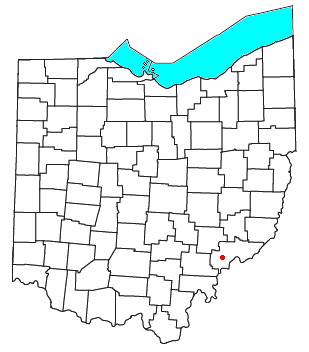
Germantown is an unincorporated community in northern Liberty Township, Washington County, Ohio, United States. It lies along Paw Paw Creek near the boundary with Noble County.

The Mad River is a stream located in the west central part of the U.S. state of Ohio. It flows 66 miles (106 km) from Logan County to downtown Dayton, where it meets the Great Miami River. The stream flows southwest from its source near Campbell Hill through West Liberty, along U.S. Route 68 west of Urbana, past Springfield, then along Ohio State Route 4 into Dayton. The stream's confluence with the Great Miami River is in Deeds Park.

Sharpsburg is an unincorporated community in northwestern Bern Township, Athens County, Ohio, United States. There is a convenience store there, with gas pumps, and also containing the post office with the ZIP code 45777. Additionally there is a church, the Bern Township office, and a few houses.

Whipple is an unincorporated community in southern Salem Township, Washington County, Ohio, United States. Although it is unincorporated, it once had a post office, with the ZIP code 45788. It lies on State Route 821 south of the village of Lower Salem, at the junction of Whipple Run with Duck Creek. The community took its name from nearby Whipple Run.

Bartlett is an unincorporated community in southwestern Wesley Township, Washington County, Ohio, United States. It has a post office with the ZIP code 45713. It sits at the intersection of State Routes 550 and 555 near Coal Run, a subsidiary of Wolf Creek, which meets the Muskingum River at Waterford to the north. Near Bartlett is located the Shinn Covered Bridge, which spans Wolf Creek.
Barlow is an unincorporated community in western Barlow Township, Washington County, Ohio, United States. Although it is unincorporated, it has a ZIP code 45712. It lies at the intersection of State Routes 339 and 550 near the South Fork of Wolf Creek, which meets the Muskingum River at Waterford to the north.

Chandlersville is an unincorporated community in western Salt Creek Township, Muskingum County, Ohio, United States. It has a post office with the ZIP code 43727. It lies along State Route 146 at its intersection with State Routes 284 and 313.

East Union is an unincorporated community in northwestern Stock Township, Noble County, Ohio, United States. It lies at the intersection of State Route 78 with County Road 6. The headwaters of Buffalo Creek, a tributary of the Muskingum River through Wills Creek, are located around East Union. It is located 7 miles east of Caldwell, the county seat of Noble County.

Harriettsville is an unincorporated community in western Elk Township, Noble County, Ohio, United States. It lies along State Route 145 at its intersection with County Road 46. The East Fork of Duck Creek, a subsidiary of the Ohio River that meets the river near Marietta, runs along State Route 145 past the community. It lies 8 miles (13 km) northeast of Lower Salem by road, and 13 miles (21 km) directly southeast of Caldwell, the county seat of Noble County.
Federal Creek is one of several major tributaries to the Hocking River in southeast Ohio. It drains an area in north-central Athens County, Ohio, as well as an adjacent area in Morgan County, Ohio. This creek is well known for severe flooding. The incorporated village of Amesville, Ohio is located on the creek, while the unincorporated communities of Kilvert, Broadwell, Sharpsburg, and Lathrop are situated on the creek or its tributaries. The confluence of Federal Creek with the Hocking River is located near the unincorporated community of Stewart, Ohio at 39°19′10″N81°52′45″W.
Fourway, also known as Burkes Garden Siding, is a former unincorporated community in Tazewell County, Virginia, that has been annexed by the town of Tazewell. It includes the intersection of U.S. Route 19/460 Business with State Route 61.
Layman is an unincorporated community in northeastern Fairfield Township, Washington County, Ohio, United States. It lies where Brownrigg Road and Tick Ridge Road intersect with State Route 550.
Eagle Mills is an unincorporated community in Vinton County, in the U.S. state of Ohio.
Middleburg is an unincorporated community in Noble County, in the U.S. state of Ohio.
Olive Green is an unincorporated community in Noble County, in the U.S. state of Ohio.
Patten Mills is an unincorporated community in Washington County, in the U.S. state of Ohio.
Rainbow is an unincorporated community in Washington County, in the U.S. state of Ohio.
Big Run is an unincorporated community in Athens County, in the U.S. state of Ohio.
Fullertown is an unincorporated community in Geauga County, in the U.S. state of Ohio.
References
- ↑ U.S. Geological Survey Geographic Names Information System: Rainbow Creek (Ohio)
- ↑ "How communities got their names". Marietta Times. February 19, 2013. Retrieved 29 December 2015.
39°29′35″N81°29′33″W / 39.49306°N 81.49250°W
| | This article related to a river in Ohio is a stub. You can help Wikipedia by expanding it. |