
Lough Neagh is a freshwater lake in Northern Ireland and is the largest lake on the island of Ireland and in the British Isles. It has a surface area of 151 square miles and is about 19 miles (31 km) long and 9 miles (14 km) wide. According to Northern Ireland Water, it supplies 40.7% of Northern Ireland's drinking water. Its main inflows are the Upper River Bann and Blackwater, and its main outflow is the Lower Bann. There are several small islands, including Ram's Island, Coney Island and Derrywarragh Island. The lake bed is owned by the 12th Earl of Shaftesbury and the lake is managed by Lough Neagh Partnership. Its name comes from Irish Loch nEachach, meaning "Eachaidh's lake".

Lough Erne is the name of two connected lakes in County Fermanagh, Northern Ireland. It is the second-biggest lake system in Northern Ireland and Ulster, and the fourth biggest in Ireland. The lakes are widened sections of the River Erne, which flows north and then curves west into the Atlantic. The smaller southern lake is called the Upper Lough as it is higher up the river. The bigger northern lake is called the Lower Lough or Broad Lough. The town of Enniskillen lies on the short stretch of river between the lakes. The lake has more than 150 islands, along with many coves and inlets. The River Erne is 80 miles (129 km) long and drains an area of about 1,680 square miles (4,350 km2).
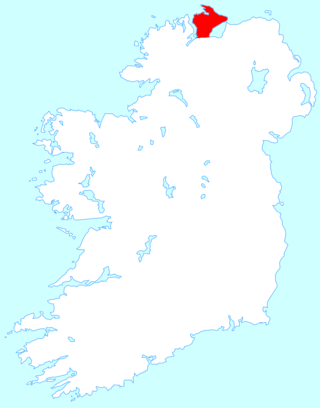
Inishowen is a peninsula in the north of County Donegal in Ireland. Inishowen is the largest peninsula on the island of Ireland.

The River Bann is the longest river in Northern Ireland, its length, Upper and Lower Bann combined, being 129 km (80 mi). However, the total length of the River Bann, including its path through the 30 km (19 mi) long Lough Neagh is 159 km (99 mi). Another length of the River Bann given is 90 mi. The river winds its way from the southeast corner of Ulster to the northwest coast, pausing in the middle to widen into Lough Neagh. The River Bann catchment has an area of 5,775 km2. The River Bann has a mean discharge rate of 92 m3/s. According to C. Michael Hogan, the Bann River Valley is a settlement area for some of the first human arrivals in Ireland after the most recent glacial retreat.

The Quoile is a river in County Down, Northern Ireland.
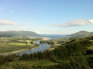
Carlingford Lough is a glacial fjord or sea inlet in northeastern Ireland, forming part of the border between Northern Ireland to the north and the Republic of Ireland to the south. On its northern shore is County Down, the Mourne Mountains, and the town of Warrenpoint; on its southern shore is County Louth, the Cooley Mountains and the village of Carlingford. The Newry River flows into the loch from the northwest.
The Crom Estate is a nature reserve located in the south of County Fermanagh, Northern Ireland, along the shores of Upper Lough Erne. It is one of three estates owned and managed by the National Trust in County Fermanagh, the others being Florence Court and Castle Coole mansions. The estate comprises 1,350 acres (5.5 km2), composed primarily of riparian forest. Some trees are so ancient that physical access is restricted.

Stewartstown is a village in Northern Ireland, close to the western shore of Lough Neagh, about 5 miles (8 km) from Cookstown, 3 miles (5 km) from Coalisland and 7 miles (11 km) from Dungannon. Established by Scottish Planters early in the 17th century, its population peaked before the Great Famine of the 1840s at over 1000. In the 2011 Census the town had a population of 650 people. Formerly in the historic County Tyrone, today it is in local-government district of Mid Ulster.
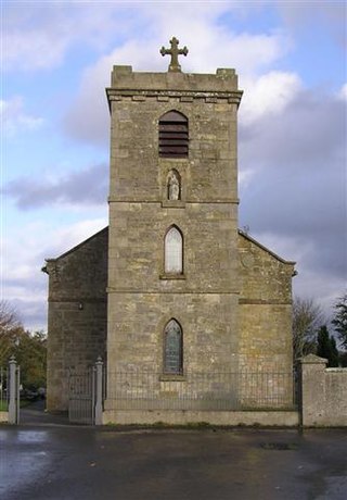
Maghery is a small village and townland in County Armagh, Northern Ireland. It lies on the southwest shore of Lough Neagh, near Derrywarragh Island, in the northwest corner of the county. As it sits between the estuaries of the rivers Blackwater and Bann, Maghery was of strategic significance in the past.

The River Blackwater or Ulster Blackwater is a river mainly in County Armagh and County Tyrone, Northern Ireland. Its source is to the north of Fivemiletown, County Tyrone. The river divides County Armagh from County Tyrone and also divides County Tyrone from County Monaghan, making it part of the border between the United Kingdom and the Republic of Ireland.
Gawley's Gate is a small village in County Antrim, Northern Ireland. It is situated on the south-eastern shore of Lough Neagh, seven miles to the north of Lurgan and ten miles west of Lisburn. It has a jetty and picnic areas, popular amongst many boating enthusiasts on the Lough. It consists of a small number of houses in close proximity; however, it is a focal point for much of the countryside on the shore of Lough Neagh from Glenavy to Aghagallon. The rural location means that much of the community is involved in farming in some capacity as well as fishing. The landscape is quite wet with marshland in places and dense woods giving way to cleared hillocks or 'islands' where settlements have developed. It also a popular destination with wildfowlers and birdwatchers due to the habitat which exists particularly around the RSPB sanctuary at nearby Portmore Lough.

Brockagh is a village in County Tyrone, Northern Ireland. It is on the western shore of Lough Neagh, about 7 kilometres (4.3 mi) east of Coalisland and north of Washing Bay. It lies within the Mid Ulster District Council area.
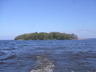
Coney Island is an island in Lough Neagh, Northern Ireland. It is about 1 km offshore from Maghery in County Armagh, is thickly wooded and of nearly 9 acres (36,000 m2) in area. It lies between the mouths of the River Blackwater and the River Bann in the south-west corner of Lough Neagh. Boat trips to the island are available at weekends from Maghery Country Park or Kinnego Marina. The island is owned by the National Trust and managed on their behalf by Armagh City, Banbridge and Craigavon Borough Council. Coney Island Flat is a rocky outcrop adjacent to the island. Although Samuel Lewis called Coney Island the only island in County Armagh, Armagh's section of Lough Neagh also includes Croaghan Island, as well as the marginal cases of Padian and Derrywarragh Island.
Crom Castle is a country house on the shores of Upper Lough Erne in County Fermanagh, Northern Ireland, the seat of the Earls Erne. Standing within the 1,900-acre (7.7 km2) Crom Estate, and within a formal garden, the castle is built in stone. A central battlemented tower includes the main entrance, and there are also smaller towers to one side. It stands apart from the ruins of Old Crom Castle, of which two towers, some walls, and a ha-ha survive, and near them two ancient yew trees, believed to be at least 800 years old.
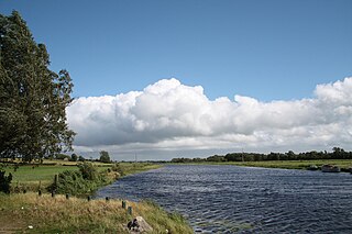
Bannfoot is a small village in the townland of Derryinver, County Armagh, Northern Ireland. It sits where the Upper Bann flows into Lough Neagh.
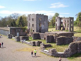
Shane's Castle is a ruined castle near Antrim in County Antrim, Northern Ireland, which was mostly destroyed in 1816 by fire. The castle is situated on the north-east shores of Lough Neagh, 2.7 miles from Randalstown. Built in 1345 by a member of the Clandeboy O'Neill dynasty, it was originally known as Edenduffcarrick, meaning "brow of black rock". It owes its present name to Shane McBrian McPhelim O'Neill, who ruled Lower Clandeboy between 1595 and 1617.

Maghery Country Park is a park in the village of Maghery, County Armagh, Northern Ireland, on the shores of Lough Neagh. It covers 30 acres (120,000 m2) and includes five km of woodland walks and picnic areas and is used for birdwatching, fishing, and walking. Coney Island lies one km off shore and boat trips are available from the park at weekends. It is an important local amenity and tourist attraction and is managed by Armagh City, Banbridge and Craigavon Borough Council.

Inis Cealtra, also known in English as Inishcaltra or Holy Island, is an island off the western shore of Lough Derg in Ireland. Now uninhabited, it was once a monastic settlement. It has an Irish round tower, and the ruins of several small churches, as well as four high crosses and a holy well. Despite the lack of population, the cemetery on this island is still in use. Coffins and mourners are transported the short distance from County Clare in small boats. Boat trips can be taken from the harbour at Mountshannon. It is conserved by the East Clare Heritage Centre.
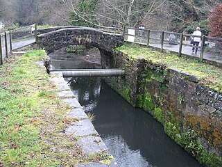
The Lagan Canal was a 44-kilometre (27 mi) canal built to connect Belfast to Lough Neagh. The first section, which is a river navigation, was opened in 1763, and linked Belfast to Lisburn. The second section from Lisburn to Lough Neagh includes a small amount of river navigation, but was largely built as a canal. At its peak it was one of the most successful of the Irish canals, but ultimately it was unable to compete with road and rail transport, and the two sections were closed in 1954 and 1958. The central section from Sprucefield to Moira was destroyed by the construction of the M1 motorway in the 1960s. Responsibility for most of its remains passed first to the Department of Agriculture and then to the Department of Culture, Arts and Leisure, although the section between Aghalee Bridge and Lough Neagh, including the final ten locks, passed into private ownership. There is an active campaign to re-open the canal, including reinstatement of the central section.
Oxford Island is a National Nature Reserve and public recreation site on the southern shores of Lough Neagh at Lurgan, County Armagh. The site covers 282 acres and is owned and maintained by Armagh City, Banbridge and Craigavon Borough Council. Much of the area is designated as a National Nature Reserve due to its wide variety of natural habitats. The purpose of all work on the island is to maintain biodiversity and to provide a recreation area for everyone.


