
Licking County is a county located in the U.S. state of Ohio. As of the 2010 census, the population was 166,492. Its county seat is Newark. The county was formed on January 30, 1808 from portions of Fairfield County. It is named for the salt licks that were in the area.

Red Butte Garden and Arboretum consists of a botanical garden, arboretum, and amphitheatre operated by the University of Utah, in the foothills of the Wasatch Range in Salt Lake City, Utah, United States. It is open year-round to the public. Red Butte Garden contains over 100 acres (0.40 km2) of botanical gardens and several miles of hiking trails through native vegetation. Red Butte Creek runs within the northern part of the park.

The Kokosing River (ko-KO-sing) is a tributary of the Walhonding River, 57.2 miles (92.1 km) long, in east-central Ohio in the United States. Via the Walhonding, Muskingum and Ohio Rivers, it is part of the watershed of the Mississippi River, draining an area of 482 square miles (1248 km²).
Etymologically, "Kokosing" translates roughly to "River of Little Owls."
The Kokosing River rises in Morrow County, northeast of Mount Gilead, and initially flows southwardly. It turns eastwardly near Chesterville and flows through Knox and Coshocton Counties, passing the communities of Mount Vernon, Howard and Gambier. In western Coshocton County the Kokosing joins the Mohican River to form the Walhonding River, about 2 miles (3 km) northwest of Nellie.

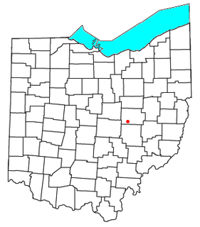
Funk is an unincorporated community in southwestern Plain Township, Wayne County, Ohio, United States. Because it is not tracked by the U.S. Census, a census population estimate is not available.
Secrest Arboretum is an arboretum located on the campus of the Ohio Agricultural Research and Development Center (OARDC), at the intersection of Pine Road and Green Drive, Wooster, Ohio. It is open daily without charge and hosts an estimated 10,000 visitors each year.

Chadwick Arboretum is a 62 acres (25 ha) arboretum on the Agriculture campus of The Ohio State University, in Columbus, Ohio, United States. The main arboretum collection is located just across Lane Avenue from the Schottenstein Center with its other collections nearby. The arboretum is open daily without charge.

Milligan is a small unincorporated community in southern Harrison Township, Perry County, Ohio, United States. It is located on State Route 93 between Crooksville and New Lexington.

Tunnel Hill is an unincorporated community in central Bedford Township, Coshocton County, Ohio, United States. It lies in the valley of the Little Wakatomika Creek a few miles south of Warsaw, along State Route 60 at its intersection with State Route 541.
Wakatomika is an unincorporated community in central Washington Township, Coshocton County, Ohio, United States. Wakatomika is located on the Little Wakatomika Creek, and lies along State Route 60.
The Metro Parks are a group of 19 metropolitan parks in and around Columbus, Ohio. They are officially organized as the "Columbus and Franklin County Metropolitan Park District". The Metro Parks system was organized in 1945 under Ohio Revised Code Section 1545 as a separate political division of the state of Ohio. The Metro Parks are overseen by a Board of Park Commissioners consisting of three citizens appointed to three-year terms without compensation by the Judge of the Probate Court of Franklin County, Ohio. The Board in turn appoints an Executive Director responsible for operations and management of the parks.
The Horse-Shoe Trail is a 140-mile (230 km) trail that runs from the western edge of Valley Forge National Historical Park westward toward Harrisburg, Pennsylvania. It ends about 15 miles (24 km) northeast of Harrisburg at the Appalachian Trail.

Jacksontown is an unincorporated community in central Licking Township, Licking County, Ohio, United States. Although it is unincorporated, it has a post office, with the ZIP code of 43030. It lies at the intersection of U.S. Route 40 with State Route 13.

Homer is an unincorporated community in northern Burlington Township, Licking County, Ohio, United States. Although it is unincorporated, it has a post office, with the ZIP code of 43027. It lies along State Route 661 between Granville and Mount Vernon.

Brownsville is a census-designated place in northeastern Bowling Green Township, Licking County, Ohio, United States. Although it is unincorporated, it has a post office, with the ZIP code of 43721. It lies at the intersection of U.S. Route 40 with State Route 668. The post office has been taken out.

Johnsville, also known as Shauck, is an unincorporated community in northern Perry Township, Morrow County, Ohio, United States. Although it is unincorporated, it has a post office, with the ZIP code of 43349. It is located at the intersection of U.S. Route 42 with State Route 314.

Nashport is an unincorporated community in western Licking Township, Muskingum County, Ohio, United States. Although it is unincorporated, it has a post office, with the ZIP code of 43830. It lies along State Route 146.
Zaleski State Forest is the second-largest state forest in the U.S. state of Ohio, located primarily in Vinton County, with areas in Athens County as well. The 28,000 acre (110 km²) forest surrounds Lake Hope State Park in Vinton County, and extensively borders the Waterloo Wildlife Research Station in Athens County. It is also located close to the Wayne National Forest. In addition, the older and much smaller Waterloo State Forest in Athens County is administered as part of the Zaleski. The forest is named after the Vinton County village of Zaleski, where the forest headquarters are located, and is centered on State Route 278.
Scioto Trail State Forest is a state forest in Pike and Ross counties in the U.S. state of Ohio. Scioto Trail State Park lies within the state forest.
The Kokosing Gap Trail is a 14-mile-long recreational trail built on a former Pennsylvania Railroad right-of-way alongside the Kokosing River in east central Ohio. The trail begins in Mount Vernon and winds itself to Danville via Gambier and Howard.

Mineral is an unincorporated community in Athens County, Ohio, United States. Centered on State Route 356, it was established as a coal-mining community. It is located on Mud Lick Run, which flows into nearby Hewitt Fork, a tributary of Raccoon Creek. The B&O Railroad once ran through the community, but was abandoned in the 1980s. In recent years, the portion of the old railroad grade going west from the community has become the Moonville Rail-Trail. The King Switch Tunnel on the grade is close to the community. The next larger community is New Marshfield, also unincorporated, to the east in the same township.


