The San Ramon Valley is a valley and region in Contra Costa County and Alameda County, in the East Bay region of the San Francisco Bay Area in northern California.
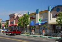
El Cerrito Plaza is a shopping center in El Cerrito, California, a suburb in the San Francisco Bay Area.

Rancho San Lorenzo was a 26,722-acre (108.14 km2) Mexican land grant given in 1841 by Governor Juan Alvarado to Guillermo Castro a career soldier posted to the Pueblo of San José. The land grant included present day Hayward, San Lorenzo, and Castro Valley, including Crow Canyon, Cull Canyon, and Palomares Canyons.
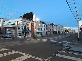
The Parkside is a neighborhood in the western part of San Francisco, California. It is located in the southern part of the Avenues south of Quintara and north of Sloat Boulevard.
Rancho San Pablo was a 17,939-acre (72.60 km2) land grant in present-day Contra Costa County, California given in 1823 by Governor Luís Antonio Argüello to Francisco María Castro (1775–1831), a former soldier at the San Francisco Presidio and one-time alcalde of the Pueblo of San José. The grant was reconfirmed by Governor José Figueroa in 1834 to the heirs of Francisco Castro, including Víctor Castro. The San Pablo grant covered what is now Richmond, San Pablo, El Cerrito, and Kensington in western Contra Costa County.

Pacheco Creek is a 3.4-mile-long (5.5 km) waterway in central Contra Costa County, California, United States. It empties into Suisun Bay. It is formed by the intersection of Walnut Creek, Grayson Creek and Pine Creek.

Rancho Arroyo de Las Nueces y Bolbones was a 17,782-acre (71.96 km2) Mexican land grant in present-day Contra Costa County, California given in 1834 by Governor José Figueroa to Juana Sanchez de Pacheco.
Rancho Acalanes was a 3,329-acre (13.47 km2) Mexican land grant in present-day Contra Costa County, California.
Rancho Buri Buri was a 14,639-acre (59.24 km2) Mexican land grant in present-day San Mateo County, California, given in 1835 by Governor José Castro to José Antonio Sánchez. The name derives from the Urebure village of the Ramaytush speaking Yelamu tribe of Ohlone people who were settled by the banks of San Bruno Creek. Rancho Buri Buri extended between the north line of South San Francisco and the middle of Burlingame, and from the San Francisco Bay to the top of the Peninsula ridge and included present-day Lomita Park, Millbrae, South San Francisco, San Bruno, and the northern part of Burlingame.
Rancho Monte del Diablo was a 17,921-acre (72.52 km2) Mexican land grant in present-day Contra Costa County, California given in 1834 by Governor José Figueroa to Salvio Pacheco. The name "Monte del Diablo" means "thicket of the devil" in Spanish. The name was later incorrectly translated as Mount Diablo. The grant covered the area from the Walnut Creek channel east to the hills, and generally from the Mount Diablo foothills north along Lime Ridge to Avon on the Carquinez Strait of the Sacramento River, and included present day Concord and parts of Pleasant Hill. Pacheco and Clayton are outside of the Rancho Monte del Diablo grant.
Rancho Las Juntas was a 13,293-acre (53.79 km2) Mexican land grant in present day Contra Costa County, California given in 1844 by Governor Manuel Micheltorena to William Welch. The name Las Juntas translates as "the Crossroads". The grant was located between Ygnacio Martinez’ Rancho El Pinole and Salvio Pacheco’s Rancho Monte del Diablo, and included northwestern Walnut Creek, all of Pleasant Hill, and the eastern portion of Martinez. The original borders of the claim were defined as the straits to the north, "Las Juntas" to the south, the Walnut creek to the east, the Reliz ridge to the west, and, to the northwest, the Alhambra creek.
Rancho San Leandro was a 6,830-acre (27.6 km2) Mexican land grant in present-day Alameda County, California given in 1842 by Governor Juan Alvarado to José Joaquín Estudillo. The grant extended along the east San Francisco Bay from San Leandro Creek south to San Lorenzo Creek, and encompassed present-day San Leandro.
Rancho San Miguel was a 4,443-acre (17.98 km2) Mexican land grant in present-day San Francisco County, California. The land grant was given in 1845 by Governor Pío Pico to José de Jesús Noé. It included what is now known as Eureka Valley, and extended past Mount Davidson almost to present-day Daly City; it encompassed the present-day San Francisco neighborhoods of Noe Valley, the Castro, Glen Park, Diamond Heights and St. Francis Wood.
Rancho San Miguelito was a 14,198-acre (57.46 km2) Mexican land grant in present-day San Luis Obispo County, California given in 1842 by Governor Juan Alvarado to Miguel Ávila, and an addition granted in 1846 by Governor Pio Pico. The grant extended along the Pacific coast, and included Point San Luis, San Luis Obispo Bay, and present day Avila Beach.
Rancho San Miguel was a 6,663-acre (26.96 km2) Mexican land grant in present-day Sonoma County, California given in 1840 by Governor Juan B. Alvarado to William Marcus West. The grant was located north of present-day Santa Rosa, between Mark West Creek and Santa Rosa Creek, and encompassed present-day Mark West and Mark West Springs.
Rancho Laguna de la Merced was a 2,219-acre (8.98 km2) Mexican land grant, in present-day southwestern San Francisco and northwestern San Mateo County, California.
Rancho Punta de Quentin was a 8,877-acre (35.92 km2) Mexican land grant in present-day Marin County, California, given in 1840 by Governor Juan B. Alvarado to John B.R. Cooper. The grant comprised not only the San Quentin peninsula, but also present-day Ross, Kentfield and part of San Anselmo.

Rancho el Corte de Madera was a 13,316-acre (53.89 km2) Mexican land grant in present day Santa Clara County, California given in 1844 by Governor Manuel Micheltorena to Máximo Martínez. The name translates as "the place where lumber is cut". The roughly triangular shaped grant was west of today's I-280, and bounded on the north by Alambique Creek and San Francisquito Creek, on the south by Los Trancos Creek and Matadero Creek, and on the west by what is now Skyline Boulevard. The grant surrounded Rancho Cañada del Corte de Madera which extended along the Portola Valley. The land grant included parts of present day Woodside, Ladera and Stanford University.
Rancho Corral de Tierra was a 7,766-acre (31.43 km2) Mexican land grant in present-day coastal western San Mateo County, northern California.
Rancho San Vicente was a 10,803-acre (43.72 km2) Mexican land grant in present day Santa Cruz County, California given in 1846 by Governor Pío Pico to Blas A. Escamilla. The grant extended along the Pacific coast from Molino Creek and Rancho Agua Puerca y las Trancas south past Davenport Landing to San Vicente Creek and Rancho Arroyo de la Laguna. The grant stretched from the coast back into the Santa Cruz Mountains between the two neighboring ranchos. The former Rancho San Vicente lands contain most of today's community of Davenport.