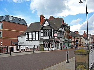
The Borough of Stafford is a local government district with borough status in Staffordshire, England. It is named after Stafford, its largest town, which is where the council is based. The borough also includes the towns of Stone and Eccleshall, as well as numerous villages and surrounding rural areas.

The Chasewater Railway is a former colliery railway running round the shores of Chasewater in Staffordshire, England. It is now operated as a heritage railway.
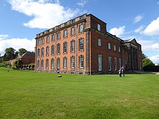
Chillington Hall is a Georgian country house near Brewood, Staffordshire, England, four miles northwest of Wolverhampton. It is the residence of the Giffard family. The Grade I listed house was designed by Francis Smith in 1724 and John Soane in 1785. The park and lake were landscaped by Capability Brown.

Norbury is a village and civil parish in the Borough of Stafford, in west Staffordshire, England. The population as taken at the 2011 census was 371.
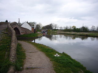
Great Haywood is a village in central Staffordshire, England, just off the A51 and about 4.5 miles (7.2 km) northwest of Rugeley and 7.1 miles (11.4 km) southeast of the county town of Stafford. Population details taken at the 2011 census can be found under Colwich.

Haughton is a village in Staffordshire, England, approximately 4 miles outside and to the west of the county town of Stafford. It lies on the A518 between Stafford and Gnosall. The name derives from a combination of the Mercian word halh meaning 'nook' and the Old English word tun meaning 'settlement', 'enclosure' or 'village.'
Milford is a village in the county of Staffordshire, England. It lies at the edge of Cannock Chase, on the A513 road between Stafford and Rugeley. Just to the north of the village is the River Sow.

The Staffordshire Way is a long-distance walk in Staffordshire, England. The path links with the Cheshire Gritstone Trail, the Heart of England Way and the North Worcestershire Path.

The Rudyard Lake Steam Railway is a ridable miniature railway and the third railway of any gauge to run along the side of Rudyard Lake in Staffordshire, England.
Stafford Rural District was a rural district in the county of Staffordshire. It was created in 1894 and abolished in 1974 by virtue of the Local Government Act 1972. On formation it contained the following civil parishes:
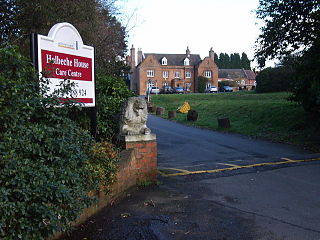
Holbeche House is a mansion located approximately 1 mile (1.6 km) north of Kingswinford, now in the Metropolitan Borough of Dudley but historically in Staffordshire. Some members of the Gunpowder Plot were either killed or captured at Holbeche House in 1605.
Colwich is a civil parish and village in Staffordshire, England. It is situated off the A51 road, about 3 miles (5 km) north-west of Rugeley and 7 miles (11 km) south-east of Stafford. It lies principally on the north-east bank of the River Trent, near Wolseley Bridge and just north of The Chase. The parish comprises about 2,862 hectares (28.62 km2) of land in the villages and hamlets of Colwich, Great Haywood, Little Haywood, Moreton, Bishton and Wolseley Bridge.
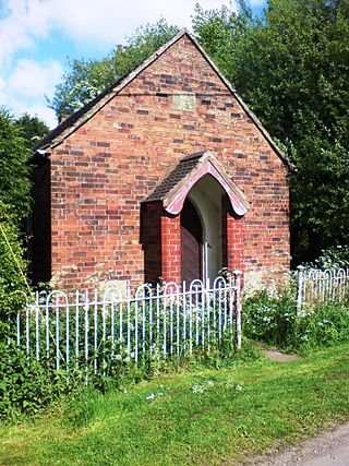
Coton Clanford is a small dispersed Staffordshire village lying in gently rolling countryside 3 miles (4.8 km) due west of Stafford, England, and 1 mile (1.6 km) southeast of Seighford. The name of the village is sometimes hyphenated to Coton-Clanford, appearing this way on some cottage names locally. The population for this village as taken at the 2011 census can be found under Seighford. It lies midway between the B5405 road, 1½ miles to the north and the A518 1½ miles to the south.

Ranton is a small hamlet in Staffordshire, England, situated 3.5 miles (5.6 km) west of Stafford, 2.5 miles (4.0 km) east of Woodseaves and 2 miles (3.2 km) northeast of Gnosall. The population taken at the 2011 census was 382. As of 2013, both public houses that once operated in Ranton were bought and subsequently removed from operation. Due to this, Ranton is now listed as a hamlet.

Ellenhall is a small Staffordshire hamlet roughly 2.5 miles south of Eccleshall originally comprising part of the extensive estates of the Earl of Lichfield. The population as taken at the 2011 census was 144. The hamlet consists of a scattered community of cottages and several farms. Ellenhall has no shop, public house or post office.

Ranton Abbey or Ranton Priory was an Augustinian Priory in Ranton, Staffordshire, England, built c.1150 by Robert fitz Noel of Ellenhall. The priory flourished in the 13th century as a subordinate house to Haughmond Abbey. Ranton was dissolved by the Suppression of Religious Houses Act 1535 for dissolving the lesser monasteries.

Abbey House is an early 19th-century ruined stately home in Ranton, Staffordshire, England.
Ellenhall is a civil parish in the Borough of Stafford, Staffordshire, England. It contains five listed buildings that are recorded in the National Heritage List for England. Of these, two are at Grade II*, the middle of the three grades, and the others are at Grade II, the lowest grade. The parish contains the villages of Ellenhall and Ranton and the surrounding countryside. The listed buildings consist of a church, a cross in the churchyard, the surviving tower of an abbey church, a house, and a milepost.
Ranton is a civil parish in the Borough of Stafford, Staffordshire, England. It contains four listed buildings that are recorded in the National Heritage List for England. All the listed buildings are designated at Grade II, the lowest of the three grades, which is applied to "buildings of national importance and special interest". The parish contains the village of Ranton and the surrounding countryside. The listed buildings consist of a church, a farmhouse, a cottage, and a milepost.


