Related Research Articles
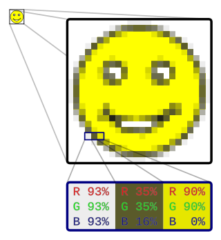
In computer graphics and digital photography, a raster graphics represents a two-dimensional picture as a rectangular matrix or grid of square pixels, viewable via a computer display, paper, or other display medium. A raster is technically characterized by the width and height of the image in pixels and by the number of bits per pixel. Raster images are stored in image files with varying dissemination, production, generation, and acquisition formats.
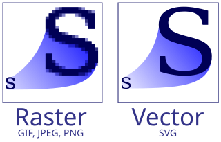
Vector graphics is a form of computer graphics in which visual images are created directly from geometric shapes defined on a Cartesian plane, such as points, lines, curves and polygons. The associated mechanisms may include vector display and printing hardware, vector data models and file formats, as well as the software based on these data models. Vector graphics is an alternative to raster or bitmap graphics, with each having advantages and disadvantages in specific situations.

A nautical chart or hydrographic chart is a graphic representation of a sea region or water body and adjacent coasts or banks. Depending on the scale of the chart, it may show depths of water (bathymetry) and heights of land (topography), natural features of the seabed, details of the coastline, navigational hazards, locations of natural and human-made aids to navigation, information on tides and currents, local details of the Earth's magnetic field, and human-made structures such as harbours, buildings, and bridges. Nautical charts are essential tools for marine navigation; many countries require vessels, especially commercial ships, to carry them. Nautical charting may take the form of charts printed on paper or computerized electronic navigational charts. Recent technologies have made available paper charts which are printed "on demand" with cartographic data that has been downloaded to the commercial printing company as recently as the night before printing. With each daily download, critical data such as Local Notices to Mariners are added to the on-demand chart files so that these charts are up to date at the time of printing.
A hydrographic office is an organization which is devoted to acquiring and publishing hydrographic information.
A GIS file format is a standard for encoding geographical information into a computer file, as a specialized type of file format for use in geographic information systems (GIS) and other geospatial applications. Since the 1970s, dozens of formats have been created based on various data models for various purposes. They have been created by government mapping agencies, GIS software vendors, standards bodies such as the Open Geospatial Consortium, informal user communities, and even individual developers.
A digital image is an image composed of picture elements, also known as pixels, each with finite, discrete quantities of numeric representation for its intensity or gray level that is an output from its two-dimensional functions fed as input by its spatial coordinates denoted with x, y on the x-axis and y-axis, respectively. Depending on whether the image resolution is fixed, it may be of vector or raster type. By itself, the term "digital image" usually refers to raster images or bitmapped images.

An image viewer or image browser is a computer program that can display stored graphical images; it can often handle various graphics file formats. Such software usually renders the image according to properties of the display such as color depth, display resolution, and color profile.
RNC may refer to:

Hierarchical Data Format (HDF) is a set of file formats designed to store and organize large amounts of data. Originally developed at the U.S. National Center for Supercomputing Applications, it is supported by The HDF Group, a non-profit corporation whose mission is to ensure continued development of HDF5 technologies and the continued accessibility of data stored in HDF.
Mixed raster content (MRC) is a method for compressing images that contain both binary-compressible text and continuous-tone components, using image segmentation methods to improve the level of compression and the quality of the rendered image. By separating the image into components with different compressibility characteristics, the most efficient and accurate compression algorithm for each component can be applied.
GRIB is a concise data format commonly used in meteorology to store historical and forecast weather data. It is standardized by the World Meteorological Organization's Commission for Basic Systems, known under number GRIB FM 92-IX, described in WMO Manual on Codes No.306. Currently there are three versions of GRIB. Version 0 was used to a limited extent by projects such as TOGA, and is no longer in operational use. The first edition is used operationally worldwide by most meteorological centers, for Numerical Weather Prediction output (NWP). A newer generation has been introduced, known as GRIB second edition, and data is slowly changing over to this format. Some of the second-generation GRIB is used for derived products distributed in the Eumetcast of Meteosat Second Generation. Another example is the NAM model.
An image file format is a file format for a digital image. There are many formats that can be used, such as JPEG, PNG, and GIF. Most formats up until 2022 were for storing 2D images, not 3D ones. The data stored in an image file format may be compressed or uncompressed. If the data is compressed, it may be done so using lossy compression or lossless compression. For graphic design applications, vector formats are often used. Some image file formats support transparency.
MrSID is an acronym that stands for multiresolution seamless image database. It is a file format developed and patented by LizardTech for encoding of georeferenced raster graphics, such as orthophotos.

An electronic navigational chart (ENC) is an official database created by a national hydrographic office for use with an Electronic Chart Display and Information System (ECDIS). ECDIS and ENCs are the primary means of electronic navigation on cargo ships.
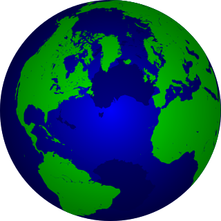
The Vector Map (VMAP), also called Vector Smart Map, is a vector-based collection of geographic information system (GIS) data about Earth at various levels of detail. Level 0 (low resolution) coverage is global and entirely in the public domain. Level 1 (global coverage at medium resolution) is only partly in the public domain.

The Geospatial Data Abstraction Library (GDAL) is a computer software library for reading and writing raster and vector geospatial data formats, and is released under the permissive X/MIT style free software license by the Open Source Geospatial Foundation. As a library, it presents a single abstract data model to the calling application for all supported formats. It may also be built with a variety of useful command line interface utilities for data translation and processing. Projections and transformations are supported by the PROJ library.
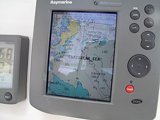
A Chartplotter is a device used in marine navigation that integrates GPS data with an electronic navigational chart (ENC).
The CALS Raster file format is a standard for the interchange of graphics data. It was developed by the United States Department of Defense (DoD) as part of the Continuous Acquisition and Life-cycle Support (CALS) initiative. It defines a standard storing raster (bit-mapped) image data, either uncompressed or compressed using CCITT Group 4 compression.
A paperless office is a work environment in which the use of paper is eliminated or greatly reduced. This is done by converting documents and other papers into digital form, a process known as digitization. Proponents claim that "going paperless" can save money, boost productivity, save space, make documentation and information sharing easier, keep personal information more secure, and help the environment. The concept can be extended to communications outside the office as well.
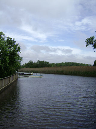
Sparkill Creek, is a tributary of the Hudson River in Rockland County, New York and Bergen County, New Jersey in the United States. It flows through the Sparkill Gap in the Hudson Palisades, which was created by a fault line which provided the only sea-level break in the Palisades.
References
- ↑ "Nautical Chart Viewer Frequently Asked Questions" (PDF). p. 3. Retrieved 2023-08-11.