| Ratnapura Dutch fort | |
|---|---|
| Ratnapura, Sri Lanka | |
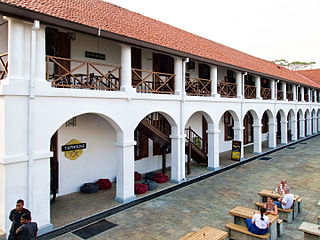
Entrance arch of the fort premises | |
 Ratnapura Dutch fort | |
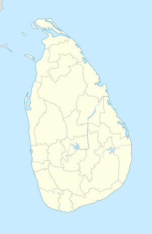
| Coordinates | 6°40′46″N80°24′09″E / 6.679548°N 80.402549°E Coordinates: 6°40′46″N80°24′09″E / 6.679548°N 80.402549°E |
| Type | Defence fort |
| Site history | |
| Built by | Dutch |

Ratnapura Dutch fort, (Sinhalese : රත්නපුර ලන්දේසි බලකොටුව), was built by the Dutch in Ratnapura, Sri Lanka.
Dutch Ceylon was a governorate established in present-day Sri Lanka by the Dutch East India Company. Although the Dutch managed to capture most of the coastal areas in Sri Lanka they were never able to control the Kandyan Kingdom located in the interior of the island. Dutch Ceylon existed from 1640 until 1796.

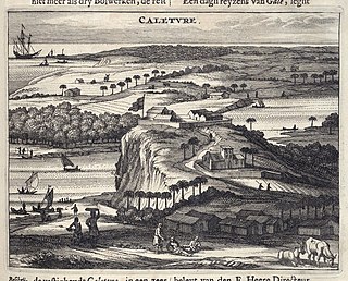
Ratnapura is a major city in Sri Lanka. It is the capital city of Sabaragamuwa Province, as well as the Ratnapura District, and is a traditional centre for the Sri Lankan gem trade. It is located on the Kalu Ganga in south-central Sri Lanka, some 101 km (63 mi) southeast of the country's capital, Colombo. Ratnapura is also spelled as Rathnapura.
The Portuguese had originally constructed a fort at Ratnapura in 1620 however was later captured and destroyed by Kirti Sri Raja Singha (the second Nayaka king of Kandy). By 1658 the Dutch had taken control over all the areas previously controlled by the Portuguese. The Dutch initially used the site of the Portuguese fort but subsequently built a new fort on a hill in the middle of the town.

Portuguese Ceylon was the control of the Kingdom of Kotte by the Portuguese Empire, in present-day Sri Lanka, after the country's Crisis of the Sixteenth Century and into the Kandyan period.

Ratnapura Portuguese fort was built by the Portuguese in Ratnapura, Sri Lanka.

Kirti Sri Raja Singha was the second Nayaka king of Kandy. He was a prince from the Madurai Nayak Dynasty and the brother-in-law of Sri Vijaya Raja Singha. He succeeded his brother-in-law to the throne in 1751.
The design of the fort is similar to the fort at Kalutara, in that it had two bastions. The fort was large enough to accommodate the governor's office and residence, court building, hospital, chapel and barracks for 40 men. It was captured by the British in 1817. [1]
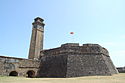
Kalutara fort was built by the Portuguese in 1622. It was located in Kalutara, Sri Lanka.
It was declared as an archaeological monument in 2002 and 2005. It was however partially demolished by the local government, who constructed a number of buildings on the site. The fort is currently being used as the offices for the National Gem and Jewellery Authority, together with a number of private offices. [2]
The site of the fort is now where the Police Station (established 1 January 1864), Public Library and the former Kachcheri (established 1817) are now situated.
A kachcheri or district secretariat is the principal government department that administrates a district in Sri Lanka. Each of the 25 districts has a kachcheri.