Stalybridge is a town in Tameside, Greater Manchester, England, with a population of 23,731 at the 2011 Census. Historically divided between Cheshire and Lancashire, it is 8 miles (12.9 km) east of Manchester city centre and 6 miles (9.7 km) north-west of Glossop.

Low Bradfield is a village within the civil parish of Bradfield in South Yorkshire, England. It is situated within the boundary of the city of Sheffield in the upper part of the Loxley Valley, 6¼ miles west-northwest of the city centre and just inside the northeast boundary of the Peak District National Park. Low Bradfield and the surrounding area is noted for its attractive countryside which draws many visitors from the more urban parts of Sheffield. At weekends the village can become quite crowded, especially when there is a match on the village cricket pitch. Low Bradfield which stands in the shadow of Agden Reservoir has a sister village High Bradfield which is located at a higher altitude, ½ mile to the northeast. The two villages are joined by the steep Woodfall Lane.

Yeadon is a town within the metropolitan borough of the City of Leeds, West Yorkshire, England.

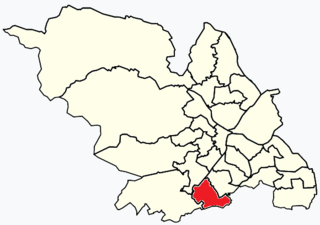
Broomhill and Sharrow Vale — which includes the districts of Broomhill, Broomhall, Crookesmoor, Endcliffe, Sharrow Vale and Tapton Hill — is one of the 28 electoral wards in City of Sheffield, England. The ward was created following the 2015 local government boundary review out of parts of the old Broomhill, Central and Nether Edge wards. It is located in the western part of the city. The population of the Broomhill ward in 2011 was 16,966 people in 5,708 households, covering an area of 2.7 km2. Broomhill & Sharrow Vale is one of the wards that make up the Sheffield Central Parliamentary Constituency.
The Metropolitan Borough of Barnsley is a metropolitan borough in South Yorkshire, England; the main settlement is Barnsley and other notable towns include Penistone, Wombwell and Hoyland.

The University of Huddersfield is a public research university located in Huddersfield, West Yorkshire, England. It has been a University since 1992, but has its origins in a series of institutions dating back to the 19th century. It has made teaching quality a particular focus of its activities, winning the inaugural Higher Education Academy Global Teaching Excellence Award, and achieving a Teaching Excellence Framework (TEF) Gold Award, both in 2017. It has consistently been ranked among the leading universities in England for the proportion of its staff with a teaching qualification, and in 2022 was at the top with 94%. The University has also put an increasing focus on research quality, and as of 2022 more than three quarters of its academic staff hold a doctorate, the third highest rate in England.

Victoria Park is a suburban area of Manchester, England. Victoria Park lies approximately two miles south of Manchester city centre, between Rusholme and Longsight.

Sheffield Tramway was an extensive tramway network serving the English city of Sheffield and its suburbs.

Marsh is a suburb of Huddersfield, West Yorkshire, England that is situated 0.93 miles (1.5 km) west of the town centre.
Paddock is a district of Huddersfield, West Yorkshire, England. It is situated 1-mile (1.6 km) to the south-west of the town centre.
Lowerhouses is a residential district in the town of Huddersfield, Kirklees, West Yorkshire, England.

Brimington is a large village and civil parish in the Borough of Chesterfield in Derbyshire, England. The population of the parish taken at the 2011 census was 8,788. The town of Staveley is to the east, and Hollingwood is nearby. The parish includes Brimington Common along the Calow Road, and New Brimington, a late 19th-century extension towards the Staveley Iron Works.

Waterloo is a suburb of Huddersfield, West Yorkshire, England. It is 2 miles (3.2 km) to the east of Huddersfield Town Centre. It is the part of Dalton named after the former Waterloo public house and consists mostly of housing with a central shopping area made up of independent shops, a large Morrisons Supermarket, and a petrol station located on Penistone Road.

Oakes is a district of Huddersfield, West Yorkshire, England. It is situated 2 miles (3 km) to the west of the town centre off the A640 New Hey Road towards the M62 motorway, between Marsh, Lindley, Quarmby and Salendine Nook.

Morley Tunnel is a railway tunnel in West Yorkshire, England, situated between Morley and Batley railway stations on the Huddersfield line. From its northern end, it extends 3,369 yards (3,081 m), passing beneath Morley town centre, to its southern end.
Dalton is a ward of Huddersfield in the metropolitan borough of Kirklees, West Yorkshire, England. It contains 44 listed buildings that are recorded in the National Heritage List for England. All the listed buildings are designated at Grade II, the lowest of the three grades, which is applied to "buildings of national importance and special interest". The ward is to the east and the northeast of the centre of Huddersfield. The southern part of the ward is mainly residential, the eastern part is mainly industrial, and to the west and north are areas of countryside. The Huddersfield Broad Canal runs along the eastern part, and the listed buildings associated with it are locks, bridges and a warehouse. Most of the listed buildings in the residential parts are houses, cottages, shops and associated structures, and in the countryside they are farmhouses and farm buildings. The other listed buildings include churches and related structures, the remains of a hypocaust and a former cloth hall re-erected in a park, a road bridge, mill buildings and a mill chimney.