
Downtown Brooklyn is the third largest central business district in New York City, and is located in the northwestern section of the borough of Brooklyn. The neighborhood is known for its office and residential buildings, such as the Williamsburgh Savings Bank Tower and the MetroTech Center office complex.

The N Broadway Express is a rapid transit service in the B Division of the New York City Subway. Its route emblem, or "bullet," is colored yellow, since it uses the BMT Broadway Line in Manhattan.

The DeKalb Avenue station is an interchange station on the BMT Brighton Line and BMT Fourth Avenue Line of the New York City Subway, located at the intersection of DeKalb and Flatbush Avenues in Downtown Brooklyn. It is served by the Q and R trains at all times, the B train on weekdays, and the D and N trains during late nights. During rush hours only, a few W train trips also serve this station.
The BMT Fourth Avenue Line is a rapid transit line of the New York City Subway, mainly running under Fourth Avenue in Brooklyn. The line is served by the D, N, and R at all times; the R typically runs local, while the D and N run express during the day and local at night. During rush hours, select W trains also serve the line. Northbound D and N trains run local along the line after 6:45 p.m. during weekdays as well. The line was originally built by the Brooklyn Rapid Transit Company and is now internally operated as part of the New York City Subway's B Division.

Myrtle Avenue is a 8.1-mile-long (13.0 km) street that runs from Duffield Street in Downtown Brooklyn to Jamaica Avenue in Richmond Hill, Queens, in New York City, United States. Myrtle is a main thoroughfare through the neighborhoods of Fort Greene, Clinton Hill, Bedford-Stuyvesant, Bushwick, Ridgewood, and Glendale.
Vanderbilt Avenue is the name of three thoroughfares in the New York City boroughs of Brooklyn, Manhattan, and Staten Island. They were named after Cornelius Vanderbilt (1794–1877), the builder of Grand Central Terminal in Midtown Manhattan.

DeKalb Avenue is a thoroughfare in the New York City boroughs of Brooklyn and Queens, with the majority of its length in Brooklyn.

The DeKalb Avenue Line is a public transit line in Brooklyn and Queens, New York City, running mostly along DeKalb Avenue, as well as eastbound on Lafayette Avenue, between Downtown Brooklyn and Ridgewood, Queens. Originally a streetcar line, it is now the B38 DeKalb/Lafayette Avenues bus route, operated by the New York City Transit Authority.
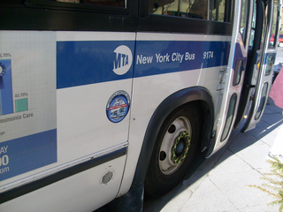
MTA Regional Bus Operations operates local and express buses serving New York City in the United States out of 29 bus depots. These depots are located in all five boroughs of the city, plus one located in nearby Yonkers in Westchester County. 21 of these depots serve MTA New York City Transit (NYCT)'s bus operations, while the remaining eight serve the MTA Bus Company These facilities perform regular maintenance, cleaning, and painting of buses, as well as collection of revenue from bus fareboxes. Several of these depots were once car barns for streetcars, while others were built much later and have only served buses.

The Brooklyn Hospital Center is a 464-licensed-bed, full-service community teaching hospital located in Downtown Brooklyn, New York City. The hospital was founded in 1845. It is affiliated with the Mount Sinai Health System, and serves a diverse population from a wide range of ethnic backgrounds.
Ocean Avenue is a major street in Brooklyn, New York that runs generally north-south and occupies the position of East 20th Street in the Brooklyn street grid, with East 19th Street to its west and East 21st Street to its east for most of its path. It runs east of and parallel to Ocean Parkway and Coney Island Avenue for most of its route. Except for a short stretch on the Manhattan Beach peninsula, Ocean Avenue starts in the south at Emmons Avenue in Sheepshead Bay just south of the Belt Parkway and continues north, ending at Flatbush Avenue at Willink Plaza after running for several blocks as the eastern edge of Prospect Park. A footbridge across Sheepshead Bay connects the two "Ocean Avenue" sections.
Wingate is a neighborhood in the north central portion of the New York City borough of Brooklyn. The area is bordered by Prospect Lefferts Gardens to the west, Crown Heights to the north and east, and East Flatbush to the south. Wingate is bounded by Empire Boulevard to the north, Troy Avenue to the east, Winthrop Street to the south, and New York Avenue to the west. The area is part of Brooklyn Community District 9. It is sometimes considered part of Crown Heights, East Flatbush, and/or Prospect Lefferts Gardens.
Wallabout is a neighborhood in the New York City borough of Brooklyn that dates back to the 17th century. It is one of the oldest areas of Brooklyn, in the area that was once Wallabout Bay but has largely been filled in and is now the Brooklyn Navy Yard.

LIU Brooklyn is a private university in Brooklyn, New York. It is the original unit and first of two main campuses of the private Long Island University system.
AVA DoBro, also known as Avalon Willoughby West and by its address of 100 Willoughby, is a residential high-rise building in Downtown Brooklyn, New York City. Developed by AvalonBay Communities, it has 826 units over 57 floors. As part of the development, a new entrance to the Jay Street–MetroTech station of the New York City Subway was built, including an elevator.

The Brooklyn Detention Complex was a jail facility located at 275 Atlantic Avenue, in Brooklyn. At full capacity, it was able to house 815 male prisoners in its single cells. Most of the population was made up of detainees undergoing the intake process or awaiting trial in Kings or Richmond County.

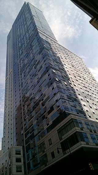
City Point is a mixed-use multi-building residential and commercial complex in Downtown Brooklyn, New York City. City Point is, by square footage, the largest mixed-use development in the city. City Point III, standing at 720 feet in height, is currently the second tallest building in Brooklyn as well as the fourth tallest on Long Island.

Albee Square is a public plaza in Downtown Brooklyn, New York City. The plaza is located at the intersection of Fulton Street, DeKalb Avenue, and Albee Square West. It is named after Edward Franklin Albee II who was the owner of several area theaters during the 1800s. Albee Square was a theater until 1977 when it was replaced by the Albee Square Mall, which was subsequently demolished for new development in 2004. The Dime Savings Bank Building, part of The Brooklyn Tower, is located on the northeast corner of Albee Square.
