Related Research Articles
A location-based service (LBS) is a general term denoting software services which use geographic data and information to provide services or information to users. LBS can be used in a variety of contexts, such as health, indoor object search, entertainment, work, personal life, etc. Commonly used examples of location based services include navigation software, social networking services, location-based advertising, and tracking systems. LBS can also include mobile commerce when taking the form of coupons or advertising directed at customers based on their current location. LBS also includes personalized weather services and even location-based games.

Wardriving is the act of searching for Wi-Fi wireless networks, usually from a moving vehicle, using a laptop or smartphone. Software for wardriving is freely available on the internet.

A satellite telephone, satellite phone or satphone is a type of mobile phone that connects to other phones or the telephone network by radio link through satellites orbiting the Earth instead of terrestrial cell sites, as cellphones do. Therefore, they can work in most geographic locations on the Earth's surface, as long as open sky and the line-of-sight between the phone and the satellite are provided. Depending on the architecture of a particular system, coverage may include the entire Earth or only specific regions. Satellite phones provide similar functionality to terrestrial mobile telephones; voice calling, text messaging, and low-bandwidth Internet access are supported through most systems. The advantage of a satphone is that it can be used in such regions where local terrestrial communication infrastructures, such as landline and cellular networks, are not available.
Floating car data (FCD) in traffic engineering and management is typically timestamped geo-localization and speed data directly collected by moving vehicles, in contrast to traditional traffic data collected at a fixed location by a stationary device or observer. In a physical interpretation context, FCD provides a Lagrangian description of the vehicle movements whereas stationary devices provide an Eulerian description. The participating vehicle acts itself consequently as a moving sensor using an onboard GPS receiver or cellular phone. The most common and widespread use of FCD is to determine the traffic speed on the road network. Based on these data, traffic congestion can be identified, travel times can be calculated, and traffic reports can be rapidly generated. In contrast to stationary devices such as traffic cameras, number plate recognition systems, and induction loops embedded in the roadway, no additional hardware on the road network is necessary.
Mobile telephony is the provision of telephone services to mobile phones rather than fixed-location phones. Telephony is supposed to specifically point to a voice-only service or connection, though sometimes the line may blur.

The history of mobile phones covers mobile communication devices that connect wirelessly to the public switched telephone network.

Mobile phone tracking is a process for identifying the location of a mobile phone, whether stationary or moving. Localization may be affected by a number of technologies, such as the multilateration of radio signals between (several) cell towers of the network and the phone or by simply using GNSS. To locate a mobile phone using multilateration of mobile radio signals, the phone must emit at least the idle signal to contact nearby antenna towers and does not require an active call. The Global System for Mobile Communications (GSM) is based on the phone's signal strength to nearby antenna masts.
Locative media or location-based media (LBM) is a virtual medium of communication functionally bound to a location. The physical implementation of locative media, however, is not bound to the same location to which the content refers.
TomTom N.V. is a Dutch multinational developer and creator of location technology and consumer electronics. Founded in 1991 and headquartered in Amsterdam, TomTom released its first generation of satellite navigation devices to market in 2004. As of 2019 the company has over 4,500 employees worldwide and operations in 29 countries throughout Europe, Asia-Pacific, and the Americas.
Traffic reporting is the near real-time distribution of information about road conditions such as traffic congestion, detours, and traffic collisions. The reports help drivers anticipate and avoid traffic problems. Traffic reports, especially in cities, may also report on major delays to mass transit that does not necessarily involve roads. In addition to periodic broadcast reports, traffic information can be transmitted to GPS units, smartphones, and personal computers.

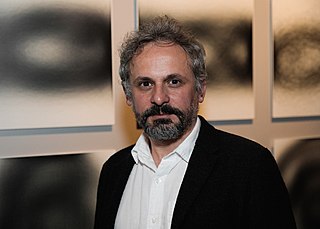
Carlo Ratti is an Italian architect, engineer, inventor, educator and activist. He is a professor at the Massachusetts Institute of Technology where he directs the MIT Senseable City Lab, a research group that explores how new technologies are changing the way we understand, design and ultimately live in cities. Ratti is also a founding partner of the international design and innovation office CRA-Carlo Ratti Associati, which he established in 2004 in Torino, Italy, and now has a branch in New York City, United States. Ratti was named one of the "50 most influential designers in America" by Fast Company and highlighted in Wired magazine's "Smart List: 50 people who will change the world".
Dashtop mobile equipment refers to wireless mobile devices mounted on the vehicle dashboard. Dashtop mobile equipment (DME) includes satellite radios, GPS navigation, OnStar, mobile TV, HD radio, vehicle tracking system, MVEDR and Broadband Wireless Access (BWA) devices. Currently, the dashtop mobile devices are mostly satellite-based wireless technology. Except for OnStar and BWA devices, most of them are in the stage of passive one-way communications equipment.
Reality mining is the collection and analysis of machine-sensed environmental data pertaining to human social behavior, with the goal of identifying predictable patterns of behavior. In 2008, MIT Technology Review called it one of the "10 technologies most likely to change the way we live."
The MIT Senseable City Laboratory is a digital laboratory within MIT's City Design and Development group, within the Department of Urban Studies and Planning, which works in collaboration with the MIT Media Lab. The lab aims to investigate and anticipate how digital technologies are changing the way people live and their implications at the urban scale.
Gregory Roman Skibiski, is an American entrepreneur. Skibiski founded Thasos Group, an artificial intelligence based data analytics firm that uses real-time locations from mobile phones worldwide to provide information for the financial services industry. Skibiski was also the Founder and former Chairman & CEO of Sense Networks, a New York City based company focused on analyzing big data from mobile phones and carrier networks. Skibiski is named lead inventor on three patent applications for analyzing emerging sensor data streams from mobile phones, culminating in the Macrosense, Citysense, and Cabsense products.
Sense Networks is a New York City based company with a focus on applications that analyze big data from mobile phones, carrier networks, and taxicabs, particularly by using machine learning technology to make sense of large amounts of location (latitude/longitude) data.
Here WeGo is a web mapping and navigation service, operated by HERE Technologies and originally developed by Nokia. In 2013, HERE Technologies released this web mapping application for Windows Phone and the World Wide Web as a revamped version of Nokia Maps. HERE Technologies released the HERE Maps application to the Android platform on December 10, 2014, and later for iOS on March 11, 2015. The company changed the product name to HERE WeGo in July 2016. It is the default maps service provider for the Amazon Fire tablets and smartphones.

Laura Kurgan is a South African architect and an associate professor at Columbia University Graduate School of Architecture, Planning and Preservation (GSAPP). She directs the interdisciplinary Center for Spatial Research at GSAPP, which she founded as the Spatial Information Design Lab in 2004. Since 1995, the architect has operated her own New York City based interdisciplinary design firm called Laura Kurgan Design. She has been awarded the Rockefeller Fellowship and a Graham Foundation Grant. Kurgan's work has been presented at prestigious institutions including the ZKM Karlsruhe, the Museum of Modern Art, the New Museum and the Venice Architecture Biennial.
AirSage is an American telecommunications company that specializes in collecting and analyzing anonymous location data, such as cell phone and GPS data, to identify patterns. It does so by tracking mobile phone data using patented technology to capture and analyze mobile phone signal tower data, primarily for the purposes of aiding transportation planning and traffic reporting. It currently works with the out-of-home advertising startup Vistar, which uses AirSage's cell phone data to create a map of consumer behavior in the United States.
Mauro Martino is an Italian artist, designer and researcher. He is the founder and director of the Visual Artificial Intelligence Lab at IBM Research, and Professor of Practice at Northeastern University. He graduated from Polytechnic University of Milan, and was a research affiliate with the Senseable City Lab at MIT. Mauro was formerly an Assistant Research Professor at Northeastern University working with Albert-Laszlo Barabasi at Center for Complex Network Research and with David Lazer and Fellows at The Institute for Quantitative Social Science (IQSS) at Harvard University.
References
- 1 2 Lombardi, Candace (8 September 2006). "When in Rome, you might be tracked". CNET. Retrieved 16 May 2023.
- ↑ Bednarz, Ann (11 September 2006). "MIT researchers use cell phone, GPS data to map populations". Network World. Retrieved 16 May 2023.
- ↑ Sutherland, JJ (19 September 2006). "Rome in Real Time". NPR. Retrieved 16 May 2023.
- ↑ Macmanus, Richard. "Real Time Cities, or Just Info Porn?". readwrite. Retrieved 16 May 2023.