Related Research Articles

Bandera County is a county in the U.S. state of Texas. It is located in the Hill Country and its county seat is Bandera. Bandera county was settled by German and Polish emigrants in the mid 1800s. Many residents are descendants of those same emigrants.

Bandera is a town in Bandera County, Texas, United States. The county seat, it lies in the Texas Hill Country, a part of the Edwards Plateau located at the crossroads of the central, southern, and western parts of the state, The population was 829 at the 2020 census. approximately 40 miles northwest of San Antonio and 90 miles southwest of Austin, the state capital.

The Edwards Plateau is a geographic region forming the crossroads of Central, South and West Texas, United States. It is named in honor of Haden Edwards. It is bounded by the Balcones Fault to the south and east; the Llano Uplift and the Llano Estacado to the north; and the Pecos River and Chihuahuan Desert to the west. San Angelo, Austin, San Antonio and Del Rio roughly outline the area. The plateau, especially its southeast portion, is also known as the Texas Hill Country.
Medina Valley, also known as the Medina River Valley, is an area in south central Texas containing the Medina River, Lake Medina, and the Medina Dam. It serves to drain the Balcones Escarpment of the Texas Hill Country and irrigate the crop fields contained therein. It is approximately 120 miles long and is named for the Medina River.
Kicaster is an unincorporated community in northwestern Wilson County, Texas, United States.
Sweetwater Creek is a stream in the Texas Panhandle and western Oklahoma. It is a tributary to the North Fork of the Red River.
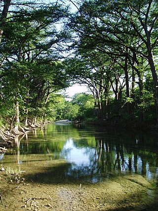
The Sabinal River, formerly Arroyo de la Soledad, is a stream in Uvalde and Bandera counties of the U.S. state of Texas. The upper part of the river runs through the Lost Maples State Natural Area, being fed by Hale, Hollow, and Can Creeks. The Mill, Little, Onion, Rancheros, Nolton, and East Elm Creeks feed in the lower region, where it runs underground in some places. The Sabinal exits into the Frio River about 16 miles south of the city of Sabinal.
Pipe Creek is a stream located primarily in Bandera County, Texas, in the United States.
Privilege Creek is a stream in Bandera County, Texas and Kerr County, Texas, in the United States.
Bandera Pass [elevation 1,745 feet (532 m)] is a mountain pass in Bandera County, Texas, in the United States. On the divide between watersheds of the Guadalupe and Medina Rivers, it is located on State Highway 173 10 miles (16 km) northwest of the town of Bandera.
Bandera Creek is a stream in Bandera County, Texas, in the United States. It rises in Bandera Pass, 2+1⁄2 miles south of Camp Verde in northeastern Bandera County, and flows south for thirteen miles to its mouth on the Medina River, a mile east of Bandera.
Doe Creek is a stream in Bandera County, Texas, in the United States.
Winans Creek is a stream in Bandera County, Texas, in the United States.
Hicks Creek is a stream in Bandera County, Texas, in the United States.
Laxson Creek is a stream in Bandera County, Texas, in the United States.
Brewington Creek is a stream in Bandera County, Texas, in the United States.
Williams Creek is a stream in Bandera County, Texas, in the United States.
Wallace Creek is a stream in Bandera County, Texas and Kerr County, Texas, in the United States.
Alum Creek is a stream in Wilson County, Texas, in the United States. It is a tributary of Cibolo Creek.

Cold Fork, California is a historical crossroads and small settlement along Cold Fork Creek, a river tributary of the Cottonwood Creek in Tehama County, in the U.S. state of California, recorded on some historical maps as a district. The tributary, which is a fork of the South Fork of Cottonwood Creek, rises on the east slope of North Yolla Bolly Mountain, and flows generally east from there for about 22 miles (35 km) falling from an altitude of 6,000 feet (1,800 m) above sea level to 5,200 feet (1,600 m).
References
- ↑ U.S. Geological Survey Geographic Names Information System: Red Bluff Creek (Medina River tributary)
- ↑ Hunter, John Marvin (1922). Pioneer History of Bandera County: Seventy-five Years of Intrepid History. Hunter's printing house. p. 228.
29°40′08″N98°58′14″W / 29.6690°N 98.9705°W
 | This article about a location in Bandera County, Texas is a stub. You can help Wikipedia by expanding it. |
 | This article about a location in Kendall County, Texas is a stub. You can help Wikipedia by expanding it. |
| | This article related to a river in Texas is a stub. You can help Wikipedia by expanding it. |