Related Research Articles

Bucks County is a county in the Commonwealth of Pennsylvania. As of the 2020 census, the population was 646,538, making it the fourth-most populous county in Pennsylvania. Its county seat is Doylestown. The county is named after the English county of Buckinghamshire. The county is part of the Southeast Pennsylvania region of the state.

Lower Southampton Township is a township in Bucks County, Pennsylvania, United States. The population was 20,599 at the 2020 census.

Warrington Township is a township in Bucks County, Pennsylvania, United States. Warrington Township is a northern suburb of Philadelphia. The population was 25,639 at the 2020 census.

Northeast Philadelphia, nicknamed Northeast Philly, the Northeast and the Great Northeast, is a section of Philadelphia, Pennsylvania. According to the 2000 census, Northeast Philadelphia has a population of between 300,000 and 450,000, depending on how the area is defined. The Northeast is known as being home to a large and diverse working class population, including Polish, German, Jewish, Russian, African American, Brazilian, Puerto Rican, Dominican, Guatemalan, Ukrainian, Indian, Chinese, Irish, and Vietnamese neighborhoods.
Roosevelt Boulevard, officially named the Theodore Roosevelt Memorial Boulevard and locally known as "the Boulevard", is a major traffic artery through North and Northeast Philadelphia. The road begins at Interstate 76 in Fairmount Park, running as a freeway also known as the Roosevelt Boulevard Extension or the Roosevelt Expressway through North Philadelphia, then transitioning into a twelve-lane boulevard that forms the spine of Northeast Philadelphia to its end at the city line.
Holmesburg began as a Village within Lower Dublin Township, Pennsylvania. It is now a neighborhood in the Northeast section of Philadelphia, Pennsylvania, United States. Holmesburg was named in Honor of Surveyor General of Pennsylvania Thomas Holme, who was a cartographer.
Byberry is a neighborhood in the far northeast section of Philadelphia, in the U.S. state of Pennsylvania. Originally it was incorporated as the Township of Byberry and was the northeasternmost municipality of Philadelphia County before the City and County were consolidated in 1854. Its approximate boundaries are the Poquessing Creek to the north, Woodhaven Road to the south, the Roosevelt Boulevard to the west, and Thornton Road to the east.

Poquessing Creek is a 10.3-mile-long (16.6 km) creek, a right tributary of the Delaware River, that forms the boundary between Philadelphia and Bensalem Township, which borders it to the northeast along the Delaware. It has defined this boundary between Bucks and Philadelphia counties since 1682.

Somerton is a neighborhood in the Far Northeast section of Philadelphia, Pennsylvania, United States. The neighborhood is bounded by Red Lion Road on the south, Roosevelt Boulevard on the east, East County Line Road and Poquessing Creek on the north, and the Philadelphia County / Montgomery County line on the west. Somerton is adjacent to the Philadelphia neighborhoods of Bustleton, Normandy, and Byberry, the townships of Bensalem and Lower Southampton in Bucks County, and Lower Moreland Township in Montgomery County. The area is home to a large and fast-growing foreign-born population, most notably of Russian, Ukrainian, Indian, and Central Asian immigrants.
Morrell Park is a neighborhood located in the Northeast section of Philadelphia, Pennsylvania, United States. It is located on the eastern side of the Far Northeast, northwest of Byberry Creek and east of Northeast Philadelphia Airport.

Andalusia is a historic neighborhood and unincorporated community in Bensalem Township, Pennsylvania, United States. It borders Philadelphia along the Poquessing Creek. The area is the southernmost part of the township and of the county. Its boundaries are Woodhaven Road to the northeast, the Delaware River to the east and south, and Poquessing Creek to the north and west. Interstate 95 - Delaware Expressway runs through its southeastern section near the Delaware River. The neighborhood takes its name from Andalusia, the estate of Philadelphia financier Nicholas Biddle (1786–1844), now preserved as a National Historic Landmark.

The Frankford Avenue Bridge, also known as the Pennypack Creek Bridge, the Pennypack Bridge, the Holmesburg Bridge, and the King's Highway Bridge, erected in 1697 in the Holmesburg section of Northeast Philadelphia, in the U.S. state of Pennsylvania, is the oldest surviving roadway bridge in the United States. The three-span, 73-foot-long (22 m) twin stone arch bridge carries Frankford Avenue, just north of Solly Avenue, over Pennypack Creek in Pennypack Park.
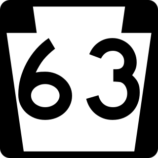
Pennsylvania Route 63 (PA 63) is a 37.4-mile-long (60.2 km) state highway located in the Philadelphia, Pennsylvania, area. The western terminus of the route is at PA 29 in Green Lane, Montgomery County. The eastern terminus is at Interstate 95 (I-95) in Bensalem Township, Bucks County. PA 63 runs northwest to southeast for most of its length. The route heads through a mix of suburban and rural areas of northern Montgomery County as a two-lane road, passing through Harleysville, before coming to an interchange with I-476 in Kulpsville. From this point, PA 63 continues through predominantly suburban areas of eastern Montgomery County as a two- to four-lane road, passing through Lansdale, Maple Glen, Willow Grove, and Huntingdon Valley. Upon entering Northeast Philadelphia, the route follows Red Lion Road and U.S. Route 1 (US 1) before heading southeast on a freeway called Woodhaven Road to I-95.

Centre Bridge is an unincorporated community on the Delaware River in Solebury Township, Bucks County, Pennsylvania, United States. Located at the crossroads of River Road and Upper York Road, it lies 3 miles (4.8 km) north of New Hope. The spelling of the name of the village is traditional.

Pennsylvania Route 74 is a 96.4-mile-long (155.1 km) north–south state highway located in central Pennsylvania. The southern terminus of the route is at the Mason–Dixon line southwest of Delta, where the road continues into Maryland as Maryland Route 165. The northern terminus is at PA 75 south of Port Royal.

Parkwood is a neighborhood located in the Far Northeast section of Philadelphia, Pennsylvania, United States. The neighborhood's boundaries include the Byberry East Industrial Park to the north and northwest, Poquessing Creek to the east, Knights Road to the southeast and Woodhaven Road to the southwest. The neighborhood was developed by Hyman Korman in the 1960-1962 as a planned residential community. The predominant housing type is the brick row house. The Parkwood Shopping Center is a local shopping destination, while the Philadelphia Mills mall is a regional shopping destination on Knights Road to the east of Parkwood's residential area.

U.S. Route 1 (US 1) is a major north–south U.S. Route, extending from Key West, Florida, in the south to Fort Kent, Maine, at the Canada–United States border in the north. In the U.S. state of Pennsylvania, US 1 runs for 81 miles (130 km) from the Maryland state line near Nottingham northeast to the New Jersey state line at the Delaware River in Morrisville, through the southeastern portion of the state. The route runs southwest to northeast and serves as a major arterial road through the city of Philadelphia and for many of the suburbs in the Delaware Valley metropolitan area. South of Philadelphia, the road mostly follows the alignment of the Baltimore Pike. Within Philadelphia, it mostly follows Roosevelt Boulevard. North of Philadelphia, US 1 parallels the route of the Lincoln Highway. Several portions of US 1 in Pennsylvania are freeways, including from near the Maryland state line to Kennett Square, the bypass of Media, the concurrency with Interstate 76 and the Roosevelt Expressway in Philadelphia, and between Bensalem Township and the New Jersey state line.

U.S. Route 13 (US 13) is a United States Numbered Highway running from Fayetteville, North Carolina, north to Morrisville, Pennsylvania. The route runs for 49.359 miles (79.436 km) through the Delaware Valley metropolitan area in the U.S. state of Pennsylvania. The route enters the state from Delaware in Marcus Hook, Delaware County. It continues northeast through Delaware County, passing through the city of Chester before heading through suburban areas along Chester Pike to Darby. US 13 enters the city of Philadelphia on Baltimore Avenue and runs through West Philadelphia to University City, where it turns north along several city streets before heading east across the Schuylkill River along Girard Avenue. The route turns north and heads to North Philadelphia, where it runs northeast along Hunting Park Avenue. US 13 becomes concurrent with US 1 on Roosevelt Boulevard, continuing into Northeast Philadelphia. US 13 splits southeast on a one-way pair of streets before heading northeast out of the city on Frankford Avenue. The route continues into Bucks County as Bristol Pike, heading northeast to Bristol, where it becomes a divided highway. US 13 becomes a freeway in Tullytown and continues north to its terminus at US 1 in Falls Township, near Morrisville. US 13 roughly parallels Interstate 95 (I-95) through its course in Pennsylvania.

The King George II Inn, located in Bristol, Pennsylvania, is believed to be the oldest continuously operated inn in the United States. It was first established in 1681 as the Ferry House by Samuel Clift. The inn was a main stopping point on the road from New York to Philadelphia. The inn overlooks the Delaware River and is located at the corner of Radcliffe and Mill Streets in the Bristol Historic District.
Jefferson Health - Northeast, also known as Aria-Jefferson Health and formerly Frankford Health Systems, is a healthcare system is a healthcare system in Northeast Philadelphia and Lower Bucks County affiliated with Jefferson Health. It consists of three hospitals and several outpatient clinics that combine to 855 beds.
References
- 1 2 Buck, William J. (1888). "The Red Lion Inn". The Pennsylvania Magazine of History and Biography. 12 (3): 359–361. ISSN 0031-4587. JSTOR 20083276.
- 1 2 Castner, Samuel Jr. "Red Lion Inn. Torresdale, Pa." Free Library of Philadelphia (Scrapbook). Philadelphia, Pa.: Free Library of Philadelphia. Archived from the original on 21 Jan 2022. Retrieved 2022-10-02.
- ↑ McCarthy, Jack (19 October 2011). ""Dr. Sangrado" in Hart's Cemetery, Rattling the Dead". Hidden City Philadelphia. Retrieved 8 January 2016.