
St Mary Redcliffe is an Anglican parish church located in the Redcliffe district of Bristol, England. The church is a short walk from Bristol Temple Meads station. The church building was constructed from the 12th to the 15th centuries, and it has been a place of Christian worship for over 900 years. The church is renowned for the beauty of its Gothic architecture and is classed as a Grade I listed building by Historic England. It was famously described by Queen Elizabeth I as "the fairest, goodliest, and most famous parish church in England."

The City of Belmont is a local government area in the inner eastern suburbs of the Western Australian capital city of Perth, located about 8 kilometres (5 mi) east of Perth's central business district on the south bank of the Swan River. The City covers an area of 39.8 square kilometres (15.4 sq mi), maintains 225 km of roads and had a population of almost 40,000 as at the 2016 Census. The City of Belmont is a member of the Eastern Metropolitan Regional Council
Hornibrook Bridge is a heritage-listed mostly-demolished road bridge on the Hornibrook Highway over Hays Inlet at Bramble Bay from Brighton, City of Brisbane to Clontarf, Moreton Bay Region, Queensland, Australia. It was designed by Manuel Hornibrook and built from 1932 to 1935 by Manuel Hornibrook. It was added to the Queensland Heritage Register on 7 October 1994.

Great Eastern Highway is a 590-kilometre-long (370 mi) road that links the Western Australian capital of Perth with the city of Kalgoorlie. A key route for road vehicles accessing the eastern Wheatbelt and the Goldfields, it is the western portion of the main road link between Perth and the eastern states of Australia. The highway forms the majority of National Highway 94, although the alignment through the Perth suburbs of Guildford and Midland, and the eastern section between Coolgardie and Kalgoorlie are not included. Various segments form parts of other road routes, including National Route 1, Alternative National Route 94, and State Route 51.

Spike Island is an inner city and harbour area of the English port city of Bristol, adjoining the city centre. It comprises the strip of land between the Floating Harbour to the north and the tidal New Cut of the River Avon to the south, from the dock entrance to the west to Bathurst Basin in the east. The island forms part of Cabot ward. The area between the Docks and New cut to the east of Bathurst Basin is in the neighbourhoods of Redcliffe and St Philip's Marsh.

Tonkin Highway is an 81-kilometre-long (50 mi) north–south highway and partial freeway in Perth, Western Australia, linking Perth Airport and Kewdale with the city's north-eastern and south-eastern suburbs. As of April 2020, the northern terminus is at the interchange with Brand Highway and Great Northern Highway in Muchea, and the southern terminus is at Thomas Road in Oakford. It forms the entire length of State Route 4, and connects to several major roads. Besides Brand Highway and Great Northern Highway, it also connects to Reid Highway, Great Eastern Highway, Leach Highway, Roe Highway, and Albany Highway.

Castle Park is a public open space in Bristol, England, managed by Bristol City Council. It is bounded by the Floating Harbour and Castle Street to the south, Lower Castle Street to the east, and Broad Weir, Newgate and Wine Street to the north. Its western boundary is less obviously defined and has been the subject of controversy, perhaps because the area around High Street and St Mary le Port Church, though not part of the park and always intended for development, is often considered at the same time as the park.
Canning is a method of preserving food in which the food contents are processed and sealed in an airtight container.

Bristol Bridge is a bridge over the floating harbour in Bristol, England, the original course of the River Avon. It is a grade II listed building.
Redcliffe, also known as Redcliff, is a district of the English port city of Bristol, adjoining the city centre to the northwest. It is bounded by the loop of the Floating Harbour to the west, north and east, together with the New Cut of the River Avon to the south. Most of Redcliffe lies within the city ward of Lawrence Hill, although the westernmost section, including the cliffs and hill from which the area takes its name, is in Cabot ward. Bristol Temple Meads station is located in Redcliffe.

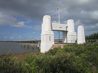
Redcliffe Bridge is a traffic bridge which carries Tonkin Highway across the Swan River between the Perth suburbs of Ascot and Bayswater. It is named after Redcliffe, which is a nearby suburb.
Blackfriars, derived from Black Friars, a common name for the Dominican Order of friars, may refer to:

Bathurst Basin is a small triangular basin adjoining the main harbour of the city of Bristol, England. The basin takes its name from Charles Bathurst, who was a Bristol MP in the early 19th century.
Redcliffe Hall may refer to

The New Cut is an artificial waterway which was constructed between 1804 and 1809 to divert the tidal river Avon through south and east Bristol, England. This was part of the process of constructing Bristol's Floating Harbour, under the supervision of engineer William Jessop. The cut runs from Totterdown Basin at the eastern end of St Phillip's Marsh, near Temple Meads, to the Underfall sluices at Rownham in Hotwells and rejoining the original course of the tidal Avon.
Redcliffe railway station is a station under construction on the Airport line in Perth, Western Australia. It will be the first railway station in the Belmont/Redcliffe area since the original Belmont line closed in 1956, over 60 years ago.

Redcliffe Caves are a series of man made tunnels beneath the Redcliffe area of Bristol, England.
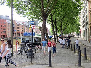
Welsh Back is a wharf and street in the main harbour of the city of Bristol, England. It extends some 450 metres (1,480 ft) along the west side of the harbour between Bristol Bridge and Redcliffe Bridge. The wharf is a grade II listed structure and takes its name because it was freqented by vessels from Welsh ports.

Redcliffe Bridge is a bascule bridge over the floating harbour in Bristol, England. The bridge was built in 1938 and rebuilt in 1942 after being damaged by bombing during the Second World War.