
Bristol Temple Meads is the oldest and largest railway station in Bristol, England. It is located 118 miles 31 chains away from London Paddington. It is an important transport hub for public transport in the city; there are bus services to many parts of the city and surrounding districts, with a ferry to the city centre. Bristol's other major station, Bristol Parkway, is a more recent station on the northern outskirts of the conurbation.

The River Avon is a river in the southwest of England. To distinguish it from a number of other rivers of the same name, it is often called the Bristol Avon. The name 'Avon' is a cognate of the Welsh word afon, meaning 'river'.

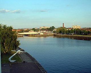
Bristol Harbour is the harbour in the city of Bristol, England. The harbour covers an area of 70 acres. It is the former natural tidal river Avon through the city but was made into its current form in 1809 when the tide was prevented from going out permanently. A tidal by-pass was dug for 2 miles through the fields of Bedminster for the river, known as the "River Avon New Cut", "New Cut", or simply "The Cut". It is often called the Floating Harbour as the water level remains constant and it is not affected by the state of the tide on the river in the Avon Gorge, The New Cut or the natural river southeast of Temple Meads to its source.

The Bristol Harbour Railway was a standard-gauge industrial railway that served the wharves and docks of Bristol, England. The line, which had a network of approximately 5 mi (8.0 km) of track, connected the Floating Harbour to the GWR mainline at Bristol Temple Meads. Freight could be transported directly by waggons to Paddington Station in London. The railway officially closed in 1964.

Spike Island is an inner city and harbour area of the English port city of Bristol, adjoining the city centre. It comprises the strip of land between the Floating Harbour to the north and the tidal New Cut of the River Avon to the south, from the dock entrance to the west to Bathurst Basin in the east. The island forms part of Cabot ward. The area between the Docks and New cut to the east of Bathurst Basin is in the neighbourhoods of Redcliffe and St Philip's Marsh.

Cabot was a council ward that covered the centre of Bristol, England. It took its name from the Cabot Tower, a memorial tower on Brandon Hill that was built to commemorate John Cabot's voyage and "discovery" of North America. The ward was abolished in 2016.

Castle Park is a public open space in Bristol, England, managed by Bristol City Council. It is bounded by the Floating Harbour and Castle Street to the south, Lower Castle Street to the east, and Broad Weir, Newgate and Wine Street to the north. Its western boundary is less obviously defined and has been the subject of controversy, perhaps because the area around High Street and St Mary le Port Church, though not part of the park and always intended for development, is often considered at the same time as the park.
Pero's Bridge is a pedestrian bascule bridge that spans St Augustine's Reach in Bristol Harbour, Bristol, England. It links Queen Square and Millennium Square.

Bristol Bridge is a bridge over the floating harbour in Bristol, England. The floating harbour was constructed on the original course of the River Avon, and there has been a bridge on the site since long before the harbour was created by impounding the river in 1809. The current bridge was completed in 1768 and is a Grade II listed building.
Redcliffe, also known as Redcliff, is a district of the English port city of Bristol, adjoining the city centre to the northwest. It is bounded by the loop of the Floating Harbour to the west, north and east, together with the New Cut of the River Avon to the south. Most of Redcliffe lies within the city ward of Lawrence Hill, although the westernmost section, including the cliffs and hill from which the area takes its name, is in Cabot ward. Bristol Temple Meads station is located in Redcliffe.

The Spit Bridge, a steel and concrete girder bridge with a bascule lift span across the Middle Harbour, is located 10 kilometres (6.2 mi) north-east of the central business district in Sydney, Australia. The bridge carries The Spit Road (A8) from a point called The Spit, and connects the suburbs of Mosman, on the south bank and Seaforth, on the north bank.

Netham Lock is the point at Netham in Bristol at which boats from the River Avon, acting as part of the Kennet and Avon Canal, gain access to Bristol's Floating Harbour.
The Cumberland Basin is the main entrance to the docks of the city of Bristol, England. It separates the areas of Hotwells from the tip of Spike Island.

The Underfall Yard is a historic boatyard on Spike Island serving Bristol Harbour in England.

Bathurst Basin is a small triangular basin adjoining the main harbour of the city of Bristol, England. The basin takes its name from Charles Bathurst, who was a Bristol MP in the early 19th century.
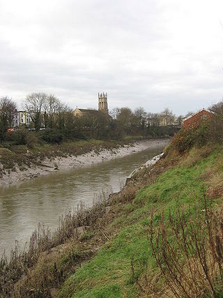
The New Cut is an artificial waterway which was constructed between 1804 and 1809 to divert the tidal river Avon through south and east Bristol, England. This was part of the process of constructing Bristol's Floating Harbour, under the supervision of engineer William Jessop. The cut runs from Totterdown Basin at the eastern end of St Phillip's Marsh, near Temple Meads, to the Underfall sluices at Rownham in Hotwells and rejoining the original course of the tidal Avon.

The Ashton Avenue Bridge is a pedestrian, cycling and busway bridge in Bristol, England. Grade II listed, it was constructed as a road-rail bridge as part of the Bristol Harbour Railway. It now carries a Bristol MetroBus guided busway route and National Cycle Network cycle routes.

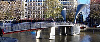
Temple Quay is an area of mixed-use development in central Bristol, England. The project was initiated by Bristol Development Corporation in 1989, under the name Quay Point until 1995. In that year it was handed over to English Partnerships, under whom development eventually started in 1998. It is bounded by Temple Way to the west and Bristol Temple Meads railway station to the southeast; to the northeast the development was bounded by Bristol Floating Harbour until 2002, when development of Temple Quay North started on the harbour's other side. In 2012 the whole area became part of Bristol Temple Quarter Enterprise Zone.

The Bristol Feeder Canal is a body of water in Bristol, England, that connects the Floating Harbour with the River Avon.
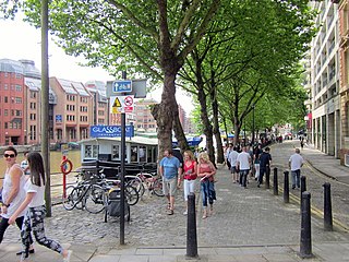
Welsh Back is a wharf and street alongside the floating harbour in the centre of the city of Bristol, England. The wharf and street extend some 450 metres (1,480 ft) along the west side of the harbour between Bristol Bridge and Redcliffe Bridge. At the northern end, the street and wharf are immediately adjacent, but to the south they are separated by a range of single story transit sheds. The wharf is a grade II listed structure and takes its name because it was freqented by vessels from Welsh ports.

