Related Research Articles

Hematite, also spelled as haematite, is a common iron oxide with a formula of Fe2O3 and is widespread in rocks and soils. Hematite crystals belong to the rhombohedral lattice system which is designated the alpha polymorph of Fe
2O
3. It has the same crystal structure as corundum (Al
2O
3) and ilmenite (FeTiO
3), with which it forms a complete solid solution at temperatures above 950 °C (1,740 °F).

JPEG is a commonly used method of lossy compression for digital images, particularly for those images produced by digital photography. The degree of compression can be adjusted, allowing a selectable trade-off between storage size and image quality. JPEG typically achieves 10:1 compression with little perceptible loss in image quality. Since its introduction in 1992, JPEG has been the most widely used image compression standard in the world, and the most widely used digital image format, with several billion JPEG images produced every day as of 2015.

2D computer graphics is the computer-based generation of digital images—mostly from two-dimensional models and by techniques specific to them. It may refer to the branch of computer science that comprises such techniques or to the models themselves.

Brown is a composite color. In the CMYK color model used in printing or painting, brown is made by combining red, black, and yellow, or red, yellow, and blue. In the RGB color model used to project colors onto television screens and computer monitors, brown is made by combining red and green, in specific proportions. In painting, brown is generally made by adding black to orange.

Opal is a hydrated amorphous form of silica (SiO2·nH2O); its water content may range from 3 to 21% by weight, but is usually between 6 and 10%. Because of its amorphous character, it is classed as a mineraloid, unlike crystalline forms of silica, which are classed as minerals. It is deposited at a relatively low temperature and may occur in the fissures of almost any kind of rock, being most commonly found with limonite, sandstone, rhyolite, marl, and basalt.

In linear algebra, the singular value decomposition (SVD) is a factorization of a real or complex matrix that generalizes the eigendecomposition of a square normal matrix to any matrix via an extension of the polar decomposition.

In mathematics, the cross product or vector product is a binary operation on two vectors in three-dimensional space , and is denoted by the symbol . Given two linearly independent vectors a and b, the cross product, a × b, is a vector that is perpendicular to both a and b, and thus normal to the plane containing them. It has many applications in mathematics, physics, engineering, and computer programming. It should not be confused with the dot product.

Felsite is a very fine-grained volcanic rock that may or may not contain larger crystals. Felsite is a field term for a light-colored rock that typically requires petrographic examination or chemical analysis for more precise definition. Color is generally white through light gray, or red to tan and may include any color except dark gray, green or black. The mass of the rock consists of a fine-grained matrix of felsic materials, particularly quartz, sodium and potassium feldspar, and may be termed a quartz felsite or quartz porphyry if the quartz phenocrysts are present. This rock is typically of extrusive origin, formed by compaction of fine volcanic ash, and may be found in association with obsidian and rhyolite. In some cases, it is sufficiently fine-grained for use in making stone tools. Its fine texture and felsic components allow for good knapped pieces, much like working chert, producing conchoidal fracture.
USDA soil taxonomy (ST) developed by United States Department of Agriculture and the National Cooperative Soil Survey provides an elaborate classification of soil types according to several parameters and in several levels: Order, Suborder, Great Group, Subgroup, Family, and Series. The classification was originally developed by Guy Donald Smith, former director of the U.S. Department of Agriculture's soil survey investigations.
A soil horizon is a layer parallel to the soil surface whose physical, chemical and biological characteristics differ from the layers above and beneath. Horizons are defined in many cases by obvious physical features, mainly colour and texture. These may be described both in absolute terms and in terms relative to the surrounding material, i.e. ‘coarser’ or ‘sandier’ than the horizons above and below.

A Data Matrix is a two-dimensional code consisting of black and white "dots" or dots arranged in either a square or rectangular pattern, also known as a matrix. The information to be encoded can be text or numeric data. Usual data size is from a few bytes up to 1556 bytes. The length of the encoded data depends on the number of cells in the matrix. Error correction codes are often used to increase reliability: even if 15 or more cells are damaged it is unreadable, the message can still be read. A Data Matrix symbol can store up to 2,335 alphanumeric letters.

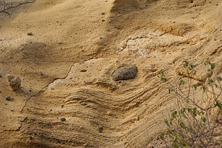
Palagonite is an alteration product from the interaction of water with volcanic glass of chemical composition similar to basalt. Palagonite can also result from the interaction between water and basalt melt. The water flashes to steam on contact with the hot lava and the small fragments of lava react with the steam to form the light-colored palagonite tuff cones common in areas of basaltic eruptions in contact with water. An example is found in the pyroclastic cones of the Galapagos Islands. Charles Darwin recognized the origin of these cones during his visit to the islands. Palagonite can also be formed by a slower weathering of lava into palagonite, resulting in a thin, yellow-orange rind on the surface of the rock. The process of conversion of lava to palagonite is called palagonitization.

A heat map is a data visualization technique that shows magnitude of a phenomenon as color in two dimensions. The variation in color may be by hue or intensity, giving obvious visual cues to the reader about how the phenomenon is clustered or varies over space. There are two fundamentally different categories of heat maps: the cluster heat map and the spatial heat map. In a cluster heat map, magnitudes are laid out into a matrix of fixed cell size whose rows and columns are discrete phenomena and categories, and the sorting of rows and columns is intentional and somewhat arbitrary, with the goal of suggesting clusters or portraying them as discovered via statistical analysis. The size of the cell is arbitrary but large enough to be clearly visible. By contrast, the position of a magnitude in a spatial heat map is forced by the location of the magnitude in that space, and there is no notion of cells; the phenomenon is considered to vary continuously.

A gley is a wetland soil that unless drained is saturated with groundwater for long enough to develop a characteristic gleyic colour pattern. The pattern is essentially made up of reddish, brownish, or yellowish colours at surfaces of soil particles and/or in the upper soil horizons mixed with greyish/blueish colours inside the peds and/or deeper in the soil. Gleysols are also known as Gleyzems, meadow soils, Aqu-suborders of Entisols, Inceptisols and Mollisols, or as groundwater soils and hydro-morphic soils.

The Chugwater Formation is a mapped bedrock unit consisting primarily of red sandstone, in the states of Wyoming, Montana, and Colorado in the United States. It is recognized as a geologic formation in Colorado and Montana, but as a Group in Wyoming.
Soil color does not affect the behavior and use of soil; however, it can indicate the composition of the soil and give clues to the conditions that the soil is subjected to. Soil can exhibit a wide range of colour; grey, black, white, reds, browns, yellows and greens. Varying horizontal bands of colour in the soil often identify a specific soil horizon. The development and distribution of color in soil results from chemical and biological weathering, especially redox reactions. As the primary minerals in soil parent material weather, the elements combine into new and colorful compounds. Soil conditions produce uniform or gradual color changes, while reducing environments result in disrupted color flow with complex, mottled patterns and points of color concentration.

Crushed stone or angular rock is a form of construction aggregate, typically produced by mining a suitable rock deposit and breaking the removed rock down to the desired size using crushers. It is distinct from gravel which is produced by natural processes of weathering and erosion, and typically has a more rounded shape.

In 1944, Arthur M. Piper proposed an effective graphic procedure for presenting water chemistry data to help in understanding the sources of the dissolved constituents in water. This procedure is based on the premise that cations and anions in water are generally in chemical equilibrium.
This glossary of structural engineering terms pertains specifically to structural engineering and its sub-disciplines. Please see glossary of engineering for a broad overview of the major concepts of engineering.
The physical properties of soils, in order of decreasing importance for ecosystem services such as crop production, are texture, structure, bulk density, porosity, consistency, temperature, colour and resistivity. Soil texture is determined by the relative proportion of the three kinds of soil mineral particles, called soil separates: sand, silt, and clay. At the next larger scale, soil structures called peds or more commonly soil aggregates are created from the soil separates when iron oxides, carbonates, clay, silica and humus, coat particles and cause them to adhere into larger, relatively stable secondary structures. Soil bulk density, when determined at standardized moisture conditions, is an estimate of soil compaction. Soil porosity consists of the void part of the soil volume and is occupied by gases or water. Soil consistency is the ability of soil materials to stick together. Soil temperature and colour are self-defining. Resistivity refers to the resistance to conduction of electric currents and affects the rate of corrosion of metal and concrete structures which are buried in soil. These properties vary through the depth of a soil profile, i.e. through soil horizons. Most of these properties determine the aeration of the soil and the ability of water to infiltrate and to be held within the soil.
References
- ↑ Schoeneberger, P.J.; Wysocki, D.A.; Benham, E.C.; Soil Survey Staff (2012). "Field book for describing and sampling soils, Version 3.0". Natural Resources Conservation Service, National Soil Survey Center.
- ↑ H.V. Cabadas-Báez, S. Sedov, S. Jiménez-Álvarez, D. Leonard, B. Lailson-Tinoco, R. García-Moll, I. Ancona-Aragón, L. Hernández. (2018). "Soils as a Source of Raw Materials for Ancient Ceramic production in the Maya region of Mexico: Micromorphological insight". Boletín de la Sociedad Geológica Mexicana. 70: 21–48. doi: 10.18268/BSGM2018v70n1a2 .CS1 maint: multiple names: authors list (link)