
Neath Abbey was a Cistercian monastery, located near the present-day town of Neath in South Wales, UK. It was once the largest abbey in Wales. Substantial ruins can still be seen, and are in the care of Cadw. Tudor historian John Leland called Neath Abbey "the fairest abbey of all Wales."

Neath Port Talbot is a county borough in the south-west of Wales. Its principal towns are Neath, Port Talbot, Briton Ferry and Pontardawe. The county borough borders Bridgend County Borough and Rhondda Cynon Taf to the east, Powys and Carmarthenshire to the north; and Swansea to the west.

Glynneath, also spelt Glyn-neath and Glyn Neath, is a town, community and electoral ward lying on the River Neath in the county borough of Neath Port Talbot, Wales. It was formerly in the historic county of Glamorgan. Glynneath ward covers only part of the community, with some 840 electors included in the neighbouring ward of Blaengwrach.

South Wales is a loosely defined region of Wales bordered by England to the east and mid Wales to the north. Generally considered to include the historic counties of Glamorgan and Monmouthshire, south Wales extends westwards to include Carmarthenshire and Pembrokeshire. In the western extent, from Swansea westwards, local people would probably recognise that they lived in both south Wales and west Wales. The Brecon Beacons National Park covers about a third of south Wales, containing Pen y Fan, the highest British mountain south of Cadair Idris in Snowdonia.
The Afan Forest Park is a 48-square-mile (120 km2) forest park in Britain. It is set in the Afan Valley in Neath Port Talbot, in south Wales. It is well known for its mountain biking and hiking or hillwalking trails. It is situated seven miles (11 km) from Junction 40 of the M4.

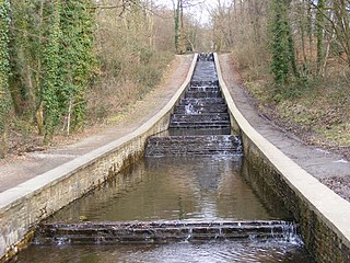
Waltham Abbey is a town and civil parish in the Epping Forest District of Essex, within the metropolitan and urban area of London, England, 13.5 miles (21.7 km) north-east of Charing Cross. It lies on the Greenwich Meridian, between the River Lea in the west and Epping Forest in the east, with large sections forming part of the Metropolitan Green Belt.

River Neath is a river in south Wales running south west from the point at which its headwaters arising in the Brecon Beacons National Park converge to its mouth at Baglan Bay below Briton Ferry on the east side of Swansea Bay.

Broadgate is a large, 32-acre (13 ha) office and retail estate in the Bishopsgate Without area of the City of London. It is owned by British Land and GIC and managed by Savills.

The Aberdulais Falls are found on the River Dulais at Aberdulais, near Neath in the county borough of Neath Port Talbot, Wales. The falls are formed as the river plunges over beds of hard Lower Pennant Sandstone just before meeting the River Neath flowing down the Vale of Neath. They are home to one of Europe's largest electricity-generating water wheels.
Resolven is a small village and community in Neath Port Talbot county borough, Wales. It is located in the Vale of Neath.

Rhigos is a small village on the saddle of higher ground between the Vale of Neath and the Cynon Valley. It was part of the old Neath Rural district Council under Glamorgan until 1974. The village then came under the jurisdiction of The Cynon Valley Borough which subsequently became Rhondda Cynon Taf, South Wales in 1996. It lies just off the old Aberdare road that was the main link between Aberdare and Glynneath, before the A465 road was extended in the 1960s. The hamlets of Cefn Rhigos and Cwm-Hwnt lie to the west of the main village.
Crymlyn Burrows is an area in Wales to the east of Swansea city centre, and south of Crymlyn Bog. It is bounded by Jersey Marine Beach to the south and the River Neath to the east. The land west of Baldwin's Crescent falls within the City and County of Swansea and from Baldwin's Crescent eastwards falls within Neath Port Talbot. The area northwest of the Fabian Way contains a small settlement at Elba Crescent and Baldwins Crescent, and areas of industry and commerce.
Glynneath is the name of an electoral ward in Neath Port Talbot county borough, Wales.
The Gnoll Country Park is a park in Wales. It is an early-18th-century landscaped garden covering over 100 acres (0.40 km2) in the Vale of Neath, in Neath Port Talbot county borough in south Wales. The park is designated Grade II* on the Cadw/ICOMOS Register of Parks and Gardens of Special Historic Interest in Wales.

The Bata shoe factory in East Tilbury is what remains of an industrial estate in Essex, England, which produced shoes for over 70 years. Founded in 1932 by Tomáš Baťa, the factory was "one of the most important planned landscapes in the East of England" in the 20th century. The factory closed in 2005.
Hirfynydd is a 481-metre-high hill in Neath Port Talbot county borough in South Wales. A Roman road, Sarn Helen, runs along its entire northeast–southwest ridge-line, a route followed by a modern-day byway. To its west is Cwm Dulais and to its southeast is the Vale of Neath. The northern end of the ridge falls away to a broad upland vale containing the Afon Pyrddin and beyond which is the Brecon Beacons National Park.
Foel Chwern is a Round cairn on the edge of the high plateau east of the Neath valley, and near the summit of Craig y Llyn. The headwaters of the River Rhondda are to the south-west. It is a burial monument dating to the Bronze Age, and is sited on the edge of a steep scarp slope, with a wide field of view to the north. The long distance footpath Coed Morgannwg Way runs close by the cairn. Conifer plantations of the Rheola Forest surround the site.

The Atlantic Trading Estate is an industrial estate in Barry, Vale of Glamorgan, south Wales, UK. It is situated near the mouth of the Cadoxton River which flows into the Bristol Channel at the Bendricks to the south-east of Barry Docks. It is accessed via the Associated British Port-owned Wimbourne Road from Ffordd-y-Mileniwm near Weston Square, Cadoxton or from the public Hayes Road from the Main B4267 Sully Moors Road, south-west of the village of Sully. It is sometimes considered to be in Sully. It covers an area of 9.22 acres (3.73 ha). It covers an area of 9.22 acres (3.73 ha).

Rheola House is a Grade II* listed country house between Glynneath and Resolven, in the Neath valley, South Wales. Designed by John Nash, it was built between 1812 and 1814 for Nash's cousin, John Edwards. It passed through inheritance to members of the Edwards, Vaughan, and Lee families, until in 1939, with the house becoming run down, it was bought by an aluminium company for use as offices, and part of the land was put to industrial uses. In 2012 an application was made for housing on the industrialised area, to enable restoration of the house and a leisure complex to sustain the estate. The application was granted in 2014. The gardens and park around the house are designated Grade II on the Cadw/ICOMOS Register of Parks and Gardens of Special Historic Interest in Wales.

Neath Port Talbot is a county borough in South Wales. It covers an area of 441 km2 (170 sq mi) and in 2021 the population was approximately 141,900.
