
The Rideau River is a river in Eastern Ontario, Canada. The river flows north from Upper Rideau Lake and empties into the Ottawa River at the Rideau Falls in Ottawa, Ontario. Its length is 146 kilometres (91 mi).

The Rideau Canal is a 202 kilometre long canal that links the Ottawa River, at Ottawa, with the Saint Lawrence River at Kingston, Ontario, Canada. Its 46 locks raise boats from the Ottawa River 83 metres upstream along the Rideau River to the Rideau Lakes, and from there drop 50 metres downstream along the Cataraqui River to Kingston.
Bytown is the former name of Ottawa, Ontario, Canada. It was founded on September 26, 1826, incorporated as a town on January 1, 1850, and superseded by the incorporation of the City of Ottawa on January 1, 1855. The founding was marked by a sod turning, and a letter from Governor General Dalhousie which authorized Lieutenant Colonel John By to divide up the town into lots. Bytown came about as a result of the construction of the Rideau Canal and grew largely due to the Ottawa River timber trade. Bytown's first mayor was John Scott, elected in 1847.
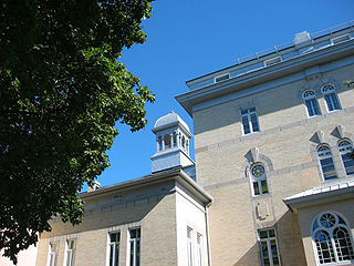
Old Ottawa South is an older urban neighbourhood in Capital Ward in Ottawa, Ontario, Canada. Old Ottawa South is a relatively small and compact neighbourhood, located between the Rideau Canal and the Rideau River. The eastern boundary is Avenue Road. Bronson Avenue forms the western border of the residential neighbourhood. Carleton University is on the other (western) side of Bronson but the campus can be considered to be geographically within Old Ottawa South as the campus is also nestled between the river and the canal.

Major's Hill Park is a park in downtown Ottawa, Ontario. The park stands above the Rideau Canal at the point where it enters the Ottawa River. The parliament buildings can be seen across the canal to the west, to the north of the park is the National Gallery of Canada, and to the east are the United States embassy and the Byward Market. To the south is the Chateau Laurier hotel, built on land that was once part of the park.
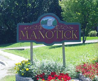
Manotick is a community in Rideau-Jock Ward in the rural south part of the City of Ottawa, Ontario, Canada. It is a suburb of the city, located on the Rideau River, immediately south of the suburbs Barrhaven and Riverside South, about 25 km (16 mi) from downtown Ottawa. It was founded by Moss Kent Dickinson in 1864. He named the village 'Manotick', after the Algonquin word for 'island'. It has been part of the City of Ottawa since amalgamation in 2001. Prior to that, it was located in Rideau Township. According to the Canada 2016 Census, Manotick had a population of 4,486.

The Bytown Museum is a museum in Ottawa located in the Colonel By Valley at the Ottawa Locks of the Rideau Canal at the Ottawa River, just below Parliament Hill. Housed in the Commissariat Building, Ottawa's oldest remaining stone building, the museum provides a comprehensive overview of the origins of Bytown and its development and growth into the present city of Ottawa.

Confederation Park(French: Parc de la Confédération) is a public park and National Historic Site of Canada, located in the downtown core of Ottawa, Ontario, Canada. It is bordered on the south by Laurier Avenue and Ottawa City Hall; on the east by the Rideau Canal and National Defence Headquarters; on the north by the Mackenzie King Bridge, the Rideau Centre and the National Arts Centre; and to the west by Elgin Street and the Lord Elgin Hotel.

The Rideau Canoe Club (RCC) is a canoe club located on the Rideau River in Ottawa, Ontario, Canada. The club is located at Mooney's Bay, where the Rideau Canal splits away from the river prior to joining up with the Ottawa River.
Burritts Rapids is a small village located on the Rideau River in eastern Ontario.
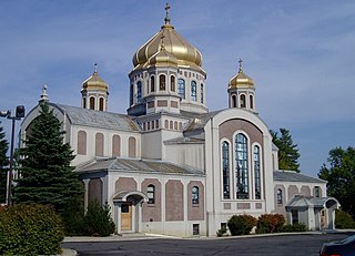
St. John the Baptist Ukrainian Catholic National Shrine is a prominent Ukrainian Catholic church in Ottawa, Ontario, Canada.
The National Day of Mourning, or Workers' Mourning Day is observed in Canada on 28 April. It commemorates workers who have been killed, injured or suffered illness due to workplace related hazards and occupational exposures.
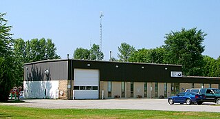
Rideau Lakes is a township located within Leeds and Grenville United Counties in Eastern Ontario, Canada. The township was incorporated on 1 January 1998 by amalgamating the former townships of North Crosby, South Crosby, Bastard, South Burgess and South Elmsley with the village of Newboro.
The Plaza Bridge in Ottawa, Ontario, Canada, is an automotive and pedestrian bridge that crosses the Rideau Canal just south of the Ottawa locks. It joins Wellington Street and Elgin Street in the Downtown core to the west with Rideau Street to the east. The Chateau Laurier abuts the bridge at the east end, while Parliament Hill is just beyond the west end. It is the northernmost bridge over the canal, just north of the Mackenzie King Bridge.
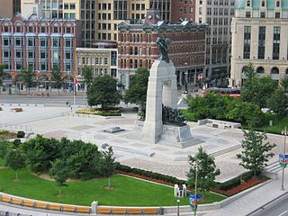
Confederation Square is an urban square in Ottawa, Ontario, Canada, and is considered the second most important ceremonial centre in Canada's capital city, after Parliament Hill. Roughly triangular in area, with Canada's National War Memorial at its centre and the Valiants Memorial at its periphery, the square is bounded by Wellington Street to the north and branches of Elgin Street to the east and west.

Mooney's Bay Park is a public park in Ottawa, Ontario, Canada, on the Rideau River. Its main entrance is on Riverside Drive, opposite Ridgewood Avenue, but can also be accessed from Hog's Back Road.

Upper Rideau Lake is located in the municipality of Rideau Lakes, United Counties of Leeds and Grenville in Eastern Ontario, Canada. It is in the Saint Lawrence River Drainage Basin, and geographically the highest lake on the Rideau Canal System.
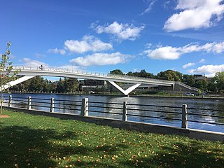
The Flora Footbridge, named after Flora MacDonald, is a pedestrian/cycling bridge in Ottawa, Ontario, Canada, that spans the Rideau Canal, connecting Clegg Street in Old Ottawa East to Fifth Avenue in the Glebe. It also crosses Colonel By Drive.


