
Tangipahoa is a village in Tangipahoa Parish, Louisiana, United States. The population was 425 at the 2020 census. It was named after the Tangipahoa Native American tribe. Tangipahoa is part of the Hammond Micropolitan Statistical Area.

Kenilworth is a census-designated place (CDP) in North Coventry Township, Chester County, Pennsylvania, United States. The population was 2,148 at the 2020 census.
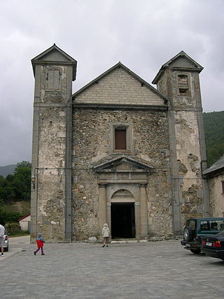
Orbaizeta is a town and municipality located in the province and autonomous community of Navarre, northern Spain.

Magdalenenstraße is a Berlin U-Bahn station located on the U5 line.

Stade Auguste Bonal is a multi-purpose stadium in Montbéliard, France. It is used mostly for football matches. It is the home ground of FC Sochaux-Montbéliard. The stadium is able to hold 20,025 people. Constructed in 1931, it has undergone several renovations, most recently in 2000.

South Texada Island Provincial Park is a provincial park in British Columbia, Canada, located on the southwest side of Texada Island. Created in 1997, the park is approximately 900 hectares in area.
The Notre-Dame-de-Lourdes College is a high school level education facility located in Longueuil, Quebec, Canada. It is a school which is part of the International Baccalaureate. The students attending the college normally refer to it as NDL, Collège Notre-Dame-de-Lourdes being a long name.
Bëyuk-Oriyat is a village in the Neftchala Rayon of Azerbaijan.
Shua-Ermani is a settlement in the Dzau district of South Ossetia.

The Salimiyya Madrasa is a 16th-century madrasa in Damascus, Syria. It is part of the Sulaymaniyya Takiyya, started under the Ottoman sultan Süleyman I.
Yuman is a former Maidu settlement in Butte County, California. It lay at an elevation of 171 feet. Its location is currently within the city limits of Oroville.

Peters Corners is a hamlet in the town of Alden in Erie County, New York, United States.
Jiefang District is a district of the city of Jiaozuo, Henan, China.
Aïn Sandel is a town and commune in Guelma Province, Algeria. According to the 1998 census it has a population of 5,083.
Nancy Wrights Corner is an unincorporated community in Caroline County, in the U.S. state of Virginia. It is located along US 1 and VSR 605, west of Woodford. The community was one of the sites of the Battle of North Anna.
Avaste is a village in Märjamaa Parish, Rapla County in western Estonia.
Ennu is a village in Saaremaa Parish, Saare County in western Estonia.
Zebica is a village in the municipality of Kruševac, Serbia. According to the 2002 census, the village has a population of 206 people.
Chah-e Dasht Mohammad Khan 6 is a village in Sahra Rural District, Anabad District, Bardaskan County, Razavi Khorasan Province, Iran. At the 2006 census, its population was 17, in 5 families.

Jaitpur State was a princely state in the Bundelkhand region. It was centered on Jaitpur, in present-day Mahoba district, Uttar Pradesh, which was the capital of the state. There were two forts in the area.
