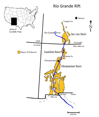
The Rio Grande rift is a north-trending continental rift zone. It separates the Colorado Plateau in the west from the interior of the North American craton on the east. The rift extends from central Colorado in the north to the state of Chihuahua, Mexico, in the south. The rift zone consists of four basins that have an average width of 50 kilometres (31 mi). The rift can be observed on location at Rio Grande National Forest, White Sands National Park, Santa Fe National Forest, and Cibola National Forest, among other locations.

The Taos Plateau volcanic field is an area of extensive volcanism in Taos County, New Mexico, United States. It is the largest volcanic field in the Rio Grande Rift, spreading over 7,000 square kilometers (2,700 sq mi). The total erupted volume is estimated at 420 cubic kilometers (100 cu mi). The age of most of the vents and associated lava flows in the field is estimated to be between 1.8 and 4 million years, with a few 22-million-year-old vents. The composition of the lavas varies from tholeiitic basalt to rhyolite. Landforms include sheet flows, cinder cones, and shield volcanoes. The sheet flows of the Servilleta Basalt are well-exposed in the Rio Grande Gorge carved by the Rio Grande. The highest point of the field is San Antonio Mountain at 10,908 feet (3,325 m).
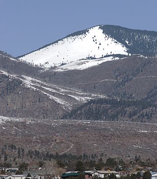
The Jemez Mountains are a group of mountains in Rio Arriba, Sandoval, and Los Alamos counties, New Mexico, United States.
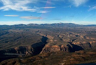
The Pajarito Plateau is a volcanic plateau in north central New Mexico, United States. The plateau, part of the Jemez Mountains, is bounded on the west by the Sierra de los Valles, the range forming the east rim of the Valles Caldera, and on the east by the Puye escarpment, which rises about 300 to 400 feet above the Rio Grande valley about a mile (1.6 km) west of the river. The Rio Grande passes through White Rock Canyon to the southeast, and the Caja del Rio across the river is sometimes regarded as part of the plateau. The plateau is occupied by several notable entities, including Bandelier National Monument, the town of Los Alamos and its remote suburb White Rock, and Los Alamos National Laboratory. Elevations range from about 5,600 feet at the river to about 7,800 feet where the plateau merges into the mountain range.
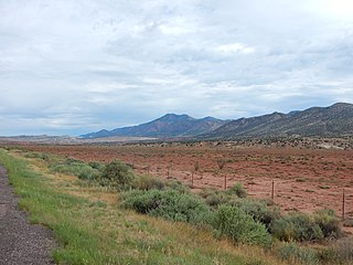
The Sierra Nacimiento, or Nacimiento Mountains, are a mountain range in the northwestern part of the U.S. state of New Mexico. They are just west of the more prominent Jemez Mountains near the town of Cuba, and are separated from them by the Río Guadalupe and the Río de Las Vacas. This article will consider them as a unit together with the San Pedro Mountains, which are a smaller range contiguous with the Sierra Nacimiento on the north, and which are also part of the Nacimiento Uplift and lie at the edge of the greater San Juan Basin, which sits atop the Colorado Plateau. The combined range runs almost due north-south with a length of about 40 mi (65 km). The highest point in the combined range is the high point of the San Pedro Peaks, known unofficially as San Pedro Peak, 10,605 ft.

The Rio Chama, a major tributary river of the Rio Grande, is located in the U.S. states of Colorado and New Mexico. The river is about 130 miles (210 km) long altogether. From its source to El Vado Dam its length is about 50 miles (80 km), from El Vado Dam to Abiquiu Dam is about 51 miles (82 km), and from Abiquiu Dam to its confluence with the Rio Grande is about 34 miles (55 km).

The Jemez Lineament is a chain of late Cenozoic volcanic fields, 800 kilometers (500 mi) long, reaching from the Springerville and White Mountains volcanic fields in East-Central Arizona to the Raton-Clayton volcanic field in Northeastern New Mexico.
Teeuinge is one of the principal Tewa Pueblo ancestral sites in New Mexico, US. It is situated in the southerly angle formed by the juncture of Rio Oso and Rio Chama. The site measures approximately 525 feet (160 m) by 210 feet (64 m). It is a large ruin situated on the rim of the mesa overlooking the valley, just below the confluence of the two rivers. It is about .25 miles (0.40 km) south of the river, and the bluff on which it stands is about 200 feet (61 m). The pueblo was constructed of adobe with some use of lava blocks in the foundation walls, and is now reduced to low mounds. It was built in two large adjoining quadrangles, or as one long rectangle divided by cross walls into two courts. The walls have a perimeter of 1,470 feet (450 m). Within and contiguous to the pueblo are ten circular, subterranean kivas. A few yards to the east is a ruined shrine in circular form, 8 feet (2.4 m) in diameter, built of lava blocks set on edge.

The Abiquiu Formation is a geologic formation found in northern New Mexico. Radiometric dating constrains its age to between 18 million and 27 million years, corresponding to the late Oligocene to Miocene epochs.

The Abo Formation is a geologic formation in New Mexico. It contains fossils characteristic of the Cisuralian epoch of the Permian period.
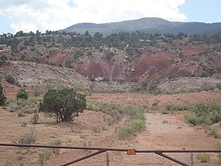
The Salitral Formation is a Late Triassic geologic formation found in north-central New Mexico, primarily the northwestern Jemez Mountains. It is an older subunit of the Chinle Group, overlying the Shinarump Conglomerate and underlying the Poleo Formation.
Chili is an unincorporated community and census-designated place in Rio Arriba County, New Mexico. Its population was 654 as of the 2010 census. U.S. Route 84 passes through the community. The name comes from a station of the D&RG railroad that was known locally as the "Chili Line."
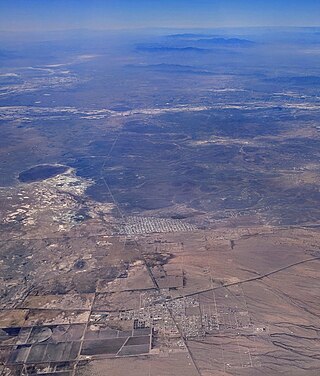
Lake Palomas is a former lake in New Mexico, United States, and Chihuahua, Mexico. This lake was relatively large and reached a size of about 9,100 square kilometres (3,500 sq mi) during its highstands. Preceded by Lake Cabeza de Vaca, it formed during the Pleistocene and continued into the Holocene, when several different lake phases occurred. Presently its basin is a major source of airborne dust in the region.
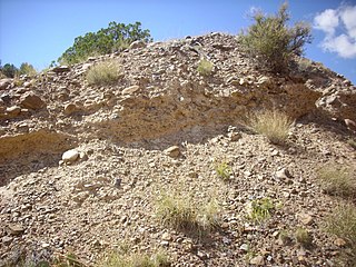
The Ritito Conglomerate is a geologic formation in northern New Mexico dating to the Oligocene epoch.
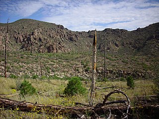
The Polvadera Group is a group of geologic formations exposed in and around the Jemez Mountains of northern New Mexico. Radiometric dating gives it an age of 13 to 2.2 million years, corresponding to the Miocene through early Quaternary.
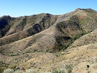
The Keres Group is a group of geologic formations exposed in and around the Jemez Mountains of northern New Mexico. Radiometric dating gives it an age of 13 to 6 million years, corresponding to the Miocene epoch.
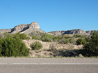
The Puye Formation is a geologic formation exposed east of the Jemez Mountains of northern New Mexico. Radiometric dating constrains its age to between 5 and 2 million years, corresponding to the Pliocene epoch.

The Ancha Formation is a geologic formation found near Santa Fe, New Mexico. It is estimated to be between 1 and 3 million years in age, corresponding to the late Pliocene and Pleistocene.

The Tewa Group is a group of geologic formations exposed in and around the Jemez Mountains of northern New Mexico. Radiometric dating gives it an age of 1.85 million to 72 thousand years, corresponding to the Pleistocene epoch.

The Espanola basin is a structural basin in northern New Mexico. It is located in the Rio Grande watershed and is part of the Rio Grande rift. The definition of its boundaries is not fully settled, but the basin is usually defined such that it includes the cities of Santa Fe, Los Alamos, and Espanola.


