Ripley, Independence, Missouri

Last updated

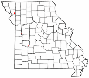
Ripley is a neighborhood of Independence, Missouri, United States. [1] [2]

Independence, Missouri City in Missouri, United States

Independence is the fifth-largest city in the U.S. state of Missouri. It lies within Jackson County, of which it is the county seat. Independence is a satellite city of Kansas City, Missouri, and is part of the Kansas City metropolitan area. In 2010, it had a total population of 116,830.

Missouri U.S. state in the United States

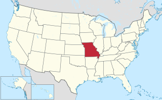
Missouri is a state in the Midwestern United States. With over six million residents, it is the 18th-most populous state of the Union. The largest urban areas are St. Louis, Kansas City, Springfield and Columbia; the capital is Jefferson City. The state is the 21st-most extensive in area. Missouri is bordered by eight states : Iowa to the north, Illinois, Kentucky and Tennessee to the east, Arkansas to the south and Oklahoma, Kansas and Nebraska to the west. In the South are the Ozarks, a forested highland, providing timber, minerals and recreation. The Missouri River, after which the state is named, flows through the center of the state into the Mississippi River, which makes up Missouri's eastern border.

United States Federal republic in North America

The United States of America (USA), commonly known as the United States or America, is a country comprising 50 states, a federal district, five major self-governing territories, and various possessions. At 3.8 million square miles, the United States is the world's third or fourth largest country by total area and is slightly smaller than the entire continent of Europe. With a population of over 327 million people, the U.S. is the third most populous country. The capital is Washington, D.C., and the most populous city is New York City. Most of the country is located contiguously in North America between Canada and Mexico.

The community was named after a railroad official; an early variant name was Adams Station. [3]

Related Research Articles

Little Blue River (Missouri) river in the United States of America

Little Blue River is a 45.4-mile-long (73.1 km) stream in Jackson County, Missouri, United States, that gave its name to the Battle of Little Blue River during the American Civil War. It rises in the southern Jackson County town of Grandview and empties into the Missouri River just west of the town of Sibley. The Little Blue was named for its smaller size relative to nearby Blue River.

Helena, Missouri unincorporated community in Missouri

Helena is an unincorporated community in southeastern Andrew County, Missouri, United States. It is located approximately twelve miles northeast of St. Joseph and is part of the St. Joseph, MO–KS Metropolitan Statistical Area.

Nashua is a neighborhood of Kansas City, Missouri, United States.

Jackson Township is an inactive township in Clinton County, in the U.S. state of Missouri.

Alta Vista is an unincorporated community in Daviess and DeKalb counties, in the U.S. state of Missouri.

Adair Park is an urban park in Independence, Missouri. The 40-acre park is equipped with a softball field and walking trail. The park has the name of Joseph Adair, the first white child born within the county's borders.

Atherton is an unincorporated community in Jackson County, in the U.S. state of Missouri.

Blue Mills is an unincorporated community in Jackson County, in the U.S. state of Missouri.

Bone Hill is a summit in Jackson County in the U.S. state of Missouri. It has an elevation of 925 feet (282 m).

Cobbler is an unincorporated community in Jackson County, in the U.S. state of Missouri.

Courtney is an unincorporated community in Jackson County, in the U.S. state of Missouri.

Hiler is an unincorporated community in Jackson County, in the U.S. state of Missouri.

Pink Hill is an unincorporated community in Jackson County, in the U.S. state of Missouri.

Blue Township is an inactive township in Jackson County, in the U.S. state of Missouri.

Brooking Township is an inactive township in Jackson County, in the U.S. state of Missouri.

Fort Osage Township is an inactive township in Jackson County, in the U.S. state of Missouri.

Prairie Township is an inactive township in Jackson County, in the U.S. state of Missouri.

Sni-A-Bar Township is an inactive township in Jackson County, in the U.S. state of Missouri.

Van Buren Township is an inactive township in Jackson County, in the U.S. state of Missouri.

Washington Township is an inactive township in Jackson County, in the U.S. state of Missouri.

References

  1. U.S. Geological Survey Geographic Names Information System: Ripley, Independence, Missouri
  2. "Ripley (in Jackson County, MO) Populated Place Profile". MO Hometown Locator. Retrieved 17 October 2016.
  3. "Jackson County Place Names, 1928–1945 (archived)". The State Historical Society of Missouri. Archived from the original on 24 June 2016. Retrieved 16 October 2016.CS1 maint: BOT: original-url status unknown (link)

Coordinates: 39°15′00″N94°34′23″W / 39.250°N 94.573°W / 39.250; -94.573

Geographic coordinate system Coordinate system

A geographic coordinate system is a coordinate system that enables every location on Earth to be specified by a set of numbers, letters or symbols. The coordinates are often chosen such that one of the numbers represents a vertical position and two or three of the numbers represent a horizontal position; alternatively, a geographic position may be expressed in a combined three-dimensional Cartesian vector. A common choice of coordinates is latitude, longitude and elevation. To specify a location on a plane requires a map projection.