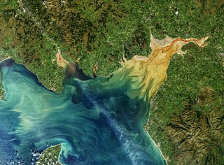
The Solway Firth is a firth that forms part of the border between England and Scotland, between Cumbria and Dumfries and Galloway. It stretches from St Bees Head, just south of Whitehaven in Cumbria, to the Mull of Galloway, on the western end of Dumfries and Galloway. The Isle of Man is also very near to the firth. The firth comprises part of the Irish Sea.
Firth is a word in the English and Scots languages used to denote various coastal waters in the United Kingdom, predominantly within Scotland. In the Northern Isles, it more often refers to a smaller inlet. It is linguistically cognate to fjord, which has a more constrained sense in English. Bodies of water named "firths" tend to be more common on the Scottish east coast, or in the southwest of the country, although the Firth of Clyde is an exception to this. The Highland coast contains numerous estuaries, straits, and inlets of a similar kind, but not called "firth" ; instead, these are often called sea lochs. Before about 1850, the spelling "Frith" was more common.
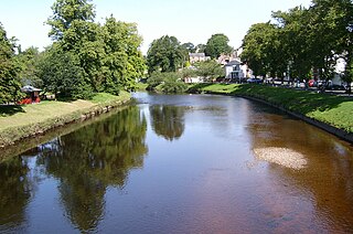
The River Eden is a river that flows through the Eden District of Cumbria, England, on its way to the Solway Firth.
River Esk is the name of:

The River Esk, also known as the Border Esk, is a river that rises in the Scottish region of Dumfries and Galloway before crossing the border to the English county of Cumbria and flowing into the Solway Firth.

Ravenglass is a coastal village in that lies between Barrow-in-Furness and Whitehaven, on the estuary of three rivers: the Esk, Mite and Irt. It is the only coastal village in the Lake District National Park. Formerly in the historical county of Cumberland, it is now part of the civil parish of Muncaster, the unitary authority of Cumberland, and the ceremonial county of Cumbria.

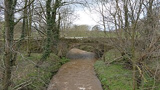
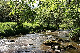
The River Esk, sometimes called the Cumbrian Esk, is a river in Cumbria, England. It flows for approximately 25 km from its source in the Scafells range of mountains to its estuary at Ravenglass. It is one of two Rivers Esk in Cumbria, and not to be confused with the Border Esk which flows into Cumbria from Scotland.

Eskdale is a glacial valley and civil parish in the western Lake District National Park in Cumbria, England. In 2001 the parish had a population of 264, increasing to 304 at the 2011 Census. One of the Lake District's most popular tourist attractions, the Ravenglass and Eskdale Railway, runs through the valley, though along with other western valleys of the Lake District, Eskdale is notably quieter during the high summer season than the more accessible eastern areas.
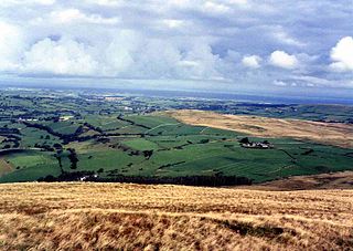
The Vale of Eden is formed by the course of the River Eden, one of the major rivers of Northwest England. It is however of much greater extent than the actual valley of the river, lying between the Cumbrian Mountains, and the northern part of the Pennine Range. It lies entirely within the county of Cumbria. The river has its source in the peat bogs below Hugh Seat, in the dale of Mallerstang. At first it heads off south before turning back north for the rest of its course – except just before its outlet into the sea which it enters from the east.

Boot is a small village in Eskdale on the western side of the English Lake District. It lies within the civil parish of Eskdale, the unitary authority of Cumberland, and the ceremonial county of Cumbria. The main part of the village lies beside the Whillan Beck, whilst its church, St Catherine's, lies 0.6 miles (0.97 km) to the south on the bank of the River Esk. The Whillan Beck flows into the Esk just downstream of the village.

The River Irt is a river in the county of Cumbria in northern England. It flows for approximately 22 kilometres (14 mi) from its source in Wast Water to its estuary at Ravenglass.

The River Mite is a river in the county of Cumbria in northern England. The valley through which the river Mite runs is called Miterdale.

The Ellen is a river in the English county of Cumbria, flowing from Skiddaw in the Northern Fells to the Solway Firth at Maryport. It was historically in the county of Cumberland. It is approximately 25 miles (40.2 km) in length.
The River Wampool is a river flowing through north western Cumbria in England. It is in the Waver and Wampool catchment which includes the towns of Silloth and Wigton.

The River Caldew is a river running through Cumbria in England. The river rises high up on the northern flanks of Skiddaw, in the Northern Fells area of the English Lake District, and flows in a northerly direction until it joins the River Eden on the north side of the city of Carlisle.

The Solway Coast is a designated Area of Outstanding Natural Beauty in northern Cumbria, England. It incorporates two areas of coastline along the Solway Firth, the first running from just north of the city of Carlisle, at the estuary of the rivers Esk and Eden, in a westerly direction as far as Silloth-on-Solway, including the villages of Bowness-on-Solway, Burgh-by-Sands, Port Carlisle, and Skinburness. The second area begins just north of the hamlet of Beckfoot, and runs south down the coast to the southern end of Allonby Bay near the village of Crosscanonby. Included in this area are the villages of Mawbray and Allonby, and the hamlets of Dubmill, Hailforth and Salta. The hamlet of Wolsty lies just outside the AONB. Beginning at Silloth, the B5300 coast road runs in a south-westerly direction, entering the AONB just north of Beckfoot, and exiting near Crosscanonby.
The Solway Plain or Solway Basin is a coastal plain located mostly in northwest Cumbria in England, extending just over the Scottish border to the low-lying area around Gretna and Annan. It lies generally north and west of Carlisle along the Solway Firth, and is drained by the rivers Esk and Lyne. It is associated with the westernmost part of Hadrian's Wall. In medieval times, clay houses known as dabbins were commonly built on the Solway Plain. The Solway coast has been designated an “Area of Outstanding Natural Beauty”.
The Kirtle Water is a river in Dumfries and Galloway in southern Scotland. It rises on the southern slopes of Haggy Hill where its headwaters are impounded to form Winterhope Reservoir. Below the dam it flows in a generally southerly direction passing Waterbeck and Eaglesfield to the village of Kirtlebridge along which stretch it is closely followed both by the A74(M) motorway and the mainline railway between Carlisle and Glasgow. From Kirtlebridge it turns southeastwards to flow by Kirkpatrick-Fleming and on, to the west of Gretna, to empty into the estuary of the Border Esk at the eastern limit of the Solway Firth.

Haaf net fishing is an ancient type of salmon and sea trout net fishing practised in Britain, and is particularly associated with the Solway Firth, the estuary forming part of the border between England and Scotland. The technique involves fishermen standing chest-deep in the sea and using large submerged framed nets to scoop up fish that swim towards them. It is a form of fishing that is believed to have been brought to Britain by the Vikings more than a thousand years ago and to have been practised in the Solway Firth since then.