
The Allegheny River is a 325-mile-long (523 km) headwater stream of the Ohio River that is located in western Pennsylvania and New York in the United States. It runs from its headwaters just below the middle of Pennsylvania's northern border, northwesterly into New York, then in a zigzag southwesterly across the border and through Western Pennsylvania to join the Monongahela River at the Forks of the Ohio at Point State Park in Downtown Pittsburgh, Pennsylvania.

Ottawa is a city in and the county seat of LaSalle County, Illinois, United States. It is located at the confluence of the navigable Fox River and Illinois River, the latter being a conduit for river barges and connects Lake Michigan at Chicago, to the Mississippi River, and North America's 25,000 mile river system. The population estimate was 18,742, as of 2020. It is the principal city of the Ottawa, IL Micropolitan Statistical Area.
The River Douglas, also known as the River Asland or Astland, flows through parts of Lancashire and Greater Manchester in North West England. It is a tributary of the River Ribble and has several tributaries, the major ones being the River Tawd and the River Yarrow.

The Wisconsin River is a tributary of the Mississippi River in the U.S. state of Wisconsin. At approximately 430 miles long, it is the state's longest river. The river's name was first recorded in 1673 by Jacques Marquette as "Meskousing", which is rooted in the Algonquian languages used by the area's Native American tribes. The river's original meaning is obscure, but French explorers who followed in the wake of Marquette later modified the name to "Ouisconsin", and so it appears on Guillaume de L'Isle's map. This was simplified to "Wisconsin" in the early 19th century, before being applied to Wisconsin Territory and finally the state of Wisconsin.

The Chattahoochee River forms the southern half of the Alabama and Georgia border, as well as a portion of the Florida and Georgia border. It is a tributary of the Apalachicola River, a relatively short river formed by the confluence of the Chattahoochee and Flint rivers and emptying from Florida into Apalachicola Bay in the Gulf of Mexico. The Chattahoochee River is about 430 miles (690 km) long. The Chattahoochee, Flint, and Apalachicola rivers together make up the Apalachicola–Chattahoochee–Flint River Basin. The Chattahoochee makes up the largest part of the ACF's drainage basin.
The Kama is a 1,805-kilometre (1,122 mi) long river in Russia. It has a drainage basin of 507,000 square kilometres (196,000 sq mi). It is the longest left tributary of the Volga and the largest one in discharge. At their confluence, in fact, the Kama is even larger than the Volga.

The North Platte River is a major tributary of the Platte River and is approximately 716 miles (1,152 km) long, counting its many curves. In a straight line, it travels about 550 miles (890 km), along its course through the U.S. states of Colorado, Wyoming, and Nebraska.

The French Broad River is a river in the U.S. states of North Carolina and Tennessee. It flows 218 miles (351 km) from near the town of Rosman in Transylvania County, North Carolina, into Tennessee, where its confluence with the Holston River at Knoxville forms the beginning of the Tennessee River. The river flows through the counties of Transylvania, Buncombe, Henderson, and Madison in North Carolina, and Cocke, Jefferson, Sevier, and Knox in Tennessee. It drains large portions of the Pisgah National Forest and the Cherokee National Forest.
The Flint River is a 344-mile-long (554 km) river in the U.S. state of Georgia. The river drains 8,460 square miles (21,900 km2) of western Georgia, flowing south from the upper Piedmont region south of Atlanta to the wetlands of the Gulf Coastal Plain in the southwestern corner of the state. Along with the Apalachicola and the Chattahoochee rivers, it forms part of the ACF basin. In its upper course through the red hills of the Piedmont, it is considered especially scenic, flowing unimpeded for over 200 miles (320 km). Historically, it was also called the Thronateeska River.
The Big River is a tributary of the Coast Fork Willamette River, approximately 12 miles (19 km) long, in western Oregon in the United States. It drains an area of the Calapooya Mountains south of Eugene.
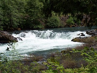
The North Umpqua River is a tributary of the Umpqua River, about 106 miles (171 km) long, in southwestern Oregon in the United States. It drains a scenic and rugged area of the Cascade Range southeast of Eugene, flowing through steep canyons and surrounded by large Douglas-fir forests. Renowned for its emerald green waters, it is considered one of the best fly fishing streams in the Pacific Northwest for anadromous fish.

The Calapooya Mountains are a mountain range in Lane and Douglas counties of southwestern Oregon in the United States. The range runs for approximately 60 miles (97 km) west from the Cascade Range between Eugene on the north and Roseburg on the south.

The River Deveron, known anciently as the Dovern, is a river in the north east of Scotland. The river has a length of 60 miles (97 km), and has a reputation for its Atlantic salmon, sea trout and brown trout fishing. In its upper reaches peaty water flows over a bottom of shingle and rock and is fast flowing.
The River Dhoo is a river on the Isle of Man. The river rises in Marown and flows east towards Douglas through the central valley of the island, passing Crosby and Union Mills before meeting with the River Glass on the outskirts of Douglas where it flows out to sea through Douglas Harbour. The Dhoo and the Glass converge to form the River Douglas. It has a length of approx. 6.5 mi (10.5 km).

The geography of New York (state) varies widely. Most of New York is dominated by farms, forests, rivers, mountains, and lakes. New York's Adirondack Park is larger than any U.S. National Park in the contiguous United States. Niagara Falls, on the Niagara River as it flows from Lake Erie to Lake Ontario, is a popular attraction. The Hudson River begins near Lake Tear of the Clouds and flows south through the eastern part of the state without draining lakes George or Champlain. Lake George empties at its north end into Lake Champlain, whose northern end extends into Canada, where it drains into the Richelieu River and then the St. Lawrence. Four of New York City's five boroughs are on the three islands at the mouth of the Hudson River: Manhattan Island, Staten Island, and Brooklyn and Queens on Long Island.

MacKerricher State Park is a state park in California in the United States. It is located 3 miles (4.8 km) north of Fort Bragg in Mendocino County. It covers 9 miles (14 km) of coastline and contains several types of coastal habitat, including beaches, dunes, headlands, coves, wetlands, tide pools, forest, and a freshwater lake.
Sturgeon River is a 106-mile-long (171 km) river in Baraga County and Houghton counties in the U.S. state of Michigan. 25.0 miles (40.2 km) of the river were added to the National Wild and Scenic Rivers System in 1992.

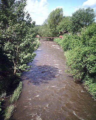
The River Worfe is a river in Shropshire, England. The name Worfe is said to derive from the Old English meaning to wander which the river is notable for in its middle section. Mapping indicates that the river begins at Cosford Bridge where the Cosford Brook and Albrighton Brook meet.
Kadva river is a minor but important tributary of Godavari in Nashik district, Maharashtra. It originates and flows through the Dindori Taluka of Nashik District.
The Azerbaijan is a country with very favorable natural conditions and rich natural resources. Snowy peaks, high mountains, foothill fertile soils, wide plains, Lowest Land Points Below Ocean Level are the main landscape forms of republic. This complex landscape structure has caused the variety in natural conditions - climate, soil-vegetation, and water resources. This, in turn, led to the uneven distribution of population and farms on the territory, and the specialization of production on different types.
