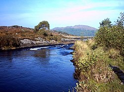
Loch Shiel is a freshwater loch situated 20 kilometres (12 mi) west of Fort William in the Highland council area of Scotland. At 28 kilometres long it is the 4th longest loch in Scotland, and is the longest to have retained a natural outflow without any regulation of its water level, being 120 m (393 ft) deep. Its nature changes considerably along its length, being deep and enclosed by mountains in the north east and shallow surrounded by bog and rough pasture in the south west, from which end the 4 km River Shiel drains to the sea in Loch Moidart near Castle Tioram.

The River Leven is a river in Fife, Scotland. It flows from Loch Leven into the Firth of Forth at the town of Leven. The river is home to brown trout and hosts a run of sea trout and atlantic salmon. The estuary has bass and mullet.

The Jones River is a 7.5-mile-long (12.1 km) river running through Kingston, Massachusetts. The river drains about 30 square miles (78 km2), has its source in Silver Lake and drains into Kingston Bay. Land surrounding the river is 52% forested, of which 22% has been developed for residential use. There is a USGS stream gauge along 16 square miles (41 km2) of the river and it has measured the flow at 0.7 cubic feet per second (0.020 m3/s) per square mile of drainage area.

Canim Beach Provincial Park is a provincial park in British Columbia, Canada, located at the southwest end of Canim Lake in the Interlakes District of the South Cariboo region, adjacent to the Secwepemc Indian reserve community of Canim Lake, British Columbia just northeast of 100 Mile House. The park was established by Order-in-Council in 1956 and expanded by later legislation in 2000 and 2004 to total a current approximate of 8.2 hectares, 3.6 hectares of upland and 4.6 hectares of foreshore.

Quatsino Provincial Park is a provincial park in British Columbia, Canada, located on Quatsino Sound on northern Vancouver Island.

Sunart is a rural district and community in the south west of Lochaber in Highland, Scotland, on the shores of Loch Sunart, and part of the civil parish of Ardnamurchan. The main village is Strontian, at the head of the loch, which is the location of Ardnamurchan High School, the local fire station, police station and other facilities.

Trout River is a small rural fishing town located on the southern coastal edge of Gros Morne National Park in Newfoundland, near the Tablelands. Trout River was settled in 1815 by George Crocker and his family, who were its only inhabitants until 1880. The community is served by Route 431.

The River Eden is a river in Fife in Scotland, and is one of Fife's two principal rivers, along with the Leven. It is nearly 30 miles (48 km) long and has a fall of around 300 feet (91 m).

The Castletown River is a river which flows through the town of Dundalk, County Louth, Ireland. It rises near Newtownhamilton, County Armagh, Northern Ireland, and is known as the Creggan River in its upper reaches. Its two main tributaries are the Kilcurry and Falmore rivers and it enters the Irish Sea at Dundalk Bay.
The Blueberry River is a river in the Peace River Block of northeastern British Columbia, Canada. It is a tributary of the Beatton River, which is a tributary of the Peace River.
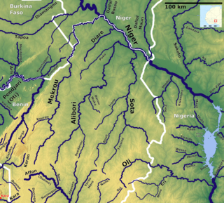
The Mékrou River is a river of Benin, Burkina Faso, and Niger. It flows through the W National Park.
Ardshealach is a small hamlet located close to the south west shore of Loch Shiel in Sunart, Lochaber, Highland, less than one mile southeast of Acharacle. It is in the Scottish council area of the Highland, Scotland.
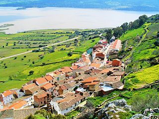
Capilla is a Spanish municipality in the province of Badajoz, Extremadura. It has a population of 189 (2007) and an area of 147 km².
The Compton Névé is a névé in the Pacific Ranges of the Coast Mountains in southwestern British Columbia, Canada, located southeast of the Homathko Icefield and Mount Gilbert and to the south of the Bishop River. It lies west of the Lillooet Icecap and is connected to it by the Ring Glacier, which sits astride Ring Pass, the divide between the Lillooet and Bishop Rivers, and has an area of 714 km2 (276 sq mi).
The Choquette River is a tributary of the Stikine River, flowing west into that river just north of its confluence with the Iskut. The river is named for Alexander "Buck" Choquette, discoverer of the strike which launched the Stikine Gold Rush and the first non-native settler in the region, who operated a store near here and also for a while the Hudson'a Bay Company post and border station at Stikine, then named Boundary. The Choquette Glacier, at the head of the river and its source, and Mount Choquette are nearby; Mount Johnny in the same region is named for one of Choquette's many sons.
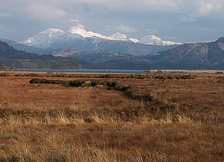
Dalnabreck is a small village, lying at the southwest end of Loch Shiel in Sunart, Lochaber, Scottish Highlands and is in the Scottish council area of Highland.
Zael is a municipality in the province of Burgos, Castile and León, Spain.
Glenville is an unincorporated community in Manheim Township, York County, Pennsylvania, United States.
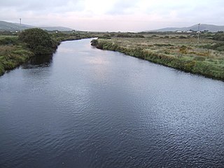
The River Inny is a river in County Kerry, Ireland.

The River Finnan is a river in Highland, Scotland that flows the Glen Finnan glen (valley). Rising from the waters of two streams near Corryhully, one named Allt a' Chaol Ghlinne, the River Finnan drains into Loch Shiel. It flows underneath the Glenfinnan Viaduct at Glenfinnan.
