
Gloucester County is located in the northeastern corner of New Brunswick, Canada. Fishing, mining and forestry are the major industries in the county. The eastern section of the county is known for its Acadian culture.

Shippagan is a Canadian town in Gloucester County, New Brunswick.

Eel River Crossing is a Canadian village in Restigouche County, New Brunswick.

Autoroute 85 is a Quebec Autoroute and the route of the Trans-Canada Highway in the province's Bas-Saint-Laurent region, also known as the Autoroute Claude-Béchard. It is currently under construction with committed Federal and Provincial funding for its completion, with an estimated completion date of 2025. Once this upgrade is completed, it will close one of the last gaps in the nearly continuous freeway section of the Trans-Canada between Arnprior, Ontario, and Sutherlands River, Nova Scotia, and for an even longer interprovincial freeway route between Windsor, Ontario and Halifax, Nova Scotia. Running between Rivière-du-Loup and a junction with New Brunswick Route 2 at the Quebec-New Brunswick border, the A-85 when complete will be the only controlled access highway link between the Maritime Provinces and the rest of the country. The A-85 is projected to be approximately 100 km (60 mi) long when construction is complete and is intended to replace Route 185, which has been called one of the deadliest highways in Canada.

The St. Francis River is a river roughly 75 miles (120 km) long, which forms part of the Canada–United States border. The river rises in a lake of the same name located 12 miles (20 km) east of the Rivière du Loup in Quebec. The portion that forms the boundary starts at the bottom of Lake Pohenegamook at the very northernmost point of New England between Estcourt Station, Maine, and Estcourt, Quebec. The river along the international boundary flows south and then south-east through two deep, narrow lakes to its mouth on the Saint John River at St. Francis, Maine/Saint-François-de-Madawaska, New Brunswick.
Berry Mills is a small, unincorporated community north-west of Moncton, New Brunswick. It is located around the main Canadian National Railway line, which was formerly the Intercolonial Railway of Canada line. Major Intersections include New Brunswick Route 128 and New Brunswick Route 2 as well as Homestead Road and New Brunswick Route 128. Berry Mills also includes the mostly forest area of Lutesville, New Brunswick.
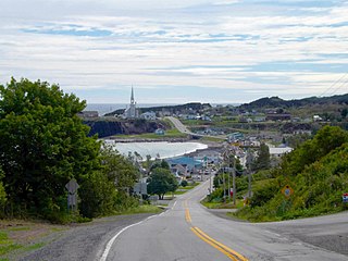
Grande-Vallée is a municipality in the Gaspésie-Îles-de-la-Madeleine region of the province of Quebec in Canada.
Allison is a community in Moncton Parish, New Brunswick on Route 106.

Pokemouche is a Canadian local service district in Gloucester County, in the northeast of New Brunswick, in the Acadian peninsula.
The Rivière du Nord is a river that flows into the Caraquet Bay west of Caraquet, New Brunswick, Canada.

New Bandon Parish is a Canadian parish in Gloucester County, New Brunswick. It was named after the town of Bandon in Ireland. Within the parish is the rural community of New Bandon, which lies between Pokeshaw on the east, and Stonehaven on the west.
Coteau Road is a settlement in New Brunswick. This Community is located almost exclusively on Route 310
Petite-Rivière-de-l'Ile is a settlement in New Brunswick.
Sainte-Rose was a settlement in New Brunswick. The community includes Haute-Sainte-Rose and Sainte-Rose-Gloucester. The community is located mainly on Route 355. It is now part of the Regional Municipality of Tracadie.

Caraquet is a town in Gloucester County, New Brunswick, Canada.
Irishtown is a community located in Westmorland County, New Brunswick, Canada. The community is situated in southeastern New Brunswick, to the north of Moncton on Route 115.
Evangeline is a community in the Canadian province of New Brunswick. The community is located mainly on Route 345.
Six-Roads is a settlement in New Brunswick. The Community is located mainly at the intersection of Route 355 and Route 11.


