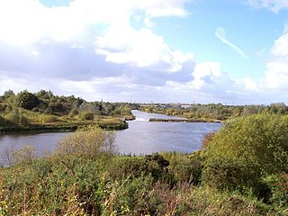
Formerly a township within the parish of Warrington, and now a parish in its own right, Woolston-with-Martinscroft consists of two settlements: Woolston to the west and Martinscroft to the east, which run along the north bank of the River Mersey and take in Paddington to the south-west. It is bounded by the River Mersey to the south, Bruche and Padgate to the west, Longbarn and Birchwood to the north and Rixton to the east.

Winwick is a village and civil parish in Warrington, Cheshire, England. Located within the historic boundaries of Lancashire, it is situated about three miles north of Warrington town centre, nearby is junction 22 of the M6 and Junction 9 of the M62. Winwick also borders Newton-le-Willows and Burtonwood.

Burtonwood is a village in the civil parish of Burtonwood and Westbrook, in the outermost suburbs of Warrington, Cheshire, England. Within the boundaries of the historic county of Lancashire, the name Burtonwood is known worldwide as the location of the former RAF Station Burtonwood military camp. Burtonwood village itself is a few miles away from the site of the former station. The civil parish also includes Westbrook, which is a council ward and suburb of Warrington. According to the 2001 census, the population of the entire civil parish was 11,265.

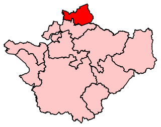
Warrington North is a parliamentary constituency represented in the House of Commons of the Parliament of the United Kingdom since 2019 by Charlotte Nichols of the Labour Party. It elects one Member of Parliament (MP) by the first past the post system of election.

Warburton is a village and civil parish within the Metropolitan Borough of Trafford in Greater Manchester, England. Historically in Cheshire, Warburton lies on the south bank of the River Mersey between the borough of Warrington and Greater Manchester. In the 21st century, the village remains predominantly rural. Altrincham is the nearest town. According to the 2001 census, the parish had a population of 286.

Culcheth is a village in the Borough of Warrington, ceremonial county of Cheshire and historic county of Lancashire, England, six miles (10 km) north-east of Warrington town centre; it is the principal settlement in Culcheth and Glazebury civil parish.

Glazebrook railway station serves the villages in the civil parish of Rixton-with-Glazebrook in the Warrington unitary authority in the ceremonial county of Cheshire, England. The station, and all trains serving it, are operated by Northern Trains. The station is 9.9 miles (16 km) west of Manchester Oxford Road on the Manchester to Liverpool Line.

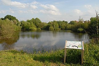
Rixton Clay Pits is a former clay extraction site in Rixton, near Hollins Green, Warrington, England. Formerly farmland, boulder clay extraction started in the 1920s for brick making in the adjacent brickworks, and ceased in 1965 - since then it has been allowed to return to nature. It is now an area of ponds, scrub, woodland and damp grassland. It is owned and managed by Warrington Borough Council as a local amenity.
Priestley Sixth Form and Community College is a sixth form college in the Wilderspool district of Warrington, Cheshire, England. It also offers adult courses and professional training on another site, and is an associate college of the University of Salford. The college offers a range of courses, including AS/A2 Levels, BTECs, Advanced Diplomas, functional skills, and pre-university foundation courses.

Burland is a village and civil parish in the unitary authority of Cheshire East and the ceremonial county of Cheshire, England, about 2½ miles west of Nantwich. The civil parish also includes the small settlements of Burland Lower Green, Burland Upper Green, Hollin Green and Stoneley Green, as well as parts of Gradeley Green and Swanley. The eastern part of the village of Ravensmoor also falls within the civil parish.

Hollins Green is a village on the eastern edge of Warrington, England, close to Glaze Brook, the boundary with Salford, in the civil parish of Rixton-with-Glazebrook; the ecclesiastical parish is Hollinfare.

Marbury is a small village located at SJ560457 in the civil parish of Marbury cum Quoisley, within the unitary authority of Cheshire East and the ceremonial county of Cheshire, England. It is administered jointly with the adjacent civil parishes of Norbury and Wirswall. The village lies around 3 miles (5 km) north east of Whitchurch in Shropshire and 7 miles (11 km) south west of Nantwich in Cheshire. Nearby villages include Malpas, No Man's Heath, Norbury, Wirswall and Wrenbury. The civil parish borders Shropshire and covers 2,168 acres (877 ha); it also contains the small settlements of Hollins Lane, Marley Green and Quoisley, as well as parts of Hollyhurst and Willeymoor. The total population was just under 250 in 2001, and – combined with Wirswall – 352 in 2011.
Warrington Rural District was, from 1894 to 1974, a local government district in the administrative county of Lancashire.

Rixton-with-Glazebrook is a civil parish in the unitary authority of Warrington, Cheshire, England. Historically part of Lancashire, it lies to the east of Warrington and borders Cadishead, and is largely farmland. It has a railway station at Glazebrook and is served by buses along the A57 road. The parish was originally a township within Warrington parish before becoming a separate parish in 1866. It was part of the Warrington Poor Law Union and, from 1894, Warrington Rural District, and the District of Warrington from 1974.
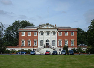
Rixton-with-Glazebrook is a civil parish in the Borough of Warrington in Cheshire, England, to the east of the town of Warrington. It contains seven buildings that are recorded in the National Heritage List for England as designated listed buildings, all of which are listed at Grade II. This grade is the lowest of the three gradings given to listed buildings, applied to "buildings of national importance and special interest". The parish is largely rural, and contains the villages of Hollins Green and Glazebrook. The A57 road runs through the parish, and three of the listed buildings are milestones along this road. The other listed buildings are a church, a war memorial, a railway station, and a former manor house.
Culcheth and Glazebury is a civil parish in the Borough of Warrington, ceremonial county of Cheshire and historic county of Lancashire, England, northeast of the town of Warrington. It contains eleven buildings that are recorded in the National Heritage List for England as designated listed buildings. Other than the villages of Culcheth and Glazebury, the parish is rural. The A574 road runs through it, and two milestones adjacent to the road are listed. In addition a parish boundary stone on the B5207 road is listed. The church in Glazebury is also listed; all the other listed buildings are related to houses or farms.

Warrington is a large town and unitary authority area in the ceremonial county of Cheshire, England, on the banks of the River Mersey. It is 20 miles (32 km) east of Liverpool, and 16 miles (26 km) west of Manchester. The population in 2019 was estimated at 165,456 for the town's urban area, and just over 210,014 for the entire borough, the latter being more than double that of 1968 when it became a new town. Warrington is the largest town in the ceremonial county of Cheshire.


