Road Harbour, located in Road Town, Tortola, is the commercial seaport of the British Virgin Islands. There are a number of smaller marinas around the harbour, such as the Road Reef Marina and the Fort Burt Marina, an overnight small boat anchorage, customs and immigration offices. Inter island ferries stop at the ferry dock on the NW edge of Road Harbour next to Customs. Road Harbour is deep and large enough to handle many of the cruise ships that make Tortola a port of call.
Entrance by sea to Road Harbour is straightforward, although many boats continue to run aground on the sand bar on the Road Reef/Fort Burt side of the harbour at the entrance.
Poole Harbour is a large natural harbour in Dorset, southern England, with the town of Poole on its shores. The harbour is a drowned valley (ria) formed at the end of the last ice age and is the estuary of several rivers, the largest being the Frome. The harbour has a long history of human settlement stretching to pre-Roman times. The harbour is extremely shallow, with one main dredged channel through the harbour, from the mouth to Holes Bay.
Virgin Gorda is the third-largest and second-most populous of the British Virgin Islands (BVI).
Saint John is one of the Virgin Islands in the Caribbean Sea and a constituent district of the United States Virgin Islands (USVI), an unincorporated territory of the United States.
Saint Peter Port Harbour is located in Saint Peter Port, Guernsey. It was a natural anchorage used by the Romans which has been changed into an artificial harbour that is now the island's main port for passengers. Loose cargo, liquids and gas are shipped to and from St Sampson's harbour.
Road Town, located on Tortola, is the capital of the British Virgin Islands. It is situated on the horseshoe-shaped Road Harbour in the centre of the island's south coast. The population was about 15,000 in 2018.
Jost Van Dyke is the smallest of the four main islands of the British Virgin Islands, measuring roughly 8 square kilometres. It rests in the northern portion of the archipelago of the Virgin Islands, located in the Atlantic Ocean and Caribbean Sea. Jost Van Dyke lies about 8 km (5 mi) to the northwest of Tortola and 8 km (5 mi) to the north of Saint John. Little Jost Van Dyke lies off its eastern end.
Cruz Bay, U.S. Virgin Islands is the main town on the island of Saint John in the United States Virgin Islands. According to the 2000 census, Cruz Bay had a population of 2,743.
Hamilton Harbour is a natural harbour in Bermuda which serves as the port for the capital, the City of Hamilton. It is an arm of the Great Sound, and forms a tapering wedge shape of water between Paget Parish and the peninsula which forms Pembroke Parish, and upon which the capital sits.
St. George's Harbour is a natural harbour in the north of Bermuda. It serves as the port for the town of St. George's, located on St. George's Island, to its north. To its south is St. David's Island. The harbour and both islands lie within St. George's Parish. It was for two centuries the primary harbour of the British Overseas Territory.
Fort Purcell is a ruined fort near Pockwood Pond on the island of Tortola in the British Virgin Islands.
Fort Charlotte is a fort built on Harrigan's Hill, Tortola, British Virgin Islands. The fort was named after Charlotte of Mecklenburg-Strelitz, who was the wife of King George III.
Fort Burt is a colonial fort that was erected on the southwest edge of Road Town, Tortola in the British Virgin Islands above Road Reef Marina. The site is now a hotel and restaurant of the same name, and relatively little of the original structure remains. However, one of the original cannons has survived and stands on the veranda of the hotel, vigilantly looking over the harbour.
Fort George is a colonial fort which was erected on the northeast edge of Road Town, Tortola in the British Virgin Islands above Baugher's Bay. The site is now a ruin.
Road Town Fort is a colonial fort which was erected on Russell Hill in Road Town, Tortola in the British Virgin Islands above the town's main wharf. In historical records it is sometimes referred to as Fort Road Town. The fort subsequently fell into ruin, and in the 1960s the Bougainvillea clinic was built on top of the old structure. The strong room of the original fort, which was once the Territory's treasury, still survives today, and is now used as a storeroom by the clinic.
Victoria Harbour is a harbour, seaport, and seaplane airport in the Canadian city of Victoria, British Columbia. It serves as a cruise ship and ferry destination for tourists and visitors to the city and Vancouver Island. It is both a port of entry and an airport of entry for general aviation. Historically it was a shipbuilding and commercial fishing centre. While the Inner Harbour is fully within the City of Victoria, separating the city's downtown on its east side from the Victoria West neighbourhood, the Upper Harbour serves as the boundary between the City of Victoria and the district municipality of Esquimalt. The inner reaches are also bordered by the district of Saanich and the town of View Royal. Victoria is a federal "public harbour" as defined by Transport Canada. Several port facilities in the harbour are overseen and developed by the Greater Victoria Harbour Authority, however the harbour master's position is with Transport Canada.
Cooper Bay ruin is a ruin in Cooper Bay, on the north side of Tortola in the British Virgin Islands. The ruin dates from the sugar plantation era, and was presumed abandoned during the economic collapse of the British Virgin Islands during the mid-19th century.
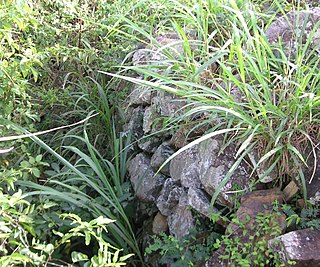
The Cooten Bay ruin is a ruin in Cooten Bay, on the north side of Tortola in the British Virgin Islands. The ruin probably dates from the sugar plantation era, although the fortification of the property with cannon may suggest an earlier date. It was presumed abandoned during the economic collapse of the British Virgin Islands during the mid-19th century, when many plantations were abandoned.
The Whelk Point Fort was a colonial fort erected on the southeast part of Tortola in the British Virgin Islands. The fort fell into disrepair and ruin, and relatively little of the original structure remains. In 1992 a house was built over the original foundations of the fort, but the remains of the barracks can still be seen on the land behind the house. The ruins are on private property and are not generally accessible to the public.
The Dutch Virgin Islands is the collective name for the enclaves that the Dutch West India Company had in the Virgin Islands. The area was ruled by a director, whose seat was not permanent. The main reason for starting a colony here was that it lay strategically between the Dutch colonies in the south and New Netherland. The Dutch West India Company was mainly affected by the competition from Denmark, England and Spain. In 1680 the remaining islands became a British colony.
Larmer Bay ruin is a ruin in Larmer Bay, on the north side of Tortola in the British Virgin Islands. The ruin dates from the sugar plantation era, and was presumed abandoned during the economic collapse of the British Virgin Islands during the mid-19th century.
This page is based on this Wikipedia article Text is available under the CC BY-SA 4.0 license; additional terms may apply. Images, videos and audio are available under their respective licenses.