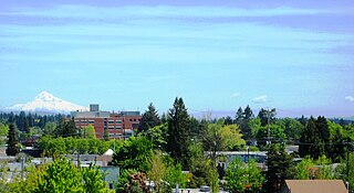
Portland is the most populous city in the U.S. state of Oregon, located in the Pacific Northwest region. Situated in the northwestern area of the state at the confluence of the Willamette and Columbia rivers, it is the county seat of Multnomah County, Oregon's most populous county. As of 2020, Portland's population was 652,503, making it the 26th-most populous city in the United States, the sixth-most populous on the West Coast, and the second-most populous in the Pacific Northwest, after Seattle. Approximately 2.5 million people live in the Portland metropolitan area, making it the 25th-most populous in the United States. About half of Oregon's population resides within the Portland metro area.

Multnomah County is one of the 36 counties in the U.S. state of Oregon. As of the 2020 census, the county's population was 815,428. Multnomah County is part of the Portland–Vancouver–Hillsboro, OR–WA metropolitan statistical area. The state's smallest and most populous county, its county seat, Portland, is the state's largest city.

Gresham is a city in the Willamette Valley, Located in Multnomah County in the U.S. state of Oregon, bordered by Portland to the northwest and partially in the southwest. it was first settled in the early 1850s by the Powell brothers. It remained unincorporated until 1905; it was named after Walter Quintin Gresham, an American Civil War general and United States Secretary of State.

Troutdale is a city in Multnomah County, Oregon, United States, immediately north of Gresham and east of Wood Village. As of the 2020 census, the city population was 16,300. The city serves as the western gateway to the Historic Columbia River Highway, the Mount Hood Scenic Byway, and the Columbia River Gorge. It is approximately 12 miles (19 km) east of Portland and is part of the Portland, Oregon metropolitan area.

Hillsboro is a city in the U.S. state of Oregon and is the county seat of Washington County. Situated in the Tualatin Valley on the west side of the Portland metropolitan area, the city hosts many high-technology companies, such as Intel, locally known as the Silicon Forest. The population was 106,447 at the 2020 census, making Hillsboro the fifth-most populous city in Oregon.

The Portland metropolitan area is a metro area with its core in the U.S. states of Oregon and Washington. It has 5 principal cities, the largest being Portland, Oregon. The U.S. Office of Management and Budget (OMB) identifies it as the Portland–Vancouver–Hillsboro, OR–WA Metropolitan Statistical Area, a metropolitan statistical area used by the United States Census Bureau (USCB) and other entities. The OMB defines the area as comprising Clackamas, Columbia, Multnomah, Washington, and Yamhill Counties in Oregon, and Clark and Skamania Counties in Washington. The area had a population of 2,512,859 at the 2020 census, an increase of over 12% since 2010.

Downtown Portland is the central business district of Portland, Oregon, United States. It is on the west bank of the Willamette River in the northeastern corner of the southwest section of the city and where most of the city's high-rise buildings are found.
South Portland is a long, narrow neighborhood just south of Downtown Portland, Oregon, hemmed in between the Willamette River and the West Hills. It stretches from I-405 and the Marquam Bridge on the north, to SW Canby St. and the Sellwood Bridge in the south. The Willamette forms the eastern boundary, and SW Barbur Blvd. most of the western boundary. In addition to Downtown to the north, other bordering neighborhoods are Southwest Hills, Homestead, Hillsdale, and South Burlingame to the west, and Hosford-Abernethy, Brooklyn, and Sellwood-Moreland across the river on the east.

Outside In is a medical and youth service nonprofit organization in Portland, Oregon, United States that provides primary care and "wraparound services" for low income and homeless clients. It also has several other programs such as needle exchange program for drug users, and eligibility restricted tattoo removal service. The needle exchange has been the cause of community objection as well as cancellation of insurance policy and donors declining to give. It has reported that in fiscal year 2015–2016, it has given out 988,399 needles which was 20,962 more needles than what was returned. Founded in 1968 to serve youth, the organization has since continued to revise its services to meet the needs of its clients. Its services as described in October 2014 include medical care, mobile medical vans, tattoo removal, housing, education, counseling, and job training.

The Lents neighborhood in the Southeast section of Portland, Oregon is bordered by SE Powell Blvd. on the north, the Clackamas County line or City of Portland line on the south, SE 82nd Ave. to the west, and roughly SE 112th on the east. The NE corner overlaps with the Powellhurst-Gilbert neighborhood. In addition to Powellhurst-Gilbert on the north and east, Lents also borders Foster-Powell, Mt. Scott-Arleta, and Brentwood-Darlington on the west and Pleasant Valley on the east.

Wilkes is the northeasternmost neighborhood in Portland, Oregon, bordered on the north by the Columbia River and on the east by the city of Gresham, where it expands into the city as the neighborhood of Wilkes East. It adjoins the neighborhoods of Argay, Russell, and Hazelwood on the west, and Glenfair on the south. Interstate 84 runs through the middle of the neighborhood.
Montavilla is a neighborhood in the Northeast and Southeast sections of Portland, Oregon, United States, and contains an area east of Mount Tabor and west of Interstate 205, from the Banfield to SE Division. It is bordered by North Tabor, Mount Tabor, South Tabor, Madison South, Hazelwood, and Powellhurst-Gilbert.

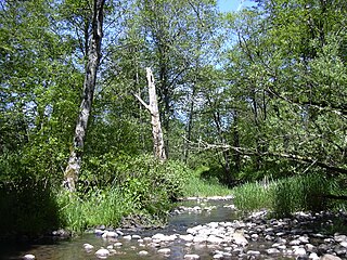
Johnson Creek is a 25-mile (40 km) tributary of the Willamette River in the Portland metropolitan area of the U.S. state of Oregon. Part of the drainage basin of the Columbia River, its catchment consists of 54 square miles (140 km2) of mostly urban land occupied by about 180,000 people as of 2012. Passing through the cities of Gresham, Portland, and Milwaukie, the creek flows generally west from the foothills of the Cascade Range through sediments deposited by glacial floods on a substrate of basalt. Though polluted, it is free-flowing along its main stem and provides habitat for salmon and other migrating fish.

The Columbia Slough is a narrow waterway, about 19 miles (31 km) long, in the floodplain of the Columbia River in the U.S. state of Oregon. From its source in the Portland suburb of Fairview, the Columbia Slough meanders west through Gresham and Portland to the Willamette River, about 1 mile (1.6 km) from the Willamette's confluence with the Columbia. It is a remnant of the historic wetlands between the mouths of the Sandy River to the east and the Willamette River to the west. Levees surround much of the main slough as well as many side sloughs, detached sloughs, and nearby lakes. Drainage district employees control water flows with pumps and floodgates. Tidal fluctuations cause reverse flow on the lower slough.

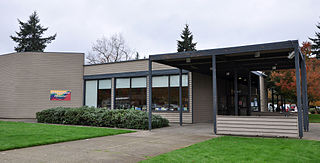
The Rockwood Library is a branch of the Multnomah County Library, located in Portland, Oregon. The branch offers the Multnomah County Library catalog of two million books, periodicals and other materials. The library also features a 30-person capacity meeting room for hosting community events at no charge on a first come, first served basis.

Southwest Portland is one of the sextants of Portland, Oregon.

Ricardo "Ricki" Ruiz is an American politician and community organizer serving as a member of the Oregon House of Representatives from the 50th district.

According to the City of Portland, "In all categories, the Eastside is more racially diverse than the Westside. Hispanics are most concentrated in North Portland at nearly 15% of the population. NE Portland has the highest concentration of African Americans at 30%. The concentration of Asians in Portland are mostly within NE, SE, and outer East Portland, with a percent population of 11%, 10%, and 9% respectively. Whites are the most common race group citywide."
Lori Stegmann is an American politician currently serving as a member of the Multnomah County Commission in Oregon representing the 4th district which covers East Multnomah County and parts of East Portland.

East County is a region of Multnomah County, Oregon, in the Portland metropolitan area. It is generally defined as being the entirety of Multnomah County east of Portland.


