Rod Koh

Last updated

Rod Koh or Rod Kohi (Persian : راد کوہ) is a form of irrigation system in Pakistan. Rod means channel and Koh means mountain in Persian. The Rod Kohi system based on Kulyat Riwajat (Fromulae and Traditions) which governed the irrigation system ever since the Pashtun tribes moved into Damaan. The British officers moved all these to writing during their Land Settlements in the later part of the nineteenth century. The Bolton Irrigation Notes of 1908 are still considered the Bible of Rod Kohi irrigation. [1] Rod Koh is the main torrent bed which usually remains dry, when there is no flood, whereas Zam means the flow of perennial water coming out of springs. [2]

Persian language Western Iranian language

Persian, also known by its endonym Farsi, is one of the Western Iranian languages within the Indo-Iranian branch of the Indo-European language family. It is primarily spoken in Iran, Afghanistan, and Tajikistan, Uzbekistan and some other regions which historically were Persianate societies and considered part of Greater Iran. It is written right to left in the Persian alphabet, a modified variant of the Arabic script, which itself evolved from the Aramaic alphabet.

Pakistan federal parliamentary constitutional republic in South Asia

Pakistan, officially the Islamic Republic of Pakistan, is a country in South Asia. It is the world’s sixth-most populous country with a population exceeding 212,742,631 people. In area, it is the 33rd-largest country, spanning 881,913 square kilometres. Pakistan has a 1,046-kilometre (650-mile) coastline along the Arabian Sea and Gulf of Oman in the south and is bordered by India to the east, Afghanistan to the west, Iran to the southwest, and China in the far northeast. It is separated narrowly from Tajikistan by Afghanistan's Wakhan Corridor in the northwest, and also shares a maritime border with Oman.

Zam system is a form of irrigation system in Pakistan. Zam means the flow of perennial water coming out of springs, whereas Rod Koh is the main torrent bed which remains usually dry, when there is no flood.

Contents

The flood and perennial water of the Zam is used for irrigation and drinking purpose. Zam water is classified into two categories: Buga Pani (flood water) and Kala Pani (perennial water).

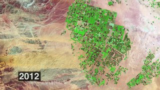
Rod Koh (torrent-spate-irrigation) systems go back at least as early as 330 BC and provided economic basis for some of the early civilisations. Alexander the Great, according to Arrian, sailed down the river Jhelum to its junction with Indus River. His land forces marched in two bodies on either side of the river. They noticed some form of torrent agriculture although in a very poor state in a few locations of the Sulaiman piedmont. Heavy rains in the catchments, which extend up to Balochistan region, Afghanistan, Sulaiman Range, Shirani Hills and Bhattani Range result in water rushing intotorrents in the foothill plains, named as Daman area, where torrent agriculture (Rod Kohi) is practised. [3]

Alexander the Great King of Macedon

Alexander III of Macedon, commonly known as Alexander the Great, was a king (basileus) of the ancient Greek kingdom of Macedon and a member of the Argead dynasty. He was born in Pella in 356 BC and succeeded his father Philip II to the throne at the age of 20. He spent most of his ruling years on an unprecedented military campaign through Asia and northeast Africa, and he created one of the largest empires of the ancient world by the age of thirty, stretching from Greece to northwestern India. He was undefeated in battle and is widely considered one of history's most successful military commanders.

Arrian Roman historian, public servant, military commander and philosopher of the 2nd-century

Arrian of Nicomedia was a Greek historian, public servant, military commander and philosopher of the Roman period.

Jhelum River River in India and Pakistan

The Jhelum River (Urdu: جہلم‎ Punjabi: ਜਿਹਲਮ, Kashmiri: Vyeth, is a river of west Kashmir and eastern Pakistan. It is the westernmost of the five rivers of Punjab, and passes through Srinager District. It is a tributary of the Indus River and has a total length of about 725 kilometres.

See also

The Pakistan Agricultural Research Council (PARC) is in Islamabad, Pakistan. It is an apex agricultural research organization at the national level. Its main objective is to strengthen Pakistan's agricultural research system, comprising the federal and provincial components.

Spate irrigation uses seasonal floods of rivers, streams, ponds and lakes to fill water storage canals. If irrigation is the manipulation of water for use in growing crops, spate irrigation is perhaps the most ancient method devised. Evidence of basic spate irrigation engineering can be traced back beyond recorded history and include the Ancient Egyptian diversion of the Nile River for storage at times of heavy rainfall for use in the dryer times of the year.

Related Research Articles

Indus River river in Asia

The Indus River is one of the longest rivers in Asia. Originating in the Tibetan Plateau in the vicinity of Lake Manasarovar, the river runs a course through the Ladakh region of Indian state Jammu and Kashmir, towards the Gilgit-Baltistan region of Pakistan and the Hindukush ranges, and then flows in a southerly direction along the entire length of Pakistan to merge into the Arabian Sea near the port city of Karachi in Sindh. It is the longest river and national river of Pakistan.

Geography of Pakistan

The Geography of Pakistan is a profound blend of landscapes varying from plains to deserts, forests, hills, and plateaus ranging from the coastal areas of the Arabian Sea in the south to the mountains of the Karakoram range in the north. Pakistan geologically overlaps both with the Indian and the Eurasian tectonic plates where its Sindh and Punjab provinces lie on the north-western corner of the Indian plate while Balochistan and most of the Khyber Pakhtunkhwa lie within the Eurasian plate which mainly comprises the Iranian Plateau. Gilgit-Baltistan and Azad Kashmir lie along the edge of the Indian plate and hence are prone to violent earthquakes where the two tectonic plates collide.

Irrigation artificial application of water to the land or soil

Irrigation is the application of controlled amounts of water to plants at needed intervals. Irrigation helps to grow agricultural crops, maintain landscapes, and revegetate disturbed soils in dry areas and during periods of less than average rainfall. Irrigation also has other uses in crop production, including frost protection, suppressing weed growth in grain fields and preventing soil consolidation. In contrast, agriculture that relies only on direct rainfall is referred to as rain-fed or dry land farming.

Sulaiman Mountains mountain range

The Sulaiman Mountains, or Kōh-e Sulaymān, are the southern extension of the Hindu Kush mountain system, located in the Zabul, Kandahar and Loya Paktia regions of Afghanistan, and in the southern Federally Administered Tribal Areas, most of northern Balochistan, and some of southwestern Punjab and Khyber Pakhtunkhwa in Pakistan. The Sulaimans form the eastern edge of the Iranian Plateau where the Indus River separates it from the Subcontinent. Bordering the Sulaimans to the north are the arid highlands of Central Hindu Kush or Paropamisadae, whose heights extend up to 3,383 metres (11,099 ft).

Gomal River river in Afghanistan and Pakistan

Gomal River is a 400 km long river in Afghanistan and Pakistan.

Kulachi Place in Khyber-Pakhtunkhwa, Pakistan

Kulachi is a city named after the Kulachi Baloch tribe and is the headquarters of Kulachi Tehsil of Dera Ismail Khan District in Khyber-Pakhtunkhwa province of Pakistan. It is located at 31°55′49″N70°27′31″E at an altitude of 209 metres (688 feet).

Gomal Zam Dam

Gomal Zam Dam is a multi-purpose gravity dam in South Waziristan Agency of Federally Administered Tribal Areas, Pakistan. The dam impounds the Gomal River, a tributary of the Indus River, at Khjori Kach, where the Gomal River passes through a narrow ravine. The purpose of the dam is irrigation, flood control and hydroelectric power generation. Construction of the dam began in August 2001 and was completed in April 2011. The powerhouse was completed in March 2013 and electricity production started in August 2013. The dam was officially inaugurated on 12 September 2013 by Minister for Water and Power Khawaja Muhammad Asif, along with the US Ambassador Richard G. Olson and Khyber Pakhtunkhwa Governor Shaukatullah Khan.

Rajanpur District District in Punjab, Pakistan

Rajanpur District, is a district of Punjab province in Pakistan. According to the 1998 census of Pakistan it had a population of 1,103,618 of which 14.27% were urban. Its administrative centre is Rajanpur.

Ras Koh Hills

The Ras Koh Hills is a range of granite hills forming part of the Sulaiman Mountain Range in the Chagai District in Pakistan's Balochistan province. The word "Ras" means "gateway" and the word "Koh" means "mountain" in Balochi. Ras Koh, therefore, means "Gateway to the Mountains." Pakistan's first nuclear tests were carried out in the Ras Koh Hills on 28th May 1998.

A river valley civilization or river culture is an agricultural nation or civilization situated beside and drawing sustenance from a river. A "civilization" means a society with large permanent settlements featuring urban development, social stratification, specialization of labour, centralized organization, and written or other formal means of communication. A river gives the inhabitants a reliable source of water for drinking and agriculture. Additional benefits include fishing, fertile soil due to annual flooding, and ease of transportation. The first great civilizations, such as those in Mesopotamia and Egypt, all grew up in river valleys.

Siahan Range

The Siahan Range is a mountain range in the central part of Balochistan Province of southwestern Pakistan. The Siahan Range is primarily made up of limestone and sandstone and was formed when the north western Indian Plate collided with the Eurasian Plate.

Environmental impact of irrigation

The environmental impacts of irrigation relate to the changes in quantity and quality of soil and water as a result of irrigation and the effects on natural and social conditions in river basins and downstream of an irrigation scheme. The impacts stem from the altered hydrological conditions caused by the installation and operation of the irrigation scheme.

This page shows statistical data on irrigation of agricultural lands worldwide.
Irrigation is the artificial abstraction of water from a source followed by the distribution of it at scheme level aiming at application at field level to enhance crop production when rainfall is scarce.

Salmon Falls Creek river in the United States of America

Salmon Falls Creek is a tributary of the Snake River, flowing from northern Nevada into Idaho in the United States. Formed in high mountains at the northern edge of the Great Basin, Salmon Falls Creek flows northwards 121 miles (195 km), draining an arid and mountainous basin of 2,103 square miles (5,450 km2). The Salmon Falls Creek valley served as a trade route between the Native American groups of the Snake River Plain and Great Basin. Today, most of its water is used for irrigation.

Hingol Dam

Hingol Dam is a proposed small, low-head, Central Core Zone, hydroelectric power generation dam of 3.5 megawatt generation capacity, located in Lasbela District across Hingol River in Balochistan Province of Pakistan at a distance of 260 km (162 mi) North West of Karachi and about 16 km (10 mi) North of Bridge across Hingol River on Makran Coastal Highway and about 8 km (5 mi) north of Kund Malir where the river falls into the sea.

Winder Dam

Winder Dam is a proposed small, low-head, Earth Core Rockfill, hydroelectric power generation dam of 0.3 megawatt generation capacity, located across Winder River about 100 km from Karachi in Lasbela District, Balochistan province of Pakistan.

Dajal, Rajanpur Town in Punjab, Pakistan

Dajal is a small town in Tehsil Jampur Distt.Rajan Pur of Punjab, Pakistan. It is on the border of Balochistan province. It is located at 29°33′34″N 70°22′33"E, and its population is around 50,000. A few people are working in Saudi Arabia and United Arab Emirates

References

  1. Aminullah Khan Gandapur, Tarikh-e-Sarzamin-e-Gomal, National Book Foundation Islamabad 2008, Page-261-62
  2. History of Daraban Zam
  3. Rod-Kohi system development and management in Pakistan A National Project