Related Research Articles

The Red Line is a rapid transit line of the Washington Metro system, consisting of 27 stations in Montgomery County, Maryland, and Washington, D.C., in the United States. It is a primary line through downtown Washington and the oldest and busiest line in the system. It forms a long, narrow "U," capped by its terminal stations at Shady Grove and Glenmont.

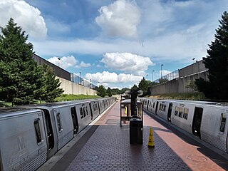
Friendship Heights station is a Washington Metro station on the Red Line straddling the border of Washington, D.C., and Montgomery County, Maryland, United States. The station was opened on August 25, 1984, and is operated by the Washington Metropolitan Area Transit Authority (WMATA).

Bethesda station is a rapid transit station on the Red Line of the Washington Metro system in Bethesda, Maryland. It is one of the busiest suburban Metro stations, serving on average 9,142 passengers each weekday in 2017. The Purple Line, a light rail system currently under construction, will terminate at Bethesda, providing rail service to other inner Maryland suburbs such as Silver Spring and College Park, each of which has additional north-south connections by Washington Metro, and New Carrollton, which has Amtrak and MARC connections to both Washington, D.C., and Baltimore.

McPherson Square station is a Washington Metro station in Downtown, Washington, D.C., United States. The side-platformed station is operated by the Washington Metropolitan Area Transit Authority (WMATA). Providing service for the Blue, Orange, and Silver Lines, the station is located between McPherson Square and Franklin Square, with two entrances on I Street at Vermont Avenue and 14th Street NW. This is the main station to access the White House, and the Vermont Avenue exit is directly underneath the Department of Veterans Affairs building.

Minnesota Avenue station is an island-platformed Washington Metro station in the Central Northeast/Mahaning Heights neighborhood of Northeast Washington, D.C., United States. The station was opened on November 20, 1978, and is operated by the Washington Metropolitan Area Transit Authority (WMATA).

U Street station is a rapid transit station on the Green Line of the Washington Metro in the U Street neighborhood of Washington, D.C.

Columbia Heights station is a Washington Metro station in Washington, D.C., on the Green Line. Due to successful redevelopment since the station's opening, Columbia Heights is one of the busiest Metro stops outside the downtown core, with over four million exits in 2010.

Georgia Avenue–Petworth station is a Washington Metro station in Washington, D.C., on the Green Line. It is located at the border of the neighborhoods of Petworth, Sixteenth Street Heights, and Park View in Northwest.

Waterfront station is a Washington Metro station in the Southwest Waterfront neighborhood of Washington, D.C., United States. The station was opened on December 28, 1991, and is operated by the Washington Metropolitan Area Transit Authority (WMATA). Waterfront is located in the Southwest Waterfront neighborhood at the intersection of 4th and M Streets SW.

Navy Yard–Ballpark station is a Washington Metro station in Washington, D.C., on the Green Line. The station is located in the Navy Yard/Near Southeast neighborhood of Southeast, with entrances on M Street at Half Street and New Jersey Avenue.

Southern Avenue station is an island platformed Washington Metro station in Prince George's County, Maryland, United States. The station was opened on January 13, 2001, and is operated by the Washington Metropolitan Area Transit Authority (WMATA). Providing service for only the Green Line, the station is located on the southern side of Southern Avenue, putting it just outside the District of Columbia, opposite Valley Terrace straddling the D.C/Maryland border. Southern Avenue is the first station in Maryland going southeast on the Green Line.
Branch Avenue station is an island-platformed Washington Metro station in Suitland, Maryland, United States. The station was opened on January 13, 2001, and is operated by the Washington Metropolitan Area Transit Authority (WMATA). The station presently serves as the southeastern terminus for the Green Line, with the Branch Avenue rail yard lying just beyond this station. The station is located near the intersection of Auth Road and Old Soper Road.

Friendship Heights is an urban commercial and residential neighborhood in northwest Washington, D.C., and southern Montgomery County, Maryland. Though its borders are not clearly defined, Friendship Heights consists roughly of the neighborhoods and commercial areas around Wisconsin Avenue north of Fessenden Street NW and Tenleytown to Somerset Terrace and Willard Avenue in Maryland, and from River Road in the west to Reno Road and 41st Street in the east. Within Maryland west of Wisconsin Avenue is the Village of Friendship Heights, technically a special taxation district.

The Pennsylvania Avenue Line, designated Routes 32 and 36, is a daily Metrobus route in Washington, D.C., Operating between the Southern Avenue station or Naylor Road station of the Green Line of the Washington Metro and Potomac Park. Until the 1960s, it was a streetcar line, opened in 1862 by the Washington and Georgetown Railroad as the first line in the city.

Mazza Gallerie was an upscale shopping mall which was demolished in 2023 and is currently being rebuilt as a mixed-use development It is located along Wisconsin Avenue in the Friendship Heights neighborhood of northwest Washington, D.C. at the Maryland border. Opened in 1977, it had 300,000 square feet (28,000 m2) of retail space on three levels, a parking garage, and a direct connection to the Friendship Heights station of the Washington Metro. The last retail business closed in December 2022. The building is to be converted to residential apartments with retail on the ground floor.

Willoughby Park is a city park in Friendship Heights, an incorporated area on the edge of Washington, D.C. Named after the adjacent Willoughby Condominium Building, it is at the intersection of Willard Ave and Friendship Boulevard. It is served by the Friendship Heights metro and bus station of the Washington Metro, which is located two blocks from the park.

The Friendship Heights–Southeast Line, designated as Routes 30N or 30S, were daily bus routes operated by the Washington Metropolitan Area Transit Authority between Friendship Heights station of the Red Line of the Washington Metro and Naylor Road station or Southern Avenue station of the Green Line of the Washington Metro. Both lines operated every 60 minutes at all times. Trips were roughly 90 minutes long. This line provided service from Friendship Heights, operating through most of NW and SE DC and ending in Southern Prince Georges County via a one bus ride. Extra services are provided by the 32, 34, and 36 in Southeast and 31 and 33 in Northwest. Service was eliminated on September 5, 2021 due to redundancy.

The Wisconsin Avenue Line, designated as Routes 31 or 33, is a daily bus route operated by the Washington Metropolitan Area Transit Authority. Its main purpose is to provide service to the upper Northwest side via Wisconsin Avenue NW.

The East Capitol Street–Cardozo Line, designated Route 96, is a daily bus route operated by the Washington Metropolitan Area Transit Authority between Tenleytown-AU station of the Red Line of the Washington Metro and Capitol Heights station of the Blue and Silver Lines of the Washington Metro. The line operates every 20–30 minutes at all times. Route 96 trips are roughly 80 minutes long.
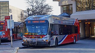
The Massachusetts Avenue Line, designated Route N2, N4, N6, is a daily bus route operated by the Washington Metropolitan Area Transit Authority between Friendship Heights station of the Red Line of the Washington Metro and Farragut Square in Downtown Washington DC. The line operates every 27 minutes during the weekdays and every 40 minutes on weekends. Trips take roughly 45 minutes to complete.