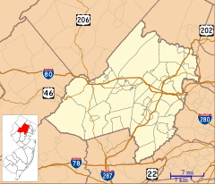
Superfund is a United States federal environmental remediation program established by the Comprehensive Environmental Response, Compensation, and Liability Act of 1980 (CERCLA). The program is administered by the Environmental Protection Agency (EPA). The program is designed to investigate and clean up sites contaminated with hazardous substances. Sites managed under this program are referred to as Superfund sites. Of all the sites selected for possible action under this program, 1178 remain on the National Priorities List (NPL) that makes them eligible for cleanup under the Superfund program. Sites on the NPL are considered the most highly contaminated and undergo longer-term remedial investigation and remedial action (cleanups). The state of New Jersey, the fifth smallest state in the U.S., is the location of about ten percent of the priority Superfund sites, a disproportionate amount.
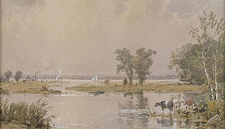
New Jersey Meadowlands, also known as the Hackensack Meadowlands after the primary river flowing through it, is a general name for a large ecosystem of wetlands in northeastern New Jersey in the United States, a few miles to the west of New York City. During the 20th century, much of the Meadowlands area was urbanized, and it became known for being the site of large landfills and decades of environmental abuse. A variety of projects began in the late 20th century to restore and conserve the remaining ecological resources in the Meadowlands.

The Kin-Buc Landfill is a 220-acre (0.89 km2) Superfund site located in Edison, New Jersey where 70 million US gallons (260,000 m3) of liquid toxic waste and 1 million tons of solid waste were dumped. It was active from the late 1940s to 1976. It was ordered closed in 1977. Cleanup operations have been underway to address environmental issues with contamination from 1980s through to 2000s. This site was one of the largest superfund sites in New Jersey having taken in around 90 million US gallons (340,000 m3). The site is heavily contaminated with PCBs, which leaked into Edmonds Creek, a tributary of the Raritan River.
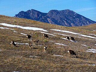
The Rocky Flats National Wildlife Refuge is 5,237-acre (21.19 km2) National Wildlife Refuge in the United States, located approximately 16 miles (26 km) northwest of Denver, Colorado. The refuge is situated west of the cities of Broomfield and Westminster and situated north of the city of Arvada.
In 1990, the Allied Paper, Inc./Portage Creek/Kalamazoo River in southwestern Michigan was declared by the Environmental Protection Agency (EPA) to be a Superfund site – in other words, an abandoned industrial site containing significant amounts of toxic waste. The EPA and companies responsible for the waste in this area, which includes a three-mile section of Portage Creek as well as part of the Kalamazoo River, into which it flows, are currently involved in an effort to reduce the amount of toxic waste at the site, which is contaminated by PCBs from paper mills and other factories.
The Killing Ground is a 1979 American documentary film written by Brit Hume. It was nominated for an Academy Award for Best Documentary Feature.
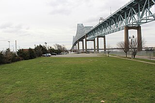
Wade Dump was a rubber recycling facility and illegal industrial waste storage and disposal facility in Chester, Pennsylvania. It was located at 1 Flower Street on the western bank of the Delaware River just north of the Commodore Barry Bridge.
Imperial Oil is a current Superfund site located off Orchard Place near Route 79 in Morganville, Marlboro Township, Monmouth County, New Jersey. This site is one of 114 Superfund sites in New Jersey. It is in the U.S. Environmental Protection Agency (EPA) Region 2 Superfund area of control and organization. The 15-acre (61,000 m2) Imperial Oil Co./Champion Chemicals site consisted of six production, storage, and maintenance buildings and 56 above-ground storage tanks.
T.H. Agriculture & Nutrition Company (THAN) was a California chemical company. It operated a pesticide-formulating facility from 1962 until 1981, and is now a Superfund site. Other companies formulated pesticides on the site from 1950 to 1962. During the 1950s and 1960s, on-site landfills were used for disposal of wastes generated from site operations, including pesticides from cleaning equipment. Waste was spilled on the surface of the site and left in piles on the ground. Sampling at the site conducted by the California Department of Health Services (CDHS) detected pesticides in soil and groundwater. The site was listed on the Superfund National Priorities List in 1986.
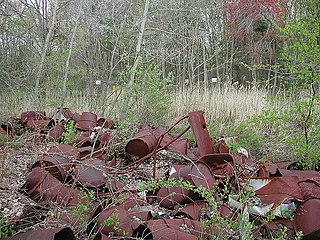
Shpack Landfill is a hazardous waste site in Norton, Massachusetts. After assessment by the United States Environmental Protection Agency (EPA) it was added to the National Priorities List in October 1986 for long-term remedial action. The site cleanup is directed by the federal Superfund program. The Superfund site covers 9.4 acres, mostly within Norton, with 3.4 acres in the adjoining city of Attleboro. The Norton site was operated as a landfill dump accepting domestic and industrial wastes, including low-level radioactive waste, between 1946 and 1965. The source of most of the radioactive waste, consisting of uranium and radium, was Metals and Controls Inc. which made enriched uranium fuel elements for the U.S. Navy under contract with the U.S. Atomic Energy Commission. Metals and Controls merged with Texas Instruments in 1959. The Shpack landfill operation was shut down by a court order in 1965.
The Dewey Loeffel Landfill is an EPA superfund site located in Rensselaer County, New York. In the 1950s and 1960s, several companies including General Electric, Bendix Corporation and Schenectady Chemicals used the site as a disposal facility for more than 46,000 tons of industrial hazardous wastes, including solvents, waste oils, polychlorinated biphenyls (PCBs), scrap materials, sludges and solids. Some hazardous substances, including volatile organic compounds (VOCs) and PCBs, have migrated from the facility to underlying aquifers and downstream surface water bodies, resulting in contamination of groundwater, surface water, sediments and several species of fish. There is currently a ban on fish consumption in Nassau Lake and the impacted tributaries. Following prior assessments and attempts at mitigating drainage from the site, the Environmental Protection Agency (EPA) has placed the site on its National Priority List. As of 2024, the EPA reports ongoing site investigations.
The Federal Creosote Superfund site is a 50-acre (20 ha) property located in Manville, New Jersey. It was used as a wood treatment facility. Starting in 1919, the site was contaminated with creosote. Creosotes are a category of carbonaceous chemicals formed by the distillation of various tars and by pyrolysis of plant-derived material, such as wood or fossil fuel. They are typically used as preservatives or antiseptics. It took the EPA about 18 years to cleanup the site.
The Diamond Head Oil Refinery is a former oil reprocessing facility located in Kearny, New Jersey, United States, that was designated as a Superfund site by the Environmental Protection Agency (EPA). It opened up in 1946, but then stopped production in 1979 and has been inactive since then. The refinery was shut down in 1980 and the EPA designated it as a Superfund site in 1991 due to the discovery of toxic chemicals in the soil and the surface water. This created a dangerous work environment for the workers at the facility. The EPA proposed a clean up plan for the site, but it has yet to take effect. So far, the Diamond Head site is still in the process of being cleaned up. Although cleanup plans were discussed and finalized, the future of the Diamond Head Oil Refinery and its cleanup state is unknown.
Bog Creek Farm, located in Howell Township, New Jersey, is a designated Environmental Protection Agency (EPA) Superfund site. Lying on 12 acres of land, Bog Creek Farm is home to several hazardous and life-threatening contamination beginning in 1973 and continuing for a year. Over a decade later, actions began to take place to clean and restore the contaminated soil and water. Bog Creek Farm is situated near several other farms that house horses, growing crops and flowers, and livestock. Less than a mile down the road lies Allaire State Park, a park used by golfers, hunters, and fisherman.

The Raritan Bay Slag Superfund Site consists of a seawall along the coast of the Raritan Bay in the Laurence Harbor section of Old Bridge Township, New Jersey, United States. The seawall itself is made of slag. In this seawall, are large concentrations of lead, antimony, arsenic, and copper. The lead in particular has contaminated the nearby soil and surface water. The slag deposits are a by-product from NL Industries, a lead smelting company, dumping its wastes in the Raritan River. The New Jersey Department of Environmental Protection (NJDEP) investigated the area and found large concentrations of metals to be dangerous to human health. The NJDEP called the United States Environmental Protection Agency (EPA) to investigate the area further, which resulted in some of the slag being physically removed and the toxic areas being fenced off.
Barrels, Inc. is a Superfund site located in Lansing, Michigan. The site's surface soils and groundwater have been contaminated from a storage tank and drum reclamation processes. Today the area is fenced in while cleanup options are being discussed in order to limit direct contact with the potential risks. In 1961, Barrels Inc. began working on the site, and continued until the owner abandoned the site in 1980.
The G&H Industrial Landfill is a Superfund site located in Shelby Charter Township near Utica, Michigan, United States. The 60-acre (24-hectare) landfill, with about 10 to 20 acres of adjacent property, operated as a waste oil recovery facility from 1955 to 1967. From 1955 to 1974 the site was used as an industrial and municipal landfill. Contaminated soil, surface water, and groundwater with hazardous chemicals have been left behind as a result of the disposal of waste solvents, waste oil and paint sludge. Operation and maintenance activities are ongoing following the cleanup.
The Laboratory for Energy-Related Health Research Superfund Site encompasses a 15-acre area that includes a former research facility for low-level radioactive studies and several landfills for campus waste of University of California, Davis (UCD). Currently, the site is undergoing cleanup processes by the Comprehensive Environmental Response, Compensation, and Liability Act of 1980. Site cleanup was jointly operated by the Department of Energy (USDOE) and the University of California, Davis (UCD), under an agreement negotiated among the Environmental Protection Agency (EPA), the California Department of Toxic Substances Control, and the University of California.
