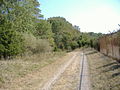
Transport in Saint Christopher and Nevis includes normal road traffic, public buses, taxis, ferries, airports, and one railway.

Coney Island is a neighborhood and entertainment area in the southwestern section of the New York City borough of Brooklyn. The neighborhood is bounded by Brighton Beach to its east, Lower New York Bay to the south and west, and Gravesend to the north and includes the subsection of Sea Gate on its west. More broadly, the Coney Island peninsula consists of Coney Island proper, Brighton Beach, and Manhattan Beach. This was formerly the westernmost of the Outer Barrier islands on the southern shore of Long Island, but in the early 20th century it became connected to the rest of Long Island by land fill.

Charlestown is the oldest neighborhood in Boston, Massachusetts, in the United States. Also called Mishawum by the Massachusett, it is located on a peninsula north of the Charles River, across from downtown Boston, and also adjoins the Mystic River and Boston Harbor waterways. Charlestown was laid out in 1629 by engineer Thomas Graves, one of its earliest settlers, during the reign of Charles I of England. It was originally a separate town and the first capital of the Massachusetts Bay Colony.

Multnomah Falls is a waterfall located on Multnomah Creek in the Columbia River Gorge, east of Troutdale, between Corbett and Dodson, Oregon, United States. The waterfall is accessible from the Historic Columbia River Highway and Interstate 84. Spanning two tiers on basalt cliffs, it is the tallest waterfall in the state of Oregon at 620 ft (189 m) in height. The Multnomah Creek Bridge, built in 1914, crosses below the falls, and is listed on the National Register of Historic Places.

The Jersey Shore, commonly referred to locally as simply the Shore, is the coastal region of the U.S. state of New Jersey. Geographically, the term encompasses about 141 miles (227 km) of oceanfront bordering the Atlantic Ocean, from Perth Amboy in the north to Cape May Point in the south. The region includes Middlesex, Monmouth, Ocean, Atlantic, and Cape May counties, which are in the central and southern parts of the state. Located in the center of the Northeast Megalopolis, the northern half of the shore region is part of the New York metropolitan area, while the southern half of the shore region is part of the Philadelphia metropolitan area, also known as the Delaware Valley. The Jersey Shore hosts the highest concentration of oceanside boardwalks in the United States.

McCormick's Creek State Park is the oldest state park in the U.S. state of Indiana, dedicated on July 4, 1916, as part of the state's centennial celebration. It is located 14 miles (23 km) west of Bloomington in Owen County. The park receives about 640,000 visitors annually.

Spuyten Duyvil Creek is a short tidal estuary in New York City connecting the Hudson River to the Harlem River Ship Canal and then on to the Harlem River. The confluence of the three water bodies separate the island of Manhattan from the Bronx and the rest of the mainland. Once a distinct, turbulent waterway between the Hudson and Harlem rivers, the creek has been subsumed by the modern ship canal.

Rockaway Beach is a neighborhood on the Rockaway Peninsula in the New York City borough of Queens. The neighborhood is bounded by Arverne to the east and Rockaway Park to the west. It is named for the Rockaway Beach and Boardwalk, which is the largest urban beach in the United States, stretching from Beach 3rd to Beach 153rd Streets on the Atlantic Ocean. The neighborhood, with 13,000 residents as of 2010, is also known as the "Irish Riviera" because of its large Irish American population.

Kent Island is the largest island in the Chesapeake Bay and a historic place in Maryland. To the east, a narrow channel known as the Kent Narrows barely separates the island from the Delmarva Peninsula, and on the other side, the island is separated from Sandy Point, an area near Annapolis, by roughly four miles (6.4 km) of water. At only four miles wide, the main waterway of the bay is at its narrowest at this point and is spanned here by the Chesapeake Bay Bridge. The Chester River runs to the north of the island and empties into the Chesapeake Bay at Kent Island's Love Point. To the south of the island lies Eastern Bay. The United States Census Bureau reports that the island has 31.62 square miles (81.90 km2) of land area.

Belle of Louisville is a steamboat owned and operated by the city of Louisville, Kentucky, and moored at its downtown wharf next to the Riverfront Plaza/Belvedere during its annual operational period. The steamboat claims itself the "most widely traveled river steamboat in American history." Belle of Louisville's offices are aboard Mayor Andrew Broaddus, and also appears on the list of National Historic Landmarks.

Charlestown State Park is an Indiana state park on 5,100 acres (20.64 km2) in Clark County, Indiana, in the United States. The park is on the banks of the Ohio River, 1 mile (2 km) east of Charlestown. It was once part of the Indiana Army Ammunition Plant (INAAP), and was donated in separate parcels to the Indiana state government. In 1993, the state of Indiana was given 859 acres (3.48 km2), and in 1994 was given an additional 1,125 acres (4.55 km2). When the park opened in 1996, it encompassed 2,400 acres (9.7 km2). With an additional 2,600 acres (10.5 km2) given by the INAAP in 2004, the park has 5,100 acres (20.6 km2), making it the third largest state park in Indiana. The park attracts nearly 200,000 visitors annually.

Shades State Park is a state park in Montgomery, Parke, and Fountain Counties in Indiana. It is located 47 miles (76 km) west-northwest of Indianapolis, Indiana. In 2018–2019, Shades received nearly 87,000 visitors.

Downtown Vancouver is the central business district and the city centre neighbourhood of Vancouver, Canada, on the northwestern shore of the Burrard Peninsula in the Lower Mainland region of British Columbia. It occupies most of the north shore of the False Creek inlet, which cuts into the Burrard Peninsula creating the Downtown Peninsula, where the West End neighbourhood and Stanley Park are also located.
Fontaine Ferry Park was an amusement park in Louisville, Kentucky that operated from 1905 to 1969. Located on 64 acres (26 ha) in western Louisville at the Ohio River, it offered over 50 rides and attractions, as well as a swimming pool, skating rink and theatre. The most popular attraction were its wooden roller coasters, of which 4 were built over the years.

Devil's Backbone is a rock formation and peninsula formed by the flow of Fourteen Mile Creek into the Ohio River, and is currently situated in Charlestown State Park near Charlestown, Indiana and across the Ohio River from Louisville, Kentucky. According to local legend, on this bedrock ridge once stood a stone fortress that was built by Welsh explorers led by Prince Madoc sometime in the 12th century.

John Work House and Mill Site is a site listed on the National Register of Historic Places in Indiana just outside Charlestown, owned by the Lincoln Heritage Council, (BSA), as part of the Tunnel Mill Scout Reservation. For a century, it was an active gristmill until technology made it obsolete, and arson destroyed much of it. Prominent features around the site are Fourteen Mile Creek and the Devil's Backbone. The land is now used by the Boy Scouts of America for camping activities such as National Youth Leadership Training and a Webelos Camp. In 2010, part of the Tunnel Mill camp was leased to a private company for the purpose of restoring the Historic John Work House for use as a living history center. In order to prevent vandalism and amateur ghost hunters from further damaging the building, security guards patrol the property each night.

Fourteen Mile Creek, shown as Fourteenmile Creek on federal maps, is a 22.7-mile-long (36.5 km) creek in Clark County, Indiana, close to Charlestown. It is so named because its mouth on the Ohio River is 14 miles (23 km) upstream from the Falls of the Ohio; similar to how Eighteen Mile Island, Twelve Mile Island, and Six Mile Island got their names. It is navigable for 2.9 miles (4.7 km) from the Ohio River. It is a State Heritage Program Site and a popular canoe trail.

The Rivergreenway is the backbone of burgeoning Fort Wayne Trails network in Fort Wayne, Indiana and the surrounding area. The Rivergreenway consists of 26-miles of connected trails through a linear park following alongside or near the City's three rivers: St. Joseph River, St. Marys River, and Maumee River. In 2009, the Rivergreenway was designated as a National Recreation Trail. The trail network also connects to the Wabash & Erie Canal Towpath Trail. Including other trails, like the scenic Pufferbelly Trail which spans Fort Wayne's north side and will eventually connect downtown Fort Wayne to the northern edge of Allen County and beyond, the City of Fort Wayne has over 101 miles of trails. 140 miles exist within Allen County.