
The Gulf of St. Lawrence is the outlet of the North American Great Lakes via the St. Lawrence River into the Atlantic Ocean. The gulf is a semi-enclosed sea, covering an area of about 226,000 square kilometres (87,000 sq mi) and containing about 34,500 cubic kilometres (8,300 cu mi) of water, which results in an average depth of 152 metres (499 ft).

Stratford is a town located in Queens County, Prince Edward Island.
Knutsford is an unincorporated rural community in Prince County, Prince Edward Island.
Foxley River is a Canadian rural community in Prince County, Prince Edward Island.
St. Felix is a municipality that holds community status in Prince Edward Island, Canada. It is located in Prince County, 4 km (2.5 mi) south of Tignish.
Alberton is a Canadian town located in Prince County, Prince Edward Island. It is situated in the western part of the county in the township of Lot 5. The population was 1,145 as of the 2016 census.

Prince County is located in western Prince Edward Island, Canada. The county's defining geographic feature is Malpeque Bay, a sub-basin of the Gulf of St. Lawrence, which creates the narrowest portion of Prince Edward Island's landmass, an isthmus upon which the city of Summerside is located.
Palmer Road is a small community located in Lot 1, in Prince County, Prince Edward Island, Canada that is located on Route 155, Route 156 and Route 158. There are approximately 100 citizens in Palmer Road, and it is located between Tignish and St. Louis, Prince Edward Island. It is also home to the Immaculate Conception Church, and the nearby Palmer Road Community Center. Palmer Road is located 2 mi (3.2 km) northwest of St. Louis, and 6 mi (9.7 km) southwest of Tignish.
Murray Harbour is a community that holds rural municipality status in Prince Edward Island, Canada. It is located in southeastern Kings County.
Miminegash is a municipality that holds community status in Prince Edward Island, Canada. It is located 8 miles (13 km) northwest of Alberton and 11 miles (18 km) southwest of Tignish. It is part of a small area in Lot 3 known as either the St. Louis, Palmer Road, or Miminegash area. This area is often associated with Tignish due to the shared Acadian roots between these areas.
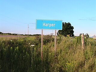
Harper is a Canadian rural community located in western Prince County, Prince Edward Island.
Leoville is a Canadian rural community located on Route 158, 3.50–5.00 miles SW of Tignish in western Prince County, Prince Edward Island.
Ascension Road, labelled Route 160, is a 2-lane collector highway in western Prince County, Prince Edward Island, Canada. It is located 2 miles (3.2 km) NW of the community of Tignish. Its maximum speed limit is 80 kilometres per hour (50 mph).
Peter Road, or Peterville Road, labelled Route 159, is a 2-lane collector highway in western Prince County, Prince Edward Island, Canada. It is near the community of Tignish. Its maximum speed limit is 80 km/h (50 mph).

Palmer Road, labelled Route 156, is a 2-lane collector highway in western Prince County, Prince Edward Island, Canada. It is between the communities of Tignish and Miminegash. Its maximum speed limit is 80 km/h (50 mph). The road is considered part of two larger communities, Tignish and Miminegash.
Wellington is a municipality that holds community status in Prince Edward Island, Canada. It is located in Prince County, and extends as Wellington Centre onto Route 2 from Richmond through to St. Nicholas.
Abram-Village is a Canadian rural municipality located in Prince County, Prince Edward Island.
Afton is Canadian rural municipality located in Queens County, Prince Edward Island.
Mont Carmel is a Canadian unincorporated area in Prince County, Prince Edward Island. The community is located in the "Evangeline Region" which is a cluster of Acadian communities in the central part of Prince County. The village is home to the Notre-dame-du-Mont-Carmel, a massive 450000-brick Catholic church built in 1898.
Collège de l'Île is a Francophone post-secondary community college in the Canadian province of Prince Edward Island with headquarters in the community of Wellington. It was originally a campus of Collège de l'Acadie which served Nova Scotia and Prince Edward Island. When the Nova Scotia operations became part of Université Sainte-Anne, its operations in Prince Edward Island were renamed Collège Acadie Î.-P.-É and subsequently Collège de l'Île.
