The Rotary River Ride is a non-competitive bicycle ride held next to the Yarra River in Melbourne, Victoria, Australia. Money raised helps finance the efforts of the Rotary in Australia.
The event consists of three options, which primarily follow the Yarra River Trail: [1] [2] [3] [4]

The Moonee Ponds Creek Trail is a shared use path for cyclists and pedestrians, which follows the Moonee Ponds Creek through the northern suburbs of Melbourne, Victoria, Australia.

The Capital City Trail is a shared use path in Melbourne, Victoria, Australia, which circles the city centre and some inner eastern and northern suburbs. It is 29km in length, and mostly consists of sections of other trails, such as the Merri Creek Trail, Main Yarra Trail, Moonee Ponds Creek Trail and Inner Circle Rail Trail.

The Diamond Creek Trail is a shared use path for cyclists and pedestrians, which follows Diamond Creek through the north eastern outer suburbs of Melbourne, Victoria, Australia.

The Merri Creek Trail is a shared use path for cyclists and pedestrians that follows the Merri Creek through the northern suburbs of Melbourne, Victoria, Australia.

Victoria Street is one of the major thoroughfares of inner Melbourne, running east–west for over six kilometres between Munster Terrace in North Melbourne and the Yarra River. The road is known as Victoria Parade for over one-and-a-half kilometres of its length, distinguishable with a wide reservation and tramway down the middle.

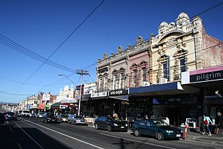
Bridge Road is a major shopping strip in Melbourne, Australia. It is best known for its abundance of restaurants, cafes and shopping, which makes it a popular tourist attraction. The Richmond Town Hall and Epworth Hospital are amongst the landmarks of Bridge Road.

Around the Bay in a Day is a non-competitive fully supported recreational cycling fundraising event organised by Bicycle Network in Victoria, Australia. Cyclists register to ride a course which is 210 km (130 mi) either clockwise or anti-clockwise around Port Phillip Bay, starting and ending in Melbourne, though other distances, both shorter and longer, are available.

The Federation Trail is a 23-kilometre-long (14 mi) shared use path for cyclists and pedestrians, which mainly follows the heritage-listed Main Outfall Sewer through the western suburbs of Melbourne, Victoria, Australia. There are three bridges spanning across major arterial roads, as well as button-activated traffic light crossings at most other major road-trail intersections.

The Chandler Highway is a short road in the inner eastern suburbs of Melbourne. It runs from Heidelberg Road in Alphington, crosses the Yarra River, then continues across the Eastern Freeway, then terminates at an intersection with Princess Street and Earl Street. Its total length is less than 2 kilometres, leading to the claim that it is "the shortest highway in the world". It was named after a prominent local businessman and politician A. E. Chandler, who was instrumental in pushing through the development of the Outer Circle railway.

The Plenty River is a perennial river of the Port Phillip catchment, located in the north-eastern Greater Melbourne region of the Australian state of Victoria.

The Hobsons Bay Coastal Trail is a shared use path for cyclists and pedestrians, which follows the coast line of Hobsons Bay in the inner western suburbs in Melbourne, Victoria, Australia. The trail forms part of the western half of the Bayside Trail which encircles Port Phillip. It runs from the west side of the Westgate bridge, south and along the coast, finishing at the Skeleton Creek Trail in Sanctuary Lakes.
The River Gum Walk Trail is a shared use path for cyclists and pedestrians in the suburb of Rosanna, an inner northern suburb of Melbourne, Victoria, Australia.
The Ruffey Creek Trail is a shared use path for cyclists and pedestrians, which follows Ruffey Creek in the inner eastern suburbs of Templestowe and Doncaster in Melbourne, Victoria, Australia.

The Sandridge Trail is a shared-use path for cyclists and pedestrians located in the inner southern suburb of Port Melbourne in Melbourne, Victoria, Australia.
Eastern Highway is a 1.2 kilometre highway in inner northern Melbourne, Australia, that ultimately acts as a feeder road into the Eastern Freeway. This name however is not widely known to most drivers, as the allocation is still best known by the name of its sole constituent part: Alexandra Parade.

The Yarra Trail is a shared use path for cyclists and pedestrians, which follows the Yarra River through the north eastern suburbs of Melbourne, Victoria, Australia.

Bike paths around Melbourne have been developed over many decades. Many off-road trails follow current or former watercourses, such as the Darebin Creek Trail and the Koonung Creek Trail and traverse long distances, meaning that responsibility for planning and maintenance is split between various State Government authorities and local councils. With the increased recognition from all levels of government of the benefit of cycling activities, Melbourne today has a network of shared bicycle trails which have developed over time along its river and creek systems and alongside freeways and railways.

The O'Shannassy River is a perennial river of the Port Phillip catchment, located in the north-eastern Greater Metropolitan Melbourne region of the Australian state of Victoria.

The Little Yarra River is a perennial river of the Port Phillip catchment, located in the Greater Metropolitan Melbourne region of the Australian state of Victoria.
The Watts River is a perennial river of the Port Phillip and Western Port catchment, located in the Healesville area, in the Central region of the Australian state of Victoria.