Fenwick Island is a coastal town in Sussex County, Delaware, USA. According to 2010 census figures, the population of the town is 379, a 10.8% increase over the last decade. It is part of the Salisbury, Maryland-Delaware Metropolitan Statistical Area. The town is located on Fenwick Island, a barrier spit.

The Maryland Transit Administration (MTA) is a state-operated mass transit administration in Maryland, and is part of the Maryland Department of Transportation. It is better known as MTA Maryland to avoid confusion with other cities' transit agencies who share the initials MTA. The MTA operates a comprehensive transit system throughout the Baltimore-Washington Metropolitan Area. There are 80 bus lines serving Baltimore's public transportation needs, along with other services that include the Light Rail, Metro Subway, and MARC Train. With nearly half the population of Baltimore residents lacking access to a car, the MTA is an important part of the regional transit picture. The system has many connections to other transit agencies of Central Maryland, Washington, D.C., Northern Virginia, and south-central Pennsylvania : WMATA, Charm City Circulator, Regional Transportation Agency of Central Maryland, Annapolis Transit, Rabbit Transit, Ride-On, and TransIT.

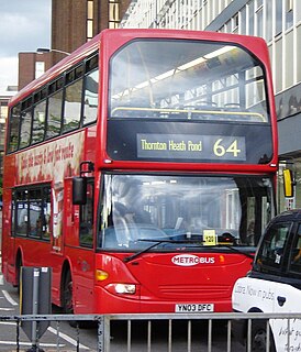
U.S. Route 64 is an east–west United States highway that runs for 2,326 miles (3,743 km) from Nags Head in eastern North Carolina to just southwest of the Four Corners in northeast Arizona. The western terminus is at U.S. Route 160 in Teec Nos Pos, Arizona. The highway's eastern terminus is at NC 12 and U.S. Route 158 at Whalebone Junction, North Carolina.

Maryland Route 5 is a 74.34-mile (119.64 km) long state highway that runs north–south in the U.S. state of Maryland. The highway runs from Point Lookout in St. Mary's County north to the Washington, D.C. border in Suitland, Prince George's County. MD 5 begins as the two-lane undivided Point Lookout Road which runs from Point Lookout, St. Mary's County, to an intersection with MD 235 in the northern part of the county. Point Lookout Road passes through rural areas as well as the county seat of Leonardtown. After the MD 235 intersection, the route becomes the four-lane divided Three Notch Road and continues into Charles County, where it becomes Leonardtown Road. Here, the route bypasses Hughesville and continues north toward the Waldorf area, which it bypasses to the east on Mattawoman Beantown Road. The route merges onto U.S. Route 301 and enters Prince George's County, splitting from US 301 at an interchange in Brandywine. From here, MD 5 continues north on Branch Avenue, running through suburban areas, before becoming a freeway as it passes Andrews Air Force Base and interchanges with Interstate 95 (I-95)/I-495. Past the Capital Beltway, the route runs through suburban areas of Hillcrest Heights and Suitland before reaching the D.C. border, where Branch Avenue continues, crossing Pennsylvania Avenue and eventually terminating at Randle Circle.

U.S. Route 13 is a U.S. Highway running from Fayetteville, North Carolina north to Morrisville, Pennsylvania. In the U.S. state of Maryland, the route runs 42.48 mi (68.36 km) from the Virginia border south of Pocomoke City in Worcester County north to the Delaware border in Delmar, Wicomico County, where the route intersects Route 54, which runs along the state line. The majority of the route within Maryland is a four-lane divided highway that passes through rural areas of woodland and farmland. The route also runs through a few municipalities including Pocomoke City and Princess Anne and it bypasses Salisbury and Fruitland to the east on the Salisbury Bypass, which is a freeway. US 13 intersects many major roads including the southern terminus of US 113 in Pocomoke City, Maryland Route 413 in Westover, and MD 12 and US 50 where the route is on the Salisbury Bypass. The route shares a concurrency with US 50 along a portion of the Salisbury Bypass.
LocalLink 95 is a bus route operated by the Maryland Transit Administration in Baltimore. The line currently runs from the intersection of Roland Avenue and Lake Avenue in Roland Park south to the Inner Harbor via Roland Avenue, University Parkway, Charles Street and St. Paul Street.
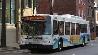
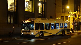
Route 27 is a bus route operated by the Maryland Transit Administration in Baltimore. The line currently runs from the Reisterstown Plaza Metro Subway Station in northwest Baltimore to Port Covington in South Baltimore through downtown. The line also serves the communities of Pimlico, Mt. Washington, Cross Keys, Hampden, and Cherry Hill, and the Greyhound bus terminal. The bus route is the successor to the 10 Roland Park, 12 Westport, and 25 Mount Washington streetcar lines.

The Maryland Transit Administration provides the primary public bus service for the Baltimore Metropolitan Area and commuter bus service in other parts of the state of Maryland. There are currently 76 bus routes, which include 43 LocalLink routes, 12 High Frequency CityLink Routes routes, 9 express bus routes, 19 commuter bus routes, and 5 Intercounty Connector or "ICC" routes. The local and commuter bus routes operate in conjunction with one subway line, three light rail lines, MARC train service, and various connections to other transit agencies.

Dorchester is a neighborhood in the Northwest District of Baltimore. It is located between the neighborhoods of Arlington (north), Central Forest Park (south), Howard Park (west) and Gallway-Garrison (east). Maryland Route 26 draws boundary between Dorchester and Central Forest Park. Dorchester's other boundaries are marked by Oakford Avenue, Eldorado Avenue and Garrison Boulevard.
Baltimore Highlands is a neighborhood in the Southeast District of Baltimore, located between the neighborhoods of Patterson Park and Kresson. Its boundaries are drawn by Pulaski Highway (north), East Baltimore Street (south), Haven Street (east) and North Clinton Street (west).
Greenspring is a neighborhood in the North District of Baltimore, located between the neighborhoods of Woodberry (east) and Central Park Heights (west). Its boundaries are marked by West Cold Spring Lane (north), Greenspring Avenue (east), and Springhill Avenue (south). The western edge of the neighborhood runs along Pimlico Road from West Cold Spring Lane to Park Heights Avenue, then along Park Heights Avenue to Springhill Avenue.

Beverly Hills is a neighborhood in the Northeast District of Baltimore, located between the neighborhoods of Moravia-Walther, Arcadia and Lauraville. Its boundaries are drawn by Harford Road (west), Weaver Avenue (south), Harcourt Road (east), Moravia Road (northeast) and Grindon Avenue (north).
Westgate is a neighborhood in the Southwest District of Baltimore, located between Baltimore County (west) and the city neighborhood of Ten Hills (east). Its boundaries are marked by Baltimore National Pike (north), Frederick Avenue (south), Rock Glen Avenue and Edmondson Avenue (east) and the city line (west).
Mount Holly is a neighborhood in the Southwest District of Baltimore, located between the neighborhoods of Fairmont (south), Walbrook (east) and Garwyn Oaks (north). Its boundaries are drawn by Denison Street (east), Clifton Avenue (southwest), Gwynns Falls Parkway (north), Windsor Mill Road (northwest), and West North Avenue (south). Gwynns Falls Leakin Park is located to the west of Mount Holly.
Better Waverly is a neighborhood in the North District of Baltimore, located between the neighborhoods of Charles Village (west) and Coldstream-Homestead-Montebello (east). Its boundaries are marked by East 33rd Street (north), Exeter Hall Avenue (south), Greenmount Avenue (west) and Loch Raven Road (east).
Martz Group is an apportioned bus company headquartered in Wilkes-Barre, Pennsylvania, operating intercity commuter buses, charter buses, and tours. The company operates Martz Trailways, which is a part of the Trailways Transportation System. Martz Trailways provides intercity commuter bus service from the Wyoming Valley cities of Wilkes-Barre and Scranton and the Pocono Mountains in Northeastern Pennsylvania to New York City and Philadelphia. The company also runs buses connecting Northeastern Pennsylvania to the casinos in Atlantic City, New Jersey and Sands Casino Resort Bethlehem. Martz Group also operates the Gold Line commuter service and Gray Line sightseeing service in Washington, D.C., the National Coach Works in Fredericksburg, Virginia, and the First Class Coach Company Trailways serving Tampa and St. Petersburg in Florida.