Route 82 could refer to:
| This disambiguation page lists articles associated with the title Route 82. If an internal link led you here, you may wish to change the link to point directly to the intended article. |
Route 82 could refer to:
| This disambiguation page lists articles associated with the title Route 82. If an internal link led you here, you may wish to change the link to point directly to the intended article. |
Interstate 82 (I-82) is an Interstate Highway in the Pacific Northwest region of the United States that travels through parts of Washington and Oregon. It runs 144 miles (232 km) from Ellensburg, Washington, to Hermiston, Oregon, passing through Yakima and the Tri-Cities. The highway also connects I-90 and I-84, which continue to Seattle and Boise, Idaho, respectively.

U.S. Route 395 is a U.S. Route in the western United States. The southern terminus of the route is in the Mojave Desert at Interstate 15 near Hesperia. The northern terminus is at the Canada–US border near Laurier, where the road becomes Highway 395 upon entering British Columbia, Canada. Before 1964, the route extended south to San Diego. I-15, I-215, and California State Route 163 replaced the stretch of 395 that ran from San Diego to Hesperia through Riverside and San Bernardino. "Old Highway 395" can be seen along or near I-15 in many locations before it branches off at Hesperia to head north.
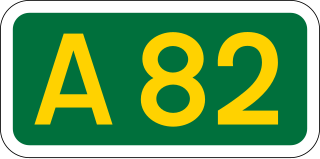
The A82 is a major road in Scotland that runs from Glasgow to Inverness via Fort William. It is mostly a trunk road managed by Transport Scotland, who view it as an important link from the Central Belt to the Scottish Highlands and beyond. The road passes close to numerous landmarks in the Highlands, including Loch Lomond, Rannoch Moor, Glen Coe, the Ballachulish Bridge, Ben Nevis, the Commando Memorial, Loch Ness and Urquhart Castle.

U.S. Route 82 is an east–west United States highway in the Southern United States. Created on July 1, 1931 across central Mississippi and southern Arkansas, US 82 eventually became a 1,625-mile (2,615 km) route extending from the White Sands of New Mexico to Georgia's Atlantic coast.

Mangazeya was a Northwest Siberian trans-Ural trade colony and later city in the 17th century. Founded in 1600 by Cossacks from Tobolsk, it was situated on the Taz River, between the lower courses of the Ob and Yenisei Rivers flowing into the Arctic Ocean. The name derives from a Nenets ethnonym Monkansi or Mongandi.

State Route 82 is a state highway in the U.S. state of California that runs from Interstate 880 (I-880) in San Jose to I-280 in San Francisco following the San Francisco Peninsula. It is the spinal arterial road of the peninsula and runs parallel to the nearby Caltrain line along much of the route. For much of its length, the highway is named El Camino Real and formed part of the historic El Camino Real mission trail. It passes through and near the historic downtowns of many Peninsula cities, including Burlingame, San Mateo, Redwood City, Menlo Park, Palo Alto, Mountain View, and Sunnyvale, and through some of the most walkable and transit-oriented neighborhoods in the region.
Melbourne tram route 82 is operated by Yarra Trams on the Melbourne tram network. It operates from Moonee Ponds Junction to Footscray railway station. It is one of only two tram routes which does not travel through the Melbourne CBD, the other being route 78. Part of its route is the last surviving segment of the Footscray tram network. It commenced operating on 2 May 1954.

The N82 road is a national secondary road in Ireland, and is located entirely in Dublin. The route was designated along the Citywest Road, which runs through the Citywest Business Campus between the N81 west of Tallaght and the Citywest Interchange of the N7.

State Route 82 is a state route in northeastern Ohio, with a western terminus at State Route 57 in Lorain County, southeast of Elyria.

New York State Route 82 (NY 82) is a state highway in the eastern Hudson Valley of New York in the United States. It begins at an intersection with NY 52 northeast of the village of Fishkill, bends eastward towards Millbrook, and then returns westward to end at a junction with U.S. Route 9, NY 9H, and NY 23 at Bell Pond, near Claverack. NY 82 meets the Taconic State Parkway twice; it is the only state highway that has more than one exit with the parkway. The road spans two counties: Dutchess and Columbia.
The Battle of the Iron Triangle took place from 16 May to 20 November 1974, when the People's Army of Vietnam (PAVN) 9th Division captured Rach Bap and An Dien. The Army of the Republic of Vietnam (ARVN) regained the lost towns in a series of costly counterattacks.

The B82 bus route constitutes a public transit line in central Brooklyn, New York City, United States. It connects Starrett City in southeast Brooklyn with Coney Island on Brooklyn's southwestern coast. The B82 operates primarily via Kings Highway and Flatlands Avenue in southern Brooklyn. The route is operated by MTA Regional Bus Operations, under the New York City Bus and Select Bus Service brands.
Federal Route 82, or Jalan Paluh Hinai-Pekan and Jalan Batu Balik, is a federal road in Pahang, Malaysia. The roads connects Paluh Hinai in the west to Pekan in the east.

Delaware Route 82 (DE 82) is a state highway in the northwest suburbs of Wilmington in New Castle County, Delaware. The route runs 5.51 miles (8.87 km) from DE 52 near Greenville to the Pennsylvania border near Yorklyn, where it continues as Pennsylvania Route 82 (PA 82). The route runs through areas of woods and fields in northern New Castle County, with much of the route paralleling the Red Clay Creek. The entire route is a part of the Red Clay Scenic Byway, created in 2005. DE 82 was first numbered by 1952 on its current alignment. In 2010, the Delaware Department of Transportation (DelDOT) proposed eliminating the route number, but the plan fell through due to public opposition.

In the U.S. state of Texas, U.S. Route 82 (US 82) is a U.S. Highway that begins on the New Mexico border and heads east through West Texas and Lubbock to the Arkansas border at Texarkana.

National Route 36 is a national highway connecting Sapporo and Muroran in Hokkaidō, Japan.
Errant Glacier is a glacier, 15 nautical miles (28 km) long, which lies on the east side of the Holyoake Range and drains south into Nimrod Glacier. This glacier offered a route to the southern party of the New Zealand Geological Survey Antarctic Expedition (1960–61) when they journeyed north from Nimrod Glacier in December 1960. It was named by them to describe the zigzag route of the party in traveling on the glacier in search for a route north.
King's Highway 82, also known as Highway 82, was a provincially maintained highway in the Canadian province of Ontario. The short highway followed the original routing of Highway 21 through Thedford until it was rerouted via Forest c. 1937. The route remained almost unchanged throughout its existence; it was renumbered as a northerly extension of Highway 79 c. 1980.
Nine special routes of U.S. Route 82 currently exist. Four of them lie within the state of Arkansas, with four more in Texas, and one in Georgia. Six more existed in the past but have since been decommissioned.