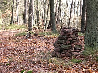
The Palatinate Forest, sometimes also called the Palatine Forest, is a low-mountain region in southwestern Germany, located in the Palatinate in the state of Rhineland-Palatinate. The forest is a designated nature park covering 1,771 km2 and its highest elevation is the Kalmit.

Ramberg is a municipality in Südliche Weinstraße district, in Rhineland-Palatinate, western Germany.

The Kalmit is the highest peak in the Palatinate Forest and the second highest in the Palatinate region of Germany. It is 672.6 m above sea level (NHN) and located 5.5 kilometres (3.4 mi) south of the town of Neustadt an der Weinstraße.

The North Palatine Uplands, sometimes incorrectly shortened to Palatine Uplands, is a low mountain range and landscape unit in the German state of Rhineland-Palatinate and belongs mainly to the Palatinate region. It is part of the Saar-Nahe Uplands.

The Blättersberg near Rhodt unter Rietburg in the Rhenish-Palatine county of Südliche Weinstraße is a mountain, 613.2 m above sea level (NHN), in the Palatine Forest in the German state of Rhineland-Palatinate.

The Hohe Stoppelkopf, locally just called the Stoppelkopf, is a 566.2-metre-high hill in the Palatine Forest in the German state of Rhineland-Palatinate. It lies 3 km north of the small town of Lambrecht.

The Eschkopf near Hofstätten in the German state of Rhineland-Palatinate is a major hill, 608.3 m above sea level (NHN) high in the Palatine Forest.

The Hochberg is a 636-metre-high mountain in the central Haardt in the Palatine Forest in Germany. It lies on the territory of the municipality of Sankt Martin (Palatinate) in the county of Südliche Weinstraße in the state of Rhineland-Palatinate. After the Kalmit, the Kesselberg and the Roßberg it is the fourth highest peak in the Palatine Forest.

The Hohe Loog, is a mountain, 619 m above sea level (NN), in the Haardt, the eastern rim of the Palatine Forest in Germany. The mountain lies within the borough of Neustadt an der Weinstraße in the southern part of the state of Rhineland-Palatinate.

The Mosisberg near Hofstätten in the German state of Rhineland-Palatinate is a hill, 608.7 m above sea level (NHN), in the central Palatine Forest. It has two domes, the eastern one is the summit and is called Langer Kopf and the western high point is the Preußenstein.
Roßberg is a German name for a hill or mountain and may refer to:

The Steigerkopf, also colloquially called the Schänzel, near Edenkoben in the county of Südliche Weinstraße in the German state of Rhineland-Palatinate, is a mountain, 613.6 m above sea level (NHN), in the Palatine Forest. At the summit, which lies on the territory of Gommersheim, is the Schänzel tower.

The Weißenberg in the Palatine Forest is a hill in the municipality of Merzalben. Its height is variously give as 610 m above sea level (NHN) or 607 m above NHN. The higher value has been officially recommended since 2011. That makes the Weißenberg the highest point in the west of the mountain range, ahead of the Eschkopf and Mosisberg. As part of the Palatine Forest-North Vosges Biosphere Reserve it is protected by special conservation measures.

The Peterskopf, near the Palatine county town of Bad Dürkheim in the German state of Rhineland-Palatinate, is a 487-metre-high hill in the Haardt mountains. On its summit is the Bismarck tower.

The Orensberg, also known in the region as the Orensfels(en) due to the striking rock formations on its summit plateau, is a hill, 581.2 m above sea level (NHN), near Frankweiler in the county of Südliche Weinstraße in the German state of Rhineland-Palatinate. The hill is part of the Haardt mountain range that forms the eastern edge of the Palatinate Forest.

The Dernbach is a river in the county of Südliche Weinstraße in the German state of Rhineland-Palatinate. It is 7.46 kilometres long and forms the left-hand, northern headstream of the Eisbach.

Drei Buchen is a hill pass in the central Palatine Forest in the German state of Rhineland-Palatinate. It lies in the estate of the village of Ramberg at a height of 403 metres above sea level (NHN). The L 506 state road runs over the pass from Ramberg to Weyher. At the top of the pass is an inn, the Waldhaus Drei Buchen. The name Drei Buchen means "Three Beeches".

The Idarkopf near Stipshausen in the Hunsrück is a mountain, 745.7 m above sea level (NHN), within the Idar Forest in the German counties of Birkenfeld and Bernkastel-Wittlich. It is one of the highest mountains in the state of Rhineland-Palatinate.

The Hochsimmer is a volcanic cone, 587.9 m above sea level (NHN), in the Eifel Mountains in Germany. It rises near Ettringen in the Rhineland-Palatine county of Mayen-Koblenz. At the summit is an observation tower, the Hochsimmer Tower.

The Hochstein is a volcanic cone, 563 m above sea level (NHN), in the Eifel near Obermendig in the German state of Rhineland-Palatinate and county ofMayen-Koblenz.


