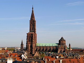
Strasbourg is the prefecture and largest city of the Grand Est region of eastern France, at the border with Germany in the historic region of Alsace. It is the prefecture of the Bas-Rhin department and the official seat of the European Parliament.
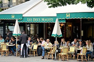
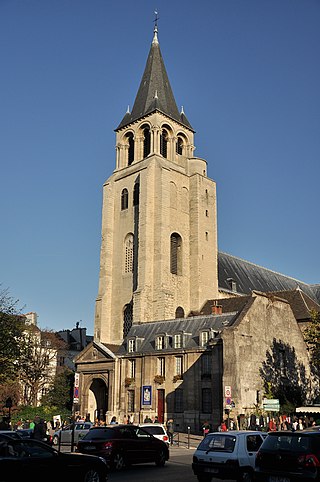
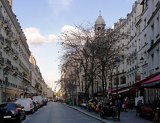
The 6th arrondissement of Paris is one of the 20 arrondissements of the capital city of France. In spoken French, it is referred to as le sixième.
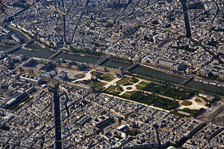
The 1st arrondissement of Paris is one of the 20 arrondissements of the capital city of France. In spoken French, this arrondissement is colloquially referred to as le premier. It is governed locally together with the 2nd, 3rd and 4th arrondissement, with which it forms the 1st sector of Paris (Paris-Centre).

Hector Guimard was a French architect and designer, and a prominent figure of the Art Nouveau style. He achieved early fame with his design for the Castel Beranger, the first Art Nouveau apartment building in Paris, which was selected in an 1899 competition as one of the best new building facades in the city. He is best known for the glass and iron edicules or canopies, with ornamental Art Nouveau curves, which he designed to cover the entrances of the first stations of the Paris Metro.

Passy is a station on Line 6 of the Paris Métro. Located in the 16th arrondissement, it is elevated at its eastern end, while its western end is in the mouth of a tunnel. Passy metro station lies above Rue de l'Alboni where the street becomes pedestrianised as a result of a steep grade.

Pont Neuf is a station on Line 7 of the Paris Métro. Located in the heart of old Paris, it is connected to the Île de la Cité by the nearby Pont Neuf after which it is named. It opened in 1926 with the line's extension from Palais Royal–Musée du Louvre to Pont Marie.

The Boulevard Saint-Michel is one of the two major streets in the Latin Quarter of Paris, France, the other being the Boulevard Saint-Germain. It is a tree-lined boulevard which runs south from the Pont Saint-Michel on the Seine and Place Saint-Michel, crosses the Boulevard Saint-Germain and continues alongside the Sorbonne and the Jardin du Luxembourg, ending at the Place Camille Jullian just before the Port-Royal RER station and the Avenue de l'Observatoire. It was created by Baron Haussmann to run parallel to the Rue Saint-Jacques which marks the historical north-south axis of Paris. It is known colloquially as Boul'Mich' in French.
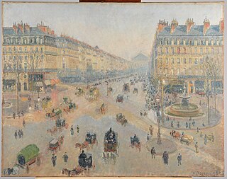
Haussmann's renovation of Paris was a vast public works programme commissioned by French Emperor Napoleon III and directed by his prefect of the Seine, Georges-Eugène Haussmann, between 1853 and 1870. It included the demolition of medieval neighbourhoods that were deemed overcrowded and unhealthy by officials at the time, the building of wide avenues, new parks and squares, the annexation of the suburbs surrounding Paris, and the construction of new sewers, fountains and aqueducts. Haussmann's work was met with fierce opposition, and he was dismissed by Napoleon III in 1870. Work on his projects continued until 1927. The street plan and distinctive appearance of the centre of Paris today are largely the result of Haussmann's renovation.

Germain Boffrand was a French architect. A pupil of Jules Hardouin-Mansart, Germain Boffrand was one of the main creators of the precursor to Rococo called the style Régence, and in his interiors, of the Rococo itself. In his exteriors he held to a monumental Late Baroque classicism with some innovations in spatial planning that were exceptional in France. His major commissions, culminating in his interiors at the Hôtel de Soubise, were memorialised in his treatise Livre d'architecture, published in 1745, which served to disseminate the French Louis XV style throughout Europe.

Rue du Bac is a street in Paris situated in the 7th arrondissement. The street, which is 1150 m long, begins at the junction of the quais Voltaire and Anatole-France and ends at the rue de Sèvres.

Rue Victor-Hugo is a pedestrian street in the 2nd arrondissement of Lyon, in the Ainay district of the Presqu'île quarter, reputed to be one of the most known shopping area of Lyon. From north to south, it connects the Place Bellecour to the Place Carnot. Beyond the Place Bellecour, the rue de la République is its natural extension, thus creating one of the biggest pedestrian streets in Europe. The street is served by metro stations Perrache, Bellecour and Ampère - Victor Hugo. It belongs to the zone classified as World Heritage Site by UNESCO.

Sèvres is a French commune in the southwestern suburbs of Paris. It is located 9.9 kilometres from the centre of Paris, in the Hauts-de-Seine department of the Île-de-France region. The commune, which had a population of 23,251 as of 2018, is known for its famous porcelain production at the Manufacture nationale de Sèvres, which was also where the Treaty of Sèvres (1920) was signed.
This article presents the main landmarks in the city of Paris within administrative limits, divided by its 20 arrondissements. Landmarks located in the suburbs of Paris, outside of its administrative limits, while within the metropolitan area are not included in this article.
The city of Paris has notable examples of architecture of every period, from the Middle Ages to the 21st century. It was the birthplace of the Gothic style, and has important monuments of the French Renaissance, Classical revival, the Flamboyant style of the reign of Napoleon III, the Belle Époque, and the Art Nouveau style. The great Exposition Universelle (1889) and 1900 added Paris landmarks, including the Eiffel Tower and Grand Palais. In the 20th century, the Art Deco style of architecture first appeared in Paris, and Paris architects also influenced the postmodern architecture of the second half of the century.

The Tours tramway is a tram network which is operated by the city of Tours, in Indre-et-Loire, in the French region of Centre-Val de Loire. Originally opening on 31 Aug 2013, the route is nearly 15 kilometers long and has 29 stations. The tramway is made up of a singular line called the A, which connects many major areas of the city, such as Tours station.
The Rue des Archives is a street in Le Marais at the border of 3rd and 4th arrondissements of Paris, France.

Rue Alsace-Lorraine is a pedestrian thoroughfare in the French commune of Saintes, in the Charente-Maritime department.

Vieux-Lille is a district in the north of Lille. It is the district with the most pre-19th-century buildings. It still boasts many cobbled streets and traces of the canals that crisscrossed the city in centuries gone by. It is home to 20,000 inhabitants.
