
The Place de la Concorde is a public square in Paris, France. Measuring 7.6 ha in area, it is the largest square in the French capital. It is located in the city's eighth arrondissement, at the eastern end of the Champs-Élysées.

Belleville is a station on Paris Métro Line 2 and Line 11. The station is in the district of Belleville at the corner of the 10th, 11th, 19th and 20th arrondissements.
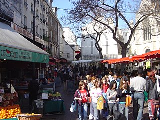
The Rue Mouffetard is a street in the 5th arrondissement of Paris, France.

Belleville is a neighbourhood of Paris, France, parts of which lie in four different arrondissements. The major portion of Belleville straddles the borderline between the 20th arrondissement and the 19th along its main street, the Rue de Belleville. The remainder lies in the 10th and 11th arrondissements.

Rue de l'Abbaye is a residential street in the 6th arrondissement of Paris, named after the Abbey of Saint-Germain-des-Prés. It has a length of some 170m and runs from the Rue Guillaume Apollinaire to the Rue de l'Echaudé. The street itself dates from 1800 although the land it runs over has a much longer history. The oldest and most prominent buildings on the street are the side entrance of the Abbey and former residence of the Abbot of the Abbey, built in 1586. It now is the home of the Catholic Institute of France.

The Rue Adolphe Mille is a street in the 19th arrondissement of Paris, near the Parc de la Villette, the Conservatoire de Musique et de Danse and the Cité de la Musique.

The Passage des Panoramas is the oldest of the covered passages of Paris, located in the 2nd arrondissement between the Boulevard Montmartre to the north and the Rue Saint-Marc to the south. It is one of the earliest venues of the Parisian philatelic trade, and it was one of the first covered commercial passageways in Europe. Bazaars and souks in the Orient had roofed commercial passageways centuries earlier, but the Passage de Panoramas innovated in having glazed roofing and, later on, in 1817, gas lights for illumination. It was an ancestor of the city gallerias of the 19th century and the covered suburban and city shopping malls of the 20th century.

The Wall of the Ferme générale was one of the several city walls of Paris built between the early Middle Ages and the mid 19th century. Built between 1784 and 1791, the 24 km wall crossed the districts of the Place de l'Étoile, Batignolles, Pigalle, Belleville, Nation, the Place d'Italie, Denfert-Rochereau, Montparnasse and the Trocadéro, roughly following the route now traced by line 2 and line 6 of the Paris Métro. The wall was demolished in the early 1860s, although elements of some of its gates remain.
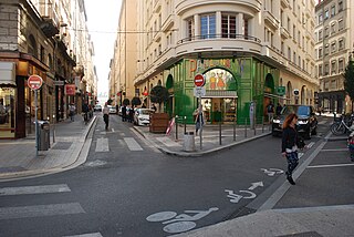
The Rue Émile-Zola is a street located in the 2nd arrondissement of Lyon, near Place Bellecour. This is one of the busiest shopping streets of Lyon, which was described as a "bourgeois" street because there are many upscale shops. It begins with the Place des Jacobins and ends at the Place Bellecour after crossing the rue des Archers, and belongs to the zone classified as World Heritage Site by UNESCO. It was named as tribute to the writer of the same name.

The Avenue Hoche is an avenue in the 8th arrondissement of Paris, France.

Rue Oudinot is a street in the 7th arrondissement of Paris, France. It was named for Marshal Nicolas-Charles Oudinot (1767–1847). The now-defunct Ministry of the Colonies was located on the street, where the current-day Ministry of the Overseas can be found.

The Rue Soufflot is a street in the 5th arrondissement of Paris, France, at the border between the Quartier de la Sorbonne and the Quartier du Val-de-Grâce. It links the Jardin du Luxembourg at the Place Edmond-Rostand on the Boulevard Saint-Michel with the Panthéon at the Place du Panthéon.
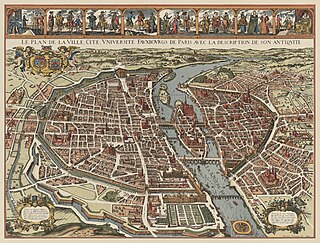
Dictionnaire historique des rues de Paris is a book by Jacques Hillairet, a historian specializing in the history of Paris. It includes 5344 streets in two volumes and 2343 illustrations. It was first published in 1960 by éditions de Minuit and was regularly re-published and updated from 1963 onwards. His sources included Dictionnaire administratif et historique des rues de Paris et de ses monuments by Louis and Félix Lazare and Histoire de Paris rue par rue, maison par maison by Charles Lefeuve.

The Hôtel de Valentinois was an hôtel particulier, a kind of large townhouse of France, in Passy, bordering at its greatest extent present-day Rue Raynouard, present-day Rue des Vignes, Rue Bois-le-Vent, to present-day Rue de l'Annonciation.

The Rue Mondétour is a small pedestrian street in the 1st arrondissement of Paris.

The Rue Beaujolais is a street in the 1st arrondissement of Paris, France.

The Rue Beautreillis is a street in Le Marais, a historic area of the 4th arrondissement in central Paris, France.
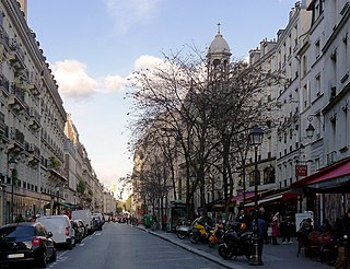
The Rue des Archives is a street in Le Marais at the border of 3rd and 4th arrondissements of Paris, France.

Rue Gît-le-Cœur is a street in the 6th arrondissement of Paris, France.
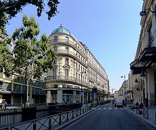
The Rue du Pont-Neuf is a street in the 1st arrondissement of Paris, France, shared between Les Halles to the north and Quartier Saint-Germain-l'Auxerrois to the south. It was pierced in the second half of the 19th century. It bears this name because it leads to the Pont Neuf.


