
The Blue Mountains are a mountainous region and a mountain range located in New South Wales, Australia. The region borders on Sydney's metropolitan area, its foothills starting about 50 kilometres (31 mi) west of centre of the state capital, close to the major suburb of Penrith. The public's understanding of the extent of the Blue Mountains is varied, as it forms only part of an extensive mountainous area associated with the Great Dividing Range. Officially the Blue Mountains region is bounded by the Nepean and Hawkesbury rivers in the east, the Coxs River and Lake Burragorang to the west and south, and the Wolgan and Colo rivers to the north. Geologically, it is situated in the central parts of the Sydney Basin.

Katoomba is the chief town of the City of Blue Mountains in New South Wales, Australia, and the administrative headquarters of Blue Mountains City Council. Katoomba is situated on the Great Western Highway 110 km (68 mi) west of Sydney and 39 km (24 mi) south-east of Lithgow. Katoomba railway station is on the Main Western line.
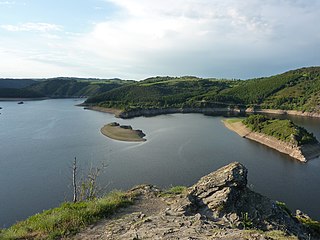
Cantal is a department in the Auvergne-Rhône-Alpes region of France, with its prefecture in Aurillac. Its other principal towns are Saint-Flour and Mauriac and its residents are known as Cantalians. Cantal borders the departments of Puy-de-Dôme, Haute-Loire, Aveyron, Lot, Lozère and Corrèze, in the Massif Central natural region. Along with Lozère and Creuse, Cantal is among the most sparsely populated and geographically isolated departments of France and Aurillac is the departmental capital farthest removed from a major motorway. It had a population of 145,969 in 2016, making it the country's 97th most populated department.

The Blue Mountains National Park is a protected national park that is located in the Blue Mountains region of New South Wales, in eastern Australia. The 267,954-hectare (662,130-acre) national park is situated approximately 80 kilometres (50 mi) west of Sydney, and the park boundary is quite irregular as it is broken up by roads, urban areas and inholdings. Despite the name mountains, the area is an uplifted plateau, dissected by a number of larger rivers. The highest point in the park is Mount Werong at 1,215 metres (3,986 ft) above sea level; while the low point is on the Nepean River at 20 metres (66 ft) above sea level as it leaves the park.

Scenic World is a private, family-owned tourist attraction located in Katoomba in the Blue Mountains, New South Wales, Australia, about 100 kilometres west of Sydney. Scenic World is home to four attractions, the Scenic Railway, the Scenic Skyway, the Scenic Cableway and Scenic Walkway a 2.4 km elevated boardwalk through ancient rainforest. Onsite facilities also include free all-day parking.

The Jamison Valley forms part of the Coxs River canyon system in the Blue Mountains of New South Wales, Australia. It is situated approximately 100 kilometres west of Sydney, capital of New South Wales, and a few kilometres south of Katoomba, the main town in the Blue Mountains.

South Wales is a loosely defined region of Wales bordered by England to the east and mid Wales to the north. It has a population of around 2.2 million, almost three-quarters of the whole of Wales, including 400,000 in Cardiff, 250,000 in Swansea and 150,000 in Newport. Generally considered to include the historic counties of Glamorgan and Monmouthshire, South Wales extends westwards to include Carmarthenshire and Pembrokeshire. In the western extent, from Swansea westwards, local people would probably recognise that they lived in both south Wales and west Wales. The Brecon Beacons National Park covers about a third of South Wales, containing Pen y Fan, the highest British mountain south of Cadair Idris in Snowdonia.

The Narrow Neck Plateau, an eroded remnant of a sandstone layer situated at an elevation of 1,000 metres (3,300 ft) above sea level that is part of the Blue Mountains Range which is a spur line off the Great Dividing Range, is situated immediately south-west of Katoomba in New South Wales, Australia, located within the Blue Mountains National Park. The neck separates the Jamison Valley from the Megalong Valley.
Wentworth Falls is a town in the Blue Mountains region of New South Wales, situated approximately 100 kilometres (62 mi) west of the Sydney central business district, and about 8 kilometres (5.0 mi) east of Katoomba, Australia on the Great Western Highway, with a Wentworth Falls railway station on the Main Western line. The town is at an elevation of 867 metres (2,844 ft) AHD . At the 2016 census, Wentworth Falls had a population of 6,076.
Leura is a suburb in the City of Blue Mountains local government area that is located 100 kilometres (62 mi) west of the Sydney central business district in New South Wales, Australia. It is one of the series of small towns stretched along the Main Western railway line and Great Western Highway that bisects the Blue Mountains National Park. Leura is situated adjacent to Katoomba, the largest centre in the upper mountains, and the two towns merge along Leura's western edge.

The Illawarra escarpment, or officially the Illawarra Range, is the fold-created cliffs and plateau-eroded outcrop mountain range west of the Illawarra coastal plain south of Sydney, in the state of New South Wales, Australia. The range encloses the Illawarra region which stretches from Stanwell Park in the north to Kiama, Gerringong and the Shoalhaven River in the south.

Swatara State Park is a 3,515-acre (1,422 ha) Pennsylvania state park in Bethel, Swatara and Union Townships, Lebanon and Pine Grove Township, Schuylkill Counties in Pennsylvania in the United States. 8 miles (13 km) of Swatara Creek lie within the park's boundaries, which are roughly formed by Pennsylvania Route 443 to the north and Interstate 81 to the south. The park is in a valley in the ridge and valley region of Pennsylvania between Second Mountain (north) and Blue Mountain (south).

Bell is a small rural and residential village in the Blue Mountains region of New South Wales, Australia. It is the north-westernmost village in the City of Blue Mountains, located approximately 125 kilometres (78 mi) west of Sydney central business district by road or 137 kilometres (85 mi) by rail, approximately 20 kilometres (12 mi) east of Lithgow and 10 kilometres (6.2 mi) north of Mount Victoria. It is a locality on the junction of the Bells Line of Road, Chifley Road and the Darling Causeway, with an elevation of approximately 1,100 metres (3,600 ft) AHD .

Mount York, a mountain in the western region of the Explorer Range, part of the Blue Mountains Range that is a spur off the Great Dividing Range, is located approximately 150 kilometres (93 mi) west of Sydney, just outside Mount Victoria in New South Wales, Australia. Mount York has an elevation of 1,061 metres (3,481 ft) AHD and is a projection of the Blue Mountains dissected plateau, creating a promontory of the western escarpment with a minor rise at its summit.

Mount Solitary, a mountain that is part of the Blue Mountains Range, a spur off the Great Dividing Range, is situated within the Blue Mountains National Park, New South Wales, Australia. Mount Solitary is located approximately 100 kilometres (62 mi) west of Sydney, and a few kilometres south of Katoomba, the main town in the Blue Mountains.

Wentworth Falls is a three-tiered waterfall fed by the Jamison Creek, near the town of Wentworth Falls in the Blue Mountains region of New South Wales, Australia. The falls are accessible via the National Pass Walking Trail and the Overcliff/Undercliff Walk. The total height of the waterfall is 187 metres (614 ft).

The Kings Tableland is a plateau, located in the Blue Mountains in Wollondilly Shire, New South Wales, Australia. The ridge is an eroded remnant of a sandstone layer that is approximately 1,000 metres (3,300 ft) AMSL, situated immediately south of Wentworth Falls. The Tableland is the major southerly spur of the main spine of the Blue Mountains Range and forms the beginning of the Southern Escarpment, an unbroken series of tall sandstone cliffs which fringes the Jamison, Megalong, Kanimbla and Hartley Valleys.

A long-distance trail is a longer recreational trail mainly through rural areas used for hiking, backpacking, cycling, horse riding or cross-country skiing. They exist on all continents except Antarctica.

The Bridal Veil Falls is a cascade waterfall on the Leura Falls Creek where it spills into the Jamison Valley, located south-east of Leura in the Blue Mountains region of New South Wales, Australia.
