Related Research Articles

The Ordnance Survey National Grid reference system (OSGB) is a system of geographic grid references used in Great Britain, distinct from latitude and longitude.
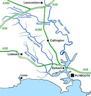
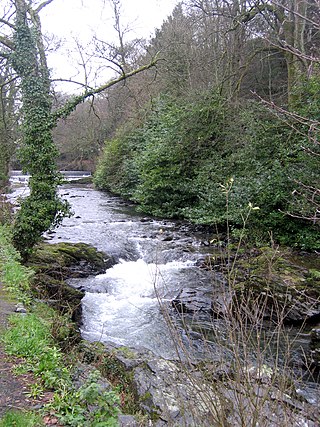
The River Inny is a small river in East Cornwall, United Kingdom. It is a tributary of the River Tamar and is about twenty miles (32 km) long from its source near Davidstow on the eastern flank of Bodmin Moor to its confluence with the Tamar at Inny Foot near Dunterton.

The River Allen in north Cornwall is one of two rivers in Cornwall which share this name. In this case the name is the result of a mistake made in 1888 by Ordnance Survey, replacing the name Layne with Allen which is the old name for the lower reaches of the Camel. The other River Allen runs through Truro.

The De Lank River is a small river in north Cornwall, England. It is a tributary of the River Camel and is approximately nine miles (14.5 km) long from its source on Bodmin Moor to its confluence with the Camel two miles (3 km) south of St Breward.
Bush is a hamlet in the parish of Bude-Stratton, Cornwall, England, UK.

Carkeel is a hamlet north of Saltash in southeast Cornwall, England.

Churchbridge is a hamlet in Cornwall, England. It is a mile west of Duloe, and is situated on the West Looe River. Both banks of the river are wooded, and to the north of the bridge is a disused quarry and Tremadart Mills, marked as a corn mill on the 1882 map.

Congdon's Shop is a hamlet in the parish of North Hill, Cornwall, England. It is at the junction of the B3254 Launceston to Liskeard road and the B3257 road from Plusha to Callington.

Connon is a hamlet near Liskeard in Cornwall, England. Connon is in the civil parish of St Pinnock.
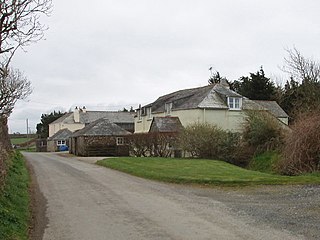
Halton Barton is a farm in the parish of St Dominic in Cornwall, England.

Lanjew is a farm in the parish of Withiel in Cornwall, England.
Middlehill is a hamlet in the parish of St Ive and Pensilva, Cornwall, England.
Muchlarnick is a hamlet in Cornwall, England. It is about two miles east of Lanreath in the civil parish of Pelynt.

Northcott is a hamlet in Cornwall, England. Northcott is north of Bude and on the coast close to Northcott Mouth.

Paramoor is a hamlet near St Mewan in Cornwall, England. Paramoor is southwest of Sticker and Paramoor Wood is nearby.
Penmayne is a hamlet next to Splatt in the civil parish of St Minver Lowlands in north Cornwall, England, UK.
Penpillick is a hamlet in Cornwall, England, UK. It is about two miles north of St Blazey on the A390 road.
Rosecare is a hamlet in the parish of St Gennys, Cornwall, England. Rosecare is east of Higher Crackington.

The River Kensey is a river in east Cornwall, England, UK which is a tributary of the River Tamar.
The River Seaton is a river in east Cornwall, England, UK which flows southwards for 11 miles (17 km) into the English Channel.
References
- ↑ Ordnance Survey: Landranger map sheet 200 Newquay & Bodmin (Map). Ordnance Survey. ISBN 978-0-319-22938-5.
- ↑ Rumford, Cornwall; Explore Britain
- ↑ Rumford dialling code
50°29′35″N4°58′00″W / 50.4929685°N 4.9665419°W
| | This Cornwall location article is a stub. You can help Wikipedia by expanding it. |