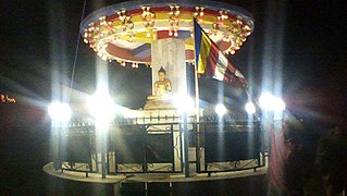
Rangeli is a Municipality and rural market town in Morang District in the Kosi Zone of south-eastern Nepal. This municipality was formed merging existing three villages i.e. Takuwa, Amgachhi and Rangeli itself since May 2014.

Kimadanda is a market center in Sandhikharka Municipality of Arghakhanchi District in the Lumbini Zone of Western Nepal. The former village development committee (VDC) was converted into municipality on 18 May 2014 by merging the existing Sandhikharka, Bangla, Narapani, Khanchikot, Kimadada, Argha and Dibharna VDCs. At the time of the 1991 Nepal census, the town had a population of 5,430 living in 1,085 houses. At the time of the 2001 Nepal census, the population was 3,514, of which 53% was literate.

Dullu is an urban Municipality in Dailekh District of Karnali Pradesh in Nepal.

Lalbandi is a Municipality in Sarlahi District in the Janakpur Zone of south-eastern Nepal. The municipality was established on 18 May 2014 by merging the existing Jabdi, Lalbandi and Pattharkot VDCs. At the time of the 2011 Nepal Census it had a population of 14583 people living in 3295 individual households.

Hiwalcha is market center in Sharada Municipality in Salyan District in the Rapti Zone of western-central Nepal. The place formerly existing as Village Development Committee was annexed to form a new municipality since 18 May 2014. At the time of the 1991 Nepal census it had a population of 3533 people living in 658 individual households.

Kajeri is market center in Sharada Municipality in Salyan District in the Rapti Zone of western-central Nepal. The place formerly existing as Village Development Committee was annexed to form a new municipality since 18 May 2014. At the time of the 1991 Nepal census it had a population of 3998 people living in 669 individual households.

Marke is market center in Sharada Municipality in Salyan District in the Rapti Zone of western-central Nepal. The place formerly existing as Village Development Committee was annexed to form a new municipality since 18 May 2014. At the time of the 1991 Nepal census it had a population of 4189 people living in 770 individual households.

Saijuwal Takura is market center in Sharada Municipality in Salyan District in the Rapti Zone of western-central Nepal. The place formerly existing as Village Development Committee was annexed to form a new municipality since 18 May 2014. At the time of the 1991 Nepal census it had a population of 3,137 living in 593 individual households.

Syanikhal is market center in Sharada Municipality in Salyan District in the Rapti Zone of western-central Nepal. The place formerly existing as Village Development Committee was annexed to form a new municipality since 18 May 2014. At the time of the 1991 Nepal census it had a population of 3711 people living in 680 individual households.

Katari is a Municipality in Udayapur District in the Province No. 1 of south-eastern Nepal.It lies by the Tawa river having the bridge of length 123.5m. This was established by merging two existing village development committees i.e. Triveni and Katari on 18 May 2014. At the time of the 1991 Nepal census it had a population of 7230 people living in 1410 individual households.

Chainpur is a municipality in Sankhuwasabha District in the Kosi Zone of north-eastern Nepal. It was formed by merging five villages i.e. Chainpur, Siddhakali, Siddhapokhari, Baneshwar and Kharang. The municipality was implemented on 18 May 2014. At the time of the 1991 Nepal census it had a population of 4933 people in 948 households.

Kanchan Rup is a Municipality in Saptari District in the Sagarmatha Zone of south-eastern Nepal. This municipality was formed on 18 May 2014 by merging nine villages around it i.e. Baramjhiya, Badgama, Theliya, Jagatpur, Kanchanpur, Pipra (Purba), Rupnagar, Dharmpur and Ghoghanpur.

Shambhunath Municipality is a Town in Saptari District in the Sagarmatha Zone of south-eastern Nepal. Merging the existing Khoksar Parbaha, Shambhunath, Mohanpur, Bhangha, Basbalpur and Rampur Jamuwa village development committee this new municipality was formed on 18 May 2014. Kathauna Bazar is now finally head office of this new municipality. At the time of the 1991 Nepal census it had a population of 5168 people living in 933 individual households.

Khaliban is a town in Rampur Municipality in Palpa District in the Lumbini Zone of southern Nepal. The municipality was established on 18 May 2014 by merging the existing Gadakot, Gegha, Khaliban, Darchha village development committee. At the time of the 1991 Nepal census it had a population of 2272 people living in 399 individual households.

Shivanagar is a town in Krishnanagar Municipality in Kapilvastu District in the Lumbini Zone of southern Nepal. The former VDC was merged to form the municipality established on 18 May 2014 Krishnanagar, Sirsihawa, Shivanagar VDCs. At the time of the 2011 Nepal census it had a population of 4,774 people living in 735 individual households.

Shivaraj is a Municipality in Kapilvastu District in the Lumbini Zone of southern Nepal. The former village development committee was transformed into Municipality from 18 May 2014 by merging the existing Birpur, Nepal, Chanai, Bishunpur, Jawabhari and Shivapur village development committees. At the time of the 1991 Nepal census it had a population of 7241 people living in 1067 individual households.

Pathari Sanischare (पथरी-शनिश्चरे) is a Municipality in Morang District in the Koshi Zone of south-eastern Nepal. It was formed by merging two existing village development committees i.e. Pathari and Sanischare in May 2014.

Siddhicharan is a municipality and the district headquarter of Okhaldhunga District in Province No. 1 of Nepal that was established in May 2014 by merging the two former Village development committees Andheri, Thulachhap, Jyamire, Salleri, Rumjatar and Okhaldhunga. It is named after the Nepali poet Siddhicharan Shrestha. At the time of the 2011 Nepal census it had a population of 27,995 people living in 6,994 individual households.

Sharada Municipality is a municipality located in Salyan District of Rapti Zone in the Western Development Region of Nepal. This municipality was formed in May 18, 2014. It was formed by merging seven Village Development Committees: Dandagaun, Hiwalcha, Kajeri, Khalanga, Marke, Saijuwal Takura and Syanikhal.

Sundar Haraicha is a municipality in Morang District of Province No. 1 in Nepal that was established on 10 March 2017 by merging the former municipalities Sundar Dulari and Koshi Haraicha. At the time of the 2011 Nepal census, the localities out of which Chaudandigadhi would be formed had a joint population of 80,518 people living in 18,610 individual households.


