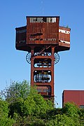
Saar-Warndt coal mining basin

Last updated
Lorraine basin location on French coal basins map Localisation - bassin houiller de Moselle.svg
Lorraine basin location on French coal basins map
Coalfields of Germany, Belgium, The Netherlands and Northern France CoalDNLBF.png
Coalfields of Germany, Belgium, The Netherlands and Northern France

Saar-Warndt coal mining basin is an area of Germany and France. It has been shaped by two centuries of coal extraction from the start of the 19th century to the start of 21st century; and it represents a significant period in the history of European industrialisation.

The Saar coalfield has passed between France and Germany during the 1900s. After World War One it was agreed in the Treaty of Versailles to be owned by France, until a plebiscite took place 15 years later where the local citizens voted to become part of Germany. Following World War Two this area was officially returned to France. However in 1957 the Saar rejoined Germany. [1]

This piece of land was valuable to these countries especially during this coal powered period of history. However most of the coal in that area was mined when it belonged to France post-WW1.

See also

Related Research Articles

Saarland State of Germany

Saarland is a state of Germany in the west of the country. With an area of 2,570 km2 (990 sq mi) and population of 995,600 in 2015, it is the smallest German state in both area and population apart from the city-states of Berlin, Bremen, and Hamburg. Saarbrücken is the state capital and largest city; other cities include Neunkirchen and Saarlouis. Saarland is mainly surrounded by the department of Moselle in France to the west and south and the neighboring state of Rhineland-Palatinate in Germany to the north and east; it also shares a small border about 8 kilometres long with the canton of Remich in Luxembourg to the northwest.

Saarbrücken Capital of Saarland, Germany

Saarbrücken is the capital and largest city of the state of Saarland, Germany. Saarbrücken is Saarland's administrative, commercial and cultural centre and is next to the French border.

Saarlouis Place in Saarland, Germany

Saarlouis is a town in Saarland, Germany, capital of the district of Saarlouis. In 2017, the town had a population of 34,758. Saarlouis, as the name implies, is located on the river Saar. It was built as a fortress in 1680 and named after Louis XIV of France.

Postage stamps and postal history of the Saar

This is a survey of the postage stamps and postal history of the German territory of the Saar. As a border region contested between France and Germany, the Saar has a somewhat complicated philatelic history.

Saar (river) River in France and Germany

The Saar is a river in northeastern France and western Germany, and a right tributary of the Moselle. It rises in the Vosges mountains on the border of Alsace and Lorraine and flows northwards into the Moselle near Trier. It has two headstreams, that both start near Mont Donon, the highest peak of the northern Vosges. After 246 kilometres (153 mi) the Saar flows into the Moselle at Konz (Rhineland-Palatinate) between Trier and the Luxembourg border. It has a catchment area of 7,431 square kilometres (2,869 sq mi).

Saar Protectorate Short-lived protectorate partitioned from Germany after its defeat in World War II

The Saar Protectorate officially Saarland was a short-lived protectorate (1946–1957) partitioned from Germany after its defeat in World War II; it was administered by the French Fourth Republic. On rejoining the Federal Republic of Germany in 1957, it became the smallest "federal state" (Bundesland), the Saarland, not counting the "city states" of West Berlin, Hamburg, and Bremen. It is named after the Saar River.

1. FC Saarbrücken German association football club based in the city of Saarbrücken, Saarland

1. FC Saarbrücken is a football club based in Saarbrücken, Saarland. The club play in the 3. Liga, which is the third tier of football in Germany. The club began its existence as the football department of Turnverein Malstatt formed in 1903. That department split off in 1907 to form the independent football club FV Malstatt-Burbach and on 1 April 1909 was renamed FV Saarbrücken.

Saar at the 1952 Summer Olympics Sporting event delegation

The National Olympic Committee (NOC) of the Saarland was founded in the spring of 1950 in the Saar Protectorate, which existed from 1947 to 1956, a region of Western Germany that was occupied in 1945 by France. As a separate team, Saar took part in its sole Olympic Games at the 1952 Summer Olympics before being allowed to rejoin the German team in 1956. Thirty-six competitors, 31 men and five women, took part in 32 events in nine sports.

Dillingen, Saarland Place in Saarland, Germany

Dillingen is a town in the district of Saarlouis, in Saarland. It has about 20,000 inhabitants and is divided into the three districts Dillingen-city center, Pachten and Diefflen. The city is located on the edge of the Saar-Hunsrück Nature Park at the mouth of the Prims in the Saar and is located about 10 km from the French border. Dillingen is located about 60 km from Luxembourg City and Trier, 50 km from Metz and 30 km from Saarbrücken and is directly adjacent to the urban area of Saarlouis. In terms of population, it is the second largest municipality in the district of Saarlouis. The Dillinger Hütte steelworks is located here.

The Saar franc was the French franc used as the official currency of the Saar during the times that the Saar territory was economically split off from Germany, in 1920–1935 as the Territory of the Saar Basin, in 1947–1957 as the Saar Protectorate and 1957–1959 as the state of Saarland in West Germany. Local notes and coins were issued during both periods, but the Saar franc was never legally an independent currency.

Merzig Place in Saarland, Germany

Merzig is a town in Saarland, Germany. Is is the capital of the district Merzig-Wadern, with about 30,000 inhabitants in 17 municipalities on 108 km². It is situated on the river Saar, approx. 35 km south of Trier, and 35 km northwest of Saarbrücken.

Blieskastel Place in Saarland, Germany

Blieskastel is a city in the Saarpfalz (Saar-Palatinate) district, in Saarland, Germany which is divided into villages. It is situated on the river Blies, approximately 10 kilometres southwest of Homburg (Saar), 8 km (5 mi) west of Zweibrücken, and 20 km (12 mi) east of Saarbrücken.

Monnet Plan Reconstruction plan for France

The Monnet Plan was proposed by French civil servant Jean Monnet after the end of World War II. It was a reconstruction plan for France that proposed giving France control over the German coal and steel areas of the Ruhr area and Saar and using these resources to bring France to 150% of pre-war industrial production. The plan was adopted by Charles de Gaulle in early 1946. The plan would permanently limit German economic capacity, and greatly increase French power.

Territory of the Saar Basin League of Nations Mandate in Western Europe

The Territory of the Saar Basin was a region of Germany occupied and governed by the United Kingdom and France from 1920 to 1935 under a League of Nations mandate. It had its own flag : a blue, white, and black horizontal tricolour. The blue and white stood for Bavaria, and white and black for Prussia, out of whose lands the Saar Territory was formed. Initially, the occupation was under the auspices of the Treaty of Versailles. Its population in 1933 was 812,000, and its capital was Saarbrücken. The territory closely corresponds with the modern German state of Saarland, but was slightly smaller in area. After a plebiscite was held in 1935, it was returned to Germany.

History of the European Coal and Steel Community (1945–1957) Aspect of history

The period saw the first moves towards European unity as the first bodies began to be established in the aftermath of the Second World War. In 1951 the first community, the European Coal and Steel Community was established and moves on new communities quickly began. Early attempts at military and political unity failed, eventually leading to the Treaties of Rome in 1957.

SaarLorLux

SaarLorLux or Saar-Lor-Lux, a portmanteau of Saarland, Lorraine and Luxembourg, is a euroregion of five regional authorities located in four European states. The term has also been applied to cooperations of several of these authorities or of their subdivisions, administrations, organisations, clubs and people. Member regions represent different political structures: the sovereign state of Luxembourg; Belgium's Walloon region, comprising the French and German speaking parts of Belgium; Lorraine, a region of France; the French départements Moselle and Meurthe-et-Moselle; and the German federated states of Saarland and Rhineland-Palatinate.

The Social Democratic Party of Saarland was a political party existing between 1946 and 1956 in the Saar Protectorate. It had a short-lived predecessor, the Social Democratic Regional Party of the Saar Territory existing between 1933 and 1935 in the Saar Territory.

Greater Region of Luxembourg

The Greater Region of Luxembourg, or simply Greater Region, is a geopolitical region within Europe, created to promote economic, cultural, touristic and social development and cooperation. It occupies an area of 65,401 square kilometres (25,251 sq mi) with Luxembourg at its center and including adjacent regions of Belgium, Germany and France.

Nord-Pas de Calais Mining Basin UNESCO World Heritage Site in northeast France

Nord-Pas-de-Calais Mining Basin is an area of France that has been added to the 2012 UNESCO World Heritage Sites list. This area has been shaped after three centuries of coal extraction from 18th century to 20th century and illustrates a significant period in the history of industrialisation in Europe.

Friendship Bridge (Germany-France)

The Friendship Bridge is a bridge which crosses the Saar river, south of Saarbrücken, and links the Saarland municipality of Kleinblittersdorf with the Lorraine commune of Grosbliederstroff.

References

  1. "Saarland | state, Germany". Encyclopedia Britannica. Retrieved 2021-02-12.