
San Germán is a historic town and municipality located in the Sabana Grande Valley of southwestern region of Puerto Rico, south of Mayagüez and Maricao, north of Lajas, east of Hormigueros and Cabo Rojo, and west of Sabana Grande. San Germán is spread over eighteen barrios plus San Germán Pueblo. It is both a principal city of the San Germán–Cabo Rojo Metropolitan Statistical Area and the Mayagüez–San Germán–Cabo Rojo Combined Statistical Area. San Germán is the second oldest city of Puerto Rico, after San Juan, and its historic downtown is preserved as the San Germán Historic District.

Sabana Grande is a town and municipality of Puerto Rico located north of Lajas and Guánica; south of Maricao; east of San Germán; and west of Yauco. Sabana Grande is spread over seven barrios and Sabana Grande Pueblo. It is part of the San Germán-Cabo Rojo Metropolitan Statistical Area.
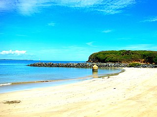
Toa Baja is a town and municipality of Puerto Rico located in the northern coast, north of Toa Alta and Bayamón; east of Dorado; and west of Cataño. Toa Baja is spread over five barrios, including Toa Baja Pueblo. Toa Baja is part of the San Juan-Caguas-Guaynabo Metropolitan Statistical Area. Toa Baja is located fifteen minutes by car from San Juan and two hours from Ponce.

Río Piedras is a populous district of San Juan, and former town and municipality of Puerto Rico, which was merged with the municipality of San Juan in 1951. The district today is composed of various barrios such as Pueblo and Universidad. The historic town was founded in 1714 as El Roble, it was given municipality rights in 1823, and since 1903 it has been the home of the University of Puerto Rico's main campus, earning the popular name of Ciudad Universitaria today. The downtown and historic center of Río Piedras is officially known as the Pueblo barrio of the municipality of San Juan.
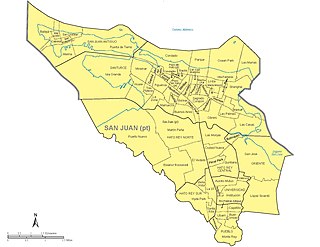
The municipality of San Juan is divided into 18 barrios, 16 of which fall within the former municipality of Río Piedras. Eight of the barrios are further divided into subbarrios, and they include the two barrios that originally composed the municipality of San Juan :
The Coco River is a river in Sabana Grande in Puerto Rico.

Río Blanco is a river in the municipality of Ponce, Puerto Rico. It is located in the northeastern area of the municipality. It empties into the Río Prieto. Together with the Río Prieto, the Río Blanco is one of the two rivers in Ponce with their mouth at the highest elevation. This river is one of the 14 rivers in the municipality.
The Cañas River is a river of Puerto Rico.
The Cruces River is a river of Sabana Grande and San Germán in Puerto Rico.
The Flores River is a river of Sabana Grande, Puerto Rico.
The Guanajibo River is a river that runs through Hormigueros, Cabo Rojo, Mayagüez, San Germán, and Sabana Grande in Puerto Rico.
Prieto River is a river in the municipality of Ponce, Puerto Rico. It is located in the northeastern area of the municipality. Forming at an altitude of 3,920 feet (1,190 m), Río Prieto originates at the second highest point of any river in the municipality after Río Inabon. It empties into Río Cerrillos. Together with Río Blanco, Río Prieto is one of the two rivers in Ponce with mouths at the highest elevation. This river is one of the 14 rivers in the municipality.
Río Sabana is a river of Cidra, Puerto Rico.
Río Piedras Pueblo, is one of 18 barrios in the municipality of San Juan, Puerto Rico. Rio Piedras Pueblo is what used to be the urban center-barrio of the former municipality of Río Piedras until 1951, when the municipality of Rio Piedras was merged with the municipality of San Juan.

Capitanejo is one of the 31 barrios of the municipality of Ponce, Puerto Rico. Along with Anón, Coto Laurel, Guaraguao, Quebrada Limón, Real, San Patricio, and Marueño, and the coastal barrio of Canas, Capitanejo is one of the municipality's nine bordering barrios. It borders the municipality of Juana Diaz. Along with Playa, Bucana, Vayas and Canas, Capitanejo is also one of Ponce's five coastal barrios. Together with Vayas, Capitanejo is also one of two rural coastal barrios in the municipality. It was founded in 1822.

The Sabana Grande Masonic Cemetery, known formally as Cementerio Masónico de la Resp. Logia Igualdad Núm. 23 de Sabana Grande, is a historic cemetery in Sabana Grande, Puerto Rico.
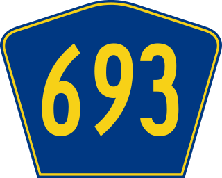
Puerto Rico Highway 693 (PR-693) is a road located between the municipalities of Dorado, Puerto Rico and Vega Alta, passing through downtown Dorado. It begins at its intersection with PR-2 and PR-165 in Río Lajas and ends at PR-690 in Sabana. It is a short divided highway in southern Dorado, which serves as an alternate route for PR-165 west of Río de la Plata.

Puerto Rico Highway 117 (PR-117) is a rural road that travels from Lajas, Puerto Rico to Sabana Grande. It begins at its junction with PR-116 and PR-315 south of downtown Lajas and ends at its intersection with PR-121 in southern Sabana Grande.
