
Mather Air Force Base was a United States Air Force Base, which was closed in 1993. It was located 12 miles (19 km) east of Sacramento, on the south side of U.S. Route 50 in Sacramento County, California. Mather Field was one of 32 Air Service training camps established after the United States entry into World War I in April 1917.
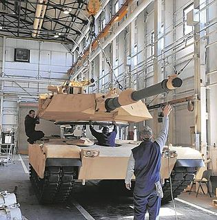
Anniston Army Depot (ANAD) is a major United States Army facility for the production and repair of ground combat vehicles, overhaul of Small Arms Weapon Systems and the storage of chemical weapons, a.k.a. the Anniston Chemical Activity. The depot is located in Bynum, Alabama.
McClellan Air Force Base (1935–2001) is a former United States Air Force base located in the North Highlands area of Sacramento County, 7 miles (11 km) northeast of Sacramento, California.

The Pueblo Chemical Depot is a chemical weapons storage site located in Pueblo County, Colorado, United States. The Pueblo Chemical Depot is one of the last two sites in the United States with chemical munitions and chemical material. The Pueblo Chemical Agent Destruction Pilot Plant (PCAPP) which is under the Assembled Chemical Weapons Alternatives (ACWA) program will destroy its stockpile of 155-mm and 105-mm artillery shells and 4.2-in. mortars, all of which contain a form of the chemical agent mustard.
Defense Depot Ogden was a U.S. military installation located in Ogden, Utah. It encompassed 1,139 acres (5 km2) with its southwest corner located on 12th Street and Tomlinson Road. Its eastern border is the old Utah Northern Railroad, now owned by the Union Pacific Railroad.

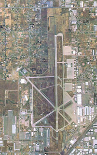
Stockton Metropolitan Airport is a joint civil-military airport three miles southeast of downtown Stockton, a city in San Joaquin County, California. It is owned by the County of San Joaquin.

Weldon Spring Ordnance Works (WSOW) was a 17,323-acre (70.10 km2) U.S. Government-owned, contractor-operated (GOCO) facility in St. Charles County, Missouri, 55 km west of St. Louis. The site was originally operated by the Atlas Powder Company during World War II from 1941 to 1945 to produce explosives. The Atomic Energy Commission acquired part of the property in 1955, and Mallinckrodt, Inc. processed uranium ore from 1957 to 1966 under contract. The site has been divided into several parcels, and ownership has transferred over the years. Two portions of the original WSOW property are now Superfund sites that require substantial cleanup efforts. The environmental remediation of the WSOW site is currently designated as a major project of the Defense Environmental Restoration Program of the United States Department of Defense. Part of the original property is still used by the Army Reserve as the Weldon Spring Training Area.
Sacramento McClellan Airport is a privately owned public-use airport located six miles (10 km) northeast of the central business district of Sacramento.
Tenth Street Stadium was a stadium in Bloomington, Indiana, USA. Originally named Memorial Stadium, it was primarily used for college football, and was the home field of the Indiana University football team between 1925 and 1959, prior to the opening of the new Memorial Stadium. The stadium held 20,000 people and was built in 1925. It replaced Jordan Field which had been the home field for the program since 1887. The stadium was renamed Tenth Street Stadium in 1971. It was later used to host the Little 500 and was used in the 1979 movie Breaking Away. The stadium was demolished in 1982 and the site on which it once stood is now a green space and recreation fields in the center of campus known as The Arboretum.
Savanna Army Depot was a 13,062-acre (52.86 km2) installation, located on the eastern bank of the Mississippi River, in Carroll and Jo Daviess counties, around seven miles (11 km) north of Savanna, Illinois. It was opened in 1917 as a proving and testing facility for weapons developed at Rock Island Arsenal. In 1921 it became a weapons depot. The U.S. Environmental Protection Agency (EPA) listed the depot as a Superfund site in 1989. The depot was selected for closure through the Base Realignment and Closure process in July 1995 and was officially closed on March 18, 2000. The Jo-Carroll Local Redevelopment Authority (LRA) was established to redevelop a portion of the property for commercial and business usage referred to as the Savanna Depot Park. On September 26, 2003, the United States Department of Defense agreed to transfer 9,404 acres (38.06 km2) of land to become the Lost Mound Unit of the Upper Mississippi River National Wildlife and Fish Refuge. 3,022 acres (12.23 km2) were initially transferred with the rest to be transferred following environmental cleanup. The portion near Lock and Dam No. 12 was transferred to the United States Army Corps of Engineers and a small part to the Illinois Department of Natural Resources.

West Virginia Ordnance Works (WVOW) was a United States Army ammunition manufacturing facility constructed and operated during World War II. It was located north of Point Pleasant, West Virginia in Mason County encompassing 8,323 acres (33.68 km2). The $45 million plant employed 3500 at its peak and operated from 1942 to 1945. The site was disposed of following the war and land was utilized by creating a landfill, the McClintic Wildlife Management Area, the Mason County Airport and an industrial park among others.

KXSE is a commercial radio station located in Davis, California, broadcasting to the Sacramento, California, area. The station offers a Spanish adult hits music format, and is the satellite station of the "La Suavecita" radio network. Its studios are in North Sacramento and its transmitter is in Woodland, California.
Letterkenny Munitions Center, located on Letterkenny Army Depot in Franklin County, Pennsylvania, is a satellite activity under Crane Army Ammunition Activity in Crane, Indiana. The center maintains, stores, and demilitarizes tactical missiles and conventional ammunition for the Army, Air Force and Navy. LEMC assembles, disassembles and tests missiles and missile sections and is also responsible for every aspect of conventional ammunition and missiles to include demilitarization, renovation and X-ray.

The California Exposition and State Fair is an independent state agency established by law in the California Food and Agriculture codes. Cal Expo is governed by an appointed 11-member Board of Directors and daily operations are managed by the chief executive officer. During the annual State Fair more than 2,000 seasonal temporary employees are hired. The California Exposition is a self-sufficient operation that receives no government funding but still has an estimated economic impact of more than $250 million on the region.
The Lone Star Army Ammunition Plant was a 15,546-acre (62.91 km2) government-owned, contractor-operated (GOCO) facility 12 miles west of Texarkana, Texas that was established in 1942. The land was purchased from local citizens through Eminent Domain by the United States Department of Defense. The Lone Star Defense Corporation, a subsidiary of the B. F. Goodrich Rubber Corporation, won the contract on July 23, 1941 to produce artillery shells, bombs, fuses, boosters, and other auxiliary munitions at the site. The plant produced ammunition throughout World War II, the Korean War and the Vietnam War. The plant was last operated by Day & Zimmermann.

Belleville Air Force Station is a closed United States Air Force General Surveillance Radar station. It is located 2 miles (3.2 km) southeast of Belleville, Illinois. It was closed in 1968.
United States Army Reserve Center, Rio Vista is a former United States Army Reserve center located in Rio Vista, Solano County, California. It was established in 1911 as the U.S. Engineers Storehouse, Rio Vista. It went through ten different names in its 81-year history, finally becoming the United States Army Reserve Center, Rio Vista California. It was closed in 1992 as a result of a BRAC recommendation.
Sacramento Air Logistics Center is a former United States Air Force unit based at McClellan Air Force Base from 1935 until its closure as part of the 1995 Base Realignment and Closure Commission.
Camp Kohler was located in the northeast corner of unincorporated Sacramento County, California, United States, until it was destroyed by a fire in 1947.

Papa Murphy's Park is a sports venue located on the grounds of Cal Expo in Sacramento, California. The soccer-specific stadium has a capacity of 11,569 and includes a full-sized soccer field. Papa Murphy's Park is the current home of Sacramento Republic FC soccer team and former home of PRO Rugby team, Sacramento Express.


