Related Research Articles
Newtown is a part of the Municipality of New-Wes-Valley, located at the North end of Bonavista Bay in the province of Newfoundland and Labrador, Canada. The approximate population is 400. Settlement in Newtown originated around 1850 when people relocated from nearby areas. Newtown is well known for being built on many small islands, and is the home of the Barbour Living Heritage Village.
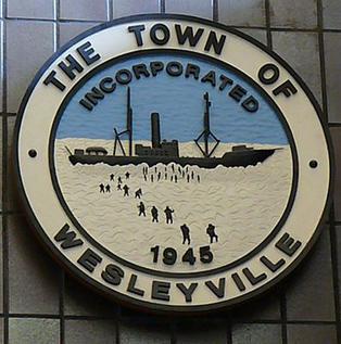
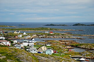
Wesleyville is a small coastal community in Newfoundland and Labrador, Canada. It is located on the Straight Shore of Bonavista Bay, on the northeast coast of Newfoundland, near the communities of Greenspond and Newtown. It was settled in the early 19th century, when residents relocated from nearby islands.

Bonavista North was a provincial electoral district for the House of Assembly of Newfoundland and Labrador, Canada. It existed from when Newfoundland joined confederation in 1949 until 2015.
Greenspond is a community in the province of Newfoundland and Labrador, Canada.
Aspen Cove is a small fishing community in the province of Newfoundland and Labrador, Canada. Formerly called Aspey or Apsey Cove, Aspen Cove was named for the presence of aspen trees in the area. It first appears in the 1857 Census as Apsey Cove with a population of thirteen, all dependent on the salmon fishery. By the 1870s more families moved to Aspen Cove for the cod and lobster fisheries. In the 1921 census the population had reached 104 and the economy had changed from salmon, fur, and agriculture to cod, lobster, and lumbering.
Templeman is a community of New-Wes-Valley in Newfoundland, Canada, located on the north side of Bonavista Bay just south of Cape Freels and north of Wesleyville. Templeman has a shallow and rocky harbour, and can only accommodate small boats.
Valleyfield, Newfoundland is a village and was served by the C.N.R. It joined the Rural District of Badger's Quay-Valleyfield-Pool's Island in April 1980 until 1992 when the District merged with other nearby towns to form New-Wes-Valley. Valleyfield has a good harbour, and is the location of the Beothic Fisheries fish plant.
Badger's Quay is a Canadian town in the province of Newfoundland and Labrador.

Rose Blanche–Harbour le Cou Town on Newfoundland's southwest shore, about 45 km from Port aux Basques, at the end of Route 470.
Musgrave Harbour is a town in the Canadian province of Newfoundland and Labrador.
New-Wes-Valley is a municipality in Newfoundland and Labrador, Canada.
Cape Island is the name of both an island and a former community in the Canadian province of Newfoundland and Labrador.
Cape Freels is one of the communities that comprise an area on the northeast coast of the Island of Newfoundland, called Bonavista North, in the province of Newfoundland and Labrador, Canada. These communities have a shared history in that they were settled by people from England, predominantly from the West Country - Dorset, Devon, Somerset and Hampshire.
Noggin Cove is a local service district and designated place in the Canadian province of Newfoundland and Labrador. It is west of Carmanville on the south side of Hamilton Sound. It is said to be named after Noggin Island, about 5 km off its eastern point.
Lumsden, formerly known as Cat Harbour, is a community located on the Straight Shore of Newfoundland in Newfoundland and Labrador, Canada, near communities such as Musgrave Harbour and Newtown. Lumsden formerly consisted of two settlements, Lumsden North on the tip of a sandy peninsula and Lumsden South on the main road. Although the harbour in Lumsden is not ideal because it is not sheltered, Lumsden has excellent fishing grounds.
Ladle Cove is a designated place in the Canadian province of Newfoundland and Labrador. It is along the Straight Shore on the island of Newfoundland.
Pool's Island is an incorporated community of Badger's Quay-Valleyfield-Pool's Island in the province of Newfoundland and Labrador, Canada. It is now part of the town of New-Wes-Valley.
Located on the northwest side of Bonavista Bay, Newfoundland at the mouth of the Indian Bay inlet is a small island named Silver Fox Island that was once inhabited. It is about 3 km in length and about 3 km from Fair Island. The first settling began at Warren's Harbour on the southern side of the island.
Pinchard's Island was one of the communities that comprise an area on the northeast coast of the Island of Newfoundland, called Bonavista North. These communities have a shared history in that they were settled by people from England, predominantly from the West Country - Dorset, Devon Somerset and Hampshire.

Division No. 1, Subdivision G is an unorganized subdivision on the Avalon Peninsula in Newfoundland and Labrador, Canada. It is in Division 1 and contains the unincorporated communities of Baccalieu Island, Besom Cove, Bradley's Cove, Burnt Point, Caplin Cove, Daniel's Cove, Grates Cove, Gull Island, Job's Cove, Kingston, Long Beach, Lower Island Cove, Low Point, Northern Bay, Ochre Pit Cove, Red Head Cove, Riverhead, Smooth Cove and Western Bay.
References
- ↑ Hanley, Kieran (7 April 2011). "MAP: The abandoned communities of our province". The Indy --. The Independent. Retrieved 20 October 2019.
- 1 2 Encyclopedia of Newfoundland and Labrador
- ↑ Naboth Winsor, Resounding God's Praises on Islands, in Coves, 1990
- ↑ Hector Swain, The Labrador Parson: Reverend Lester Leeland Burry, 1979