
Arkösund is a small village on the Swedish East Coast, on Vikbolandet peninsula, Norrköping Municipality. Its population swells in the summer, when the yacht people arrive to anchor up in the marina to shop for food. It is most famous for its archipelago — many small islands easily reached by boat from the harbour.

Kerekegyháza is a town in Bács-Kiskun county, in southern Hungary.

Mong Ton, also known historically as Möngtung and Maington, is a town and seat of Mong Tong Township in Mong Hsat District, Shan State in eastern Myanmar near the border with Thailand. Mong is equivalent to Mueang. It is located in the Daen Lao Range, in the southern part of the Shan State, east of the Salween River. Mong Ton lies on the National Highway 45 and is also connected to Mong Hsat by National Highway 49 which begins to the north-east of the town.

Żarów is a town in Świdnica County, Lower Silesian Voivodeship, in south-western Poland. It is the seat of the administrative district (gmina) called Gmina Żarów. The town lies approximately 11 kilometres (7 mi) north-east of Świdnica, and 45 kilometres (28 mi) south-west of the regional capital Wrocław.
Letsok-aw Island is an island in the Mergui Archipelago, Burma (Myanmar). With a length of 38 km and an area of 250 km² it is one of the largest islands of the archipelago. This hilly and thickly wooded island lies 14 km east of Bentinck Kyun. It stretches from north to south and has a maximum width of 9.7 km. Highest point 683 m.
Mali Kyun is an island in the Mergui Archipelago, Burma (Myanmar). This long and narrow island at the northern end of the archipekago occupies an area of 99 km2 (38 sq mi), stretching roughly from north to south.
Bentinck Kyun is an island in the Mergui Archipelago, Burma (Myanmar). It lies 14 km west of Letsok-aw Kyun in the Andaman Sea. Bentinck has a very irregular indented shape. The island is thickly wooded and its area is 78 km².
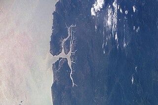
Sonadia Island is a small island of about 9 square kilometres, offshore of the Cox's Bazar coast in Chittagong Division, Bangladesh.
Gaibiel is a municipality in the comarca of Alto Palancia, Castellón, Valencia, Spain.
Thahtay Island, also known as Thahtay Kyun and Son Island, is a small Burmese island within the Mergui Archipelago in the Andaman Sea. The island is directly adjacent to Ranong, a city in the south of Thailand and to Kawthaung. The island has been given by the Burmese government on a long term concession to a Thailand-based VES Group for development as a tourism. Grand Andaman is a five star casino club golf resort now operating on the island.

Tangyan is the principal town of Tangyan Township in Shan State, Myanmar. It is situated in a valley in a mountainous region. It lies at an elevation of 946 m.

Pianu is a commune located in Alba County, Romania. It has a population of 3,390 and is composed of five villages: Pianu de Jos (Alsópián), Pianu de Sus, Plaiuri (Plaintelep), Purcăreți (Sebespurkerec) and Strungari (Sztrugár).

Ancuty is a village in the administrative district of Gmina Narew, within Hajnówka County, Podlaskie Voivodeship, in north-eastern Poland. It lies approximately 4 kilometres (2 mi) north-west of Narew, 23 km (14 mi) north of Hajnówka, and 30 km (19 mi) south-east of the regional capital Białystok.

Korycin is a village in Sokółka County, Podlaskie Voivodeship, in north-eastern Poland. It is the seat of the gmina called Gmina Korycin. It lies approximately 39 kilometres (24 mi) west of Sokółka and 44 km (27 mi) north of the regional capital Białystok.
Jastrzębiec is a village in the administrative district of Gmina Stopnica, within Busko County, Świętokrzyskie Voivodeship, in south-central Poland. It lies approximately 5 kilometres (3 mi) north of Stopnica, 16 km (10 mi) east of Busko-Zdrój, and 50 km (31 mi) south-east of the regional capital Kielce.
Kosilka is a village in Dryanovo Municipality, in Gabrovo Province, in northern central Bulgaria.
Tartar Island is a small (13 ha), ice-free, oval-shaped island 0.6 km (0.37 mi) long, lying 0.7 km (0.43 mi) north-west of Round Point, off the north coast of King George Island in the South Shetland Islands of Antarctica. It was named by the United Kingdom Antarctic Place-Names Committee (UK-APC) in 1960 for the sealing vessel Tartar from London, which visited the South Shetland Islands in 1821-22.
Sabi Island is an island in the Mergui Archipelago of Taninthayi Region, Burma (Myanmar). It lies between Money Island to the south and Parker Island to the north. The narrow channel between Sabi island and Money Island is rather shallow, but the half-mile wide channel between Sabi Island and Parker Island is quite deep. The island is heavily forested and has small bays with sandy beaches on the west side. The highest point is 326 m above the sea. Whaleback Reef, which lies about three-quarters of mile off the northeast part of the island, is exposed about 8 ft. at low tide.
The Heinze River is a river of Burma. It has its source in the Tenasserim Hills and ends in the Andaman Sea in the Tanintharyi Region coast. The Heinze Islands is a small island group located 25 km to the SSW of the mouth of the Heinze River.


