Sagleipie

Last updated
Sagleipie
Liberia location map.svg
Red pog.svg
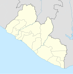
Sagleipie
Location in Liberia
Coordinates: 6°57′45″N8°50′26″W / 6.96250°N 8.84056°W / 6.96250; -8.84056
Country Flag of Liberia.svg Liberia
County Nimba County

Sagleipie (also, Sacleipea, Sacleipie, Sakalapie, Saklape, Sakripie, and Sakriple) is one of the largest cities in Liberia and the second largest city in Nimba County, with a population of over 12,000.

Related Research Articles

Guadalupe, Arizona Town in Arizona, United States

Guadalupe is a town in Maricopa County, Arizona, United States. Since its founding, Guadalupe has been known as a center of Yaqui culture and it is home to many religious festivals. The town motto, "where three cultures flourish," recognizes the town's roots in the Yaquis, Mexicans and descendants of the original farmers. Nestled between Phoenix and Tempe, the 2010 census listed the population of the town as 5,523. Guadalupe was founded around 1900 by Yaqui Indians, who fled their homeland in Sonora to avoid oppression by the Mexican government of Díaz. The cemetery of Guadalupe was established in 1904, in the original townsite of the town. The city of Tempe annexed the area surrounding the cemetery. The cemetery is now officially located in Tempe; however, it is still administered by the Guadalupe Clerk's Office. Guadalupe is primarily a residential area; most residents commute to other parts of the Phoenix area to work.

Rock Creek, Minnesota City in Minnesota, United States

Rock Creek is a city in Pine County, Minnesota, United States. The population was 1,628 at the 2010 census. Portions of the Mille Lacs Indian Reservation are located within Rock Creek.

Patch Grove is a town in Grant County, Wisconsin, United States. The population was 390 at the 2000 census. The Village of Patch Grove is located within the town.

Cape Fear (headland) Landform on the coast of North Carolina

Cape Fear is a prominent headland jutting into the Atlantic Ocean from Bald Head Island on the coast of North Carolina in the southeastern United States. It is largely formed of barrier beaches and the silty outwash of the Cape Fear River as it drains the southeast coast of North Carolina through an estuary south of Wilmington. Cape Fear is formed by the intersection of two sweeping arcs of shifting, low-lying beach, the result of longshore currents which also form the treacherous, shifting Frying Pan Shoals, part of the Graveyard of the Atlantic.

South Omaha is a former city and current district of Omaha, Nebraska, United States. During its initial development phase the town's nickname was "The Magic City" because of the seemingly overnight growth, due to the rapid development of the Union Stockyards. Annexed by the City of Omaha in 1915, the community has numerous historical landmarks many are within the South Omaha Main Street Historic District.

Anue

Anue is a town and municipality located in the province and autonomous community of Navarre, northern Spain.

Tebbetts, Missouri

Tebbetts is an unincorporated community in southern Callaway County, Missouri, United States. It is part of the Jefferson City, Missouri Metropolitan Statistical Area. Tebbetts is located on Route 94, approximately eight miles east of Jefferson City, on the north edge of the Missouri River floodplain, at 38°37′14″N91°57′45″W.

Autodrome Saint-Eustache

The Autodrome Saint-Eustache was a motor sport complex in Saint-Eustache, Quebec, Canada established in 1965, which contained a .40-mile paved oval and a 1.1-mile paved road course with hot pits, grandstands and services.

Rudderville is an unincorporated community near Franklin in Williamson County, Tennessee. It is the location of Fred J. Page High School.

Cloghan, County Donegal

Cloghan is a village located in the rural centre of County Donegal, Ireland, on the R252 regional road 13 km (8.1 mi) northwest of the “Twin Towns” of Ballybofey and Stranorlar.

Plymouth Beach, Massachusetts

Plymouth Beach is a small village located in Plymouth, Massachusetts, United States. It is located directly south of Plymouth Center, and is adjacent to Plimoth Plantation. Plymouth Beach consists of a motel, a restaurant and a small beachside community along Warren Cove.

Huerta de Rey Municipality and town in Castile and León, Spain

Huerta de Rey is a municipality and town located in the province of Burgos, Castile and León, Spain. According to the 2004 census (INE), the municipality has a population of 1,208 inhabitants.

Church of St. Stanislaus, Bishop and Martyr (Buffalo, New York) Church in New York, United States

St. Stanislaus - Bishop & Martyr Church is located at 123 Townsend Street, Buffalo, New York on the city's east side. The Church is the oldest Polish church in the Roman Catholic Diocese of Buffalo and holds the title of "Mother Church of Polonia" for western New York.

Mason County Airport (Michigan)

Mason County Airport is a county-owned public-use airport located two miles (3 km) northeast of the central business district of Ludington, a city in Mason County, Michigan, United States.

Estadio Municipal de Santo Domingo

The Estadio Municipal de Santo Domingo is a football stadium located in Alcorcón, Community of Madrid, Spain. It is currently the home ground of AD Alcorcón.

Market Square (Lake Forest, Illinois)

Market Square is a 103,000-square-foot (9,600 m2) neighborhood shopping center in Lake Forest, Illinois, United States, in the Chicago metropolitan area. Opened in 1916, it is often cited as the first planned shopping center in the United States, with common design and management and designated area for parking automobiles.

Ouled Riyah is a town and commune in Tlemcen Province in north-western Algeria.

Sweetwater, is a populated place located along the south side of the Gila River, between Sacaton and Casa Blanca, in what is now the Gila River Indian Community in Pinal County, Arizona at an elevation of 1,211 feet,(369m).

Toledo is an unincorporated community in Callaway County, in the U.S. state of Missouri. The community is on routes JJ and UU, approximately six miles east of Fulton.

Vera Cruz is an unincorporated community in Brown County, in the U.S. state of Ohio.

References

Coordinates: 6°57′45″N8°50′26″W / 6.96250°N 8.84056°W / 6.96250; -8.84056